Eriskay Islands: Difference between revisions
Jump to navigation
Jump to search
mNo edit summary |
mNo edit summary |
||
| Line 1: | Line 1: | ||
{{Infobox Islands | {{Infobox Islands | ||
| name = Eriskay Islands | | name = Eriskay Islands | ||
| image_name = | | image_name = Eriskay in Carna.png | ||
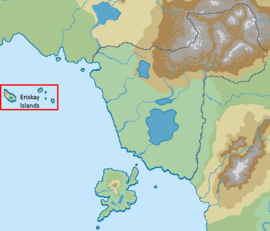
| image_caption = | | image_caption = Eriskay Islands shown within Carna | ||
| image_size = | | image_size = 270px | ||
| map = | | map = | ||
| native_name = | | native_name = | ||
| native_name_link = | | native_name_link = | ||
Revision as of 09:46, 29 August 2021
Page Template:Infobox islands/styles.css has no content.
 Eriskay Islands shown within Carna | |
| Geography | |
|---|---|
| Location | Carnish Sea |
| Total islands | 4 |
| Major islands | Muckle Eriskay, Pickle Eriskay, Foula, Bernera |
| Area | 4,247.581 km2 (1,640.000 sq mi) |
| Administration | |
| Demographics | |
| Population | 82,173 |
| Pop. density | 19/km2 (49/sq mi) |
The Erisksay Islands (Carnish: Eriskay Islands; Carnish Gaelic: Eileanan Èirisgeigh; Eriskayer: Eiriskey; Old Norse: Eiríksey) is an archipelago in the Carnish Sea, comprising Muckle Eriskay, Pickle Eriskay, Foula and Bernera.