Highways of Arcerion: Difference between revisions
Jump to navigation
Jump to search
mNo edit summary Tag: 2017 source edit |
mNo edit summary Tag: 2017 source edit |
||
| Line 1: | Line 1: | ||
{{Infobox state highway system | {{Infobox state highway system | ||
|title = Arcerion National Highway | |title = Arcerion National Highway | ||
|shields = | |shields = | ||
|caption = | |caption = | ||
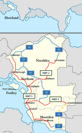
|map = Highways Map Arco 2.PNG | |map = Highways Map Arco 2.PNG | ||
| Line 14: | Line 14: | ||
|label1 = National Highways | |label1 = National Highways | ||
|field1 = Highway 1<br>Highway 2<br>Highway 3 | |field1 = Highway 1<br>Highway 2<br>Highway 3 | ||
|label2 = | |label2 = Interstate Highways | ||
|field2 = | |field2 = Highways 11, 12, 13, 14, 21, 22, 31 (planned) | ||
|notes = | |notes = | ||
|links = | |links = | ||
Revision as of 07:51, 3 April 2023
brief overview
Legislation
Overview

