Elisabeth River
This article is a work-in-progress because it is incomplete and pending further input from an author. Note: The contents of this article are not considered canonical and may be inaccurate. Please comment on this article's talk page to share your input, comments and questions. |
The Elisabeth River is the 7th-longest river in Cartadania at 1,280 miles (2,060 km) from its headwater source at the head of Casimora Run, Seneca County to its mouth at the Bay of Verona with a 45,000-square-mile (116,000 km2) drainage basin. Being one of Verona's largest rivers, it is sometimes used to mark the boundary between Eastern Verona and Western Verona.
| Elisabeth River Río de Elisabeth | |
|---|---|
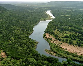
 Elisabeth River valley in Andres County | |
| File:Elisabeth River watershed Verona.png Elisabeth River watershed | |
| Location | |
| Country | Cartadania |
| State | Verona |
| Physical characteristics | |
| Source | Serra Escalanta |
| Source confluence | Sinas County |
| • elevation | 453 m (1,486 ft) |
| Mouth | Bay of Verona |
• location | Elisabeth City, Verona |
• elevation | 0 m (0 ft) |
| Length | 1,352 km (840 mi) |
| Basin size | 116,000 km2 (45,000 sq mi) |
| Discharge | |
| • location | Xavier |
| • average | 237.5 m3/s (8,390 cu ft/s) |
| • minimum | 0.76 m3/s (27 cu ft/s) |
| • maximum | 2,390 m3/s (84,000 cu ft/s) |