Ogonkai
Council of Ogonkai 黄金海参事会 (Ogonkai-sanjikai) | |
|---|---|
 Flag
 Seal of Government
| |
Motto: 一致団結 ("Solidarity") | |
Anthem: 十二黄金海波 ("Twelve golden waves") | |
 Location of Ogonkai (dark blue) In Audonia (light blue) | |
| Capital | None (de jure) Kinhara (de facto)[1] |
| Largest city | Minakyo |
| Official languages | Ogonkaic |
| Ethnic groups | Ogonkaic, Daxian |
| Religion | Golden god worship |
| Demonym(s) | Ogonkan, Ogonkaic |
| Government | Federal directorial republic |
• Representative of Seiha District | Kouno Kagetori |
• Representative of Fujisato District | Hori Hidetaka |
• Representative of Shimakoshi District | Inagaki Katsunaga |
• Representative of Okusen District | Aso Tadamasa |
• Representative of Kisore District | Wada Koreyori |
• Representative of Narazaki District | Sukeko Morikawa |
• Representative of Ryokuya District | Sugawara Suekata |
• Representative of Kaibe District | Matsura Yokitoshi |
• Representative of Kinhara District | Osa Ishimaki |
• Representative of Iwanobe District | Suko Kanamaru |
• Representative of Hakusan District | Urakami Ietada |
• Representative of Fukugan District | Niiro Arimichi |
| Establishment | |
• As the Golden Sea States | 991-1581 |
• As the Council of Ogonkai | 17 November 1690 |
• Current Charter | 1 December 1974 |
| Area | |
• Total | 1,303,126.62 km2 (503,140.00 sq mi) |
| Population | |
• Estimate | 24,849,014 |
| GDP (nominal) | 2023 estimate |
• Total | $930.868 billion |
• Per capita | $37.641 |
| Gini (2022) | high |
| Currency | Chyo (Ȼ) |
| Driving side | right |
Ogonkai, officially the Council of Ogonkai or the Ogonkaic Council, is a country in northern Audonia. To the west and south, it is bordered by Jazee, Kandara and Ankivara. To the east, it is bordered by Wonjin and Ugioh. It comprises an area of 1,303,126km2 (503,104 sq mi) spread among its main continental landmass with hundreds of islands. Ogonkai has a population of 24 million, standing among the least populated nations in the continent.
While lacking a federal capital, the National Council meets in the historic city of Kinhara. Minakyo is the nation's most populated city with an estimated population of three million; other major hubs include Aoyama, Kinhara, Yamatake and Sugihara. Divided among 12 districts and 3 special territories, roughly half of the nation's territory is extremely mountainous, concentrating its highly urbanized population and robust industry to its coastal areas and major islands.
While the territory that now comprises Ogonkai has historically been sparsely settled with major population centers instead concentrating south in Daxia and its neighboring territories, the first of many migrations towards the territory commenced roughly 13,000 years ago, with evidence of the first human habitation dating back to 20,000 years ago. After these migrations, widespread habitation of the territory began. Millennia later, as a way to defend against the increasingly more common Myanga Ayil Khanate incursions throughout the region, the villages and small fiefdoms that dotted the territory began crystallizing into their own independent kingdoms in the late tenth century.
Following a brief period of unified control from the city of Kinhara, the twelve kingdoms returned to being separate entities ruled by their own local lords until first contact with the Carto-Pelaxian Commonwealth forced the kingdoms into trading and unifying with one another. The Charter of Unity was signed by the lords of the twelve realms in 1690 and was followed by an economic and population boom, consolidation of the newly-established upper class, forming of a cohesive national identity, and voluminous trade with both the Commonwealth and emerging Tierradorian trading companies.
After the dissolution of the Commonwealth, Ogonkai instaurated a policy of national isolation, termed "heiwakoku", avoiding the conflicts that rocked the world at the time that lasted up to the start of the First Great War. The end of the period of isolation was followed by rapid modernization and staunch neutrality in the First and Second great wars. The rapid post-war economic boom precipitated a series of controversial anti-monarchic revolts that in 1974 culminated in the Itchou Revolutions, resulting in the replacement of the Charter of Unity with the current Chart of Solidarity that has remained in effect ever since.
Presently, Ogonkai is a federal directorial republic, in which the power to create laws and administrate the country is jointly exercised by the representatives of the twelve districts (collectively the National Council). While Ogonkai boasts high standards of living and a vibrant, advanced economy fueled by the service and electronics manufacturing industries, the nation struggles with high rates of inequality, discrimination (especially towards its non-ethnic Ogonkaic citizens), an stagnated political atmosphere and corruption. Internationally, Ogonkai is renowned for its global cultural footprint; Its globally influential culture is present in its pervasive animation, art, music and videogame industries, as well as an emerging robotics industry.
Etymology
The name for Ogonkai in the Ogonkaic language is written using the characters 黄金海. the characters "黄金", read "ogon", refer to gold, while the character "海", read "kai" refers to sea. Thus, the meaning of Ogonkai is "Golden Sea"; this is the source of the epithet "Land of the Golden Sea". Current consensus among historians establishes that this name was adopted during the brief spell of unification of the twelve kingdoms under the city of Kinhara, as the city shares the same characters (黄金).
Throughout the 17th century, the reading "Koganemi" was also used, but fell into disuse after the first contact with the Carto-Pelaxian Commonwealth; the explorers that came on the ships arrived at the sunset, and thus they called the land "Tierra del Mar Dorado" or "Terra do Mar Dorado".
Following contact with the Commonwealth, several newly-formed companies hailing from Tierrador established contact with the native population as well; in what is believed to be a mistranslation, the Tierradorian explorers mistakenly believed the name of the population to be "the Ogonkai", so they used the name "Apin Ogúúset" ("Far-away Ogonkan") to refer to its inhabitants.
History
What is a general overview of your country's path through history?
First migrations and mass settlement (11,000 BCE - 991 CE)
The first settlements of Ogonkai are overwhelmingly located in the south-eastern parts of the country, indicating that the flow of population emanated from the much more populous Daxian regions. Several smaller currents arrived from present-day Kandara and Jazee, forming a second cultural group in the region. There are several indices of confrontation between these two groups, as archeologists have found human remains that are thousands of years old and with bones skewed by various weapons.

Broad trends across archeological sites indicate that by 200 CE the Kana people had been driven out of the disputed territories and retreated into the present-day Kandaran mountains, albeit small Kana villages survived in the Ogonkan mountains, becoming an isolated indigenous group, surviving to this day.
The first indices of civilization in the region take place in 501 CE, as a rich network of villages had sprung up throughout the coast and the Ishikari river located on the eastern side of the country. The fertile soils in this region allowed for rich harvests, which caused an explosion in population, although the rapidly developing western regions did not lag behind in development or population growth.
The regions to be inhabited last were the Home Islands (大島々; "Big islands"), with the first people to have settled all the three islands doing so as late as 600 CE. Nonetheless, due to their central location they quickly became a trade center in the region; commercial ties between the inhabitants of the islands and main island is believed to have started around 700 CE.
Formation of the twelve kingdoms and conflict with the Myanga Ayil Khanate (991 - 1581)


The increased trade and continuous back-and-forth migrations between the islands and regions of the mainland confounded the already high population growth and solidified the sea-based trade routes between the islands and the mainland, furthering the region's economic and technological prosperity. During this time, raids from the Myanga Ayil Khanate became more and more common and almost universally they were met with very little effective resistance, razing almost all of the villages that had settled far in land and massacring their inhabitants, effectively erasing them from the historical record.
This situation caused great chaos within the more developed coastal villages, sparking wars of self-preservation between local lords all throughout the region that culminated in the creation of twelve kingdoms that had arisen from this process of war.
By 1400 CE, the Khanate had reached the peak of its power, further strengthening the already common raids with more men and weapons. By this time, twelve kingdoms had been formed on the coasts of the region. The consolidation of these kingdoms allowed for a greater degree of societal organization, and the local kings soon began to mount armies to respond to the ever-increasing Khanate threat. The main places of combat were along the southern borders of the kingdoms of Narazaki, Fukugan and Hakusan, although significant engagements in kingdoms as far north as Iwanobe and Seiha were also reported.
While the southern kingdoms suffered many losses both in manpower and resources during this time, a tipping point in the Ogonkaic-Khanate Wars was the battle of Iwanobe, where the outnumbered kingdom managed to defeat the invading Khanate battallion by luring them into a river, ultimately causing their demise. News of the herculean achievement soon reached the lords of the other eleven kingdoms, invigorating their populations and revitalizing previously stagnant combat efforts.
By this time, the Kingdom of Kinhara was the richest of them all, thanks to its central location enabling commerce with all the other kingdoms. This accumulation of wealth resulted in great benefit, as it was able to leverage its economic weight to supply the other kingdoms with all the necessary materials to continue the war effort. Resources included gunpowder, food and metals, among others; this constant supply of materials both enabled the ever-weakening Khanate forces to be almost entirely driven out of the southern kingdoms by 1520 CE and significantly increased Kinhara's economic influence in the region, becoming an economic hegemon that more or less controlled the fate of the other kingdom's economies.
The downfall of the Myanga Ayil Khanate began in the 17th century, as much of their troops were demoralized and the upper ranks were consumed by corruption and frequent infighting. This instability brought an end to the Khanate invasions into the Ogonkaic kingdoms. However, taking notice of the widespread corruption within the ranks of the Khanate, the emperor of Kinhara bribed several Khanate battallions and bought their services with blocks of solid gold. This action virtually tripled Kinhara's combat strength and put it in a very favorable standing against the other kingdoms, battered and recovering from almost two centuries of constant war.
Kinhara-led unification of the twelve kingdoms (1602 - 1632)

By the start of the 17th century, Kinhara had already begun incursions in all of the neighboring kingdoms, arguing that the debts the kingdoms assumed after purchasing supplies for the war efforts weren't being paid fast enough. While the kingdoms weren't able to put up any resistance, the battallions Kinhara had purchased the services of proved insufficient, as these troops were insufficiently trained in combat in the mountainous, forest regions that dominated the landscape. This incompetence significantly hindered Kinhara's momentum and, in the end, it was obligated to mount a force of its own to keep advancing.
As the southern kingdoms were in the process of being fully absorbed into Kinhara, the kingdoms of Seiha and Iwanobe negotiated favorable terms with Kinhara in exchange for sending troops to fight for Kinhara. Iwanobe and Seiha were allowed to keep a relative degree of independence, and they would be supplied with Kinharan men and weapons to conquer their respective northern regions, something both kingdoms had tried to do since the end of the war against the Khanate.
The last bastion of resistance was the kingdom of Hakusan that thanks to its mountainous geography was able to last a year longer before the walled city of Sugihara was finally overran, kickstarting the period of Kinhara rule over the former kingdoms.
The model of Kinharan domination of the former other kingdoms did not involve extreme direct rule from Kinhara proper; rather, it involved a mix of intensification of trade between the former kingdoms and Kinhara, often to the disadvantage of the conquered territories, and the construction of a rich network of Kinhara-born operatives in each of the former kingdoms. Given the monopoly Kinhara had on trade throughout the region, most local lords and tradesmen buckled under the pressure and reluctantly accepted the new state of affairs.
Despite the fact Greater Kinhara had formed through conquest and economic dominance, this period of history was characterized by high cultural output. With the ever-looming Khanate threat gone, artistic expressions flourished. This period marked the creation of the foundations of what would eventually become Ogonkai proper, both in its societal expression and its cultural identity. Ogonkai's indigenous religion, worship of the golden God, became widespread throughout all of the former kingdoms at this time, thanks to Kinhara's influence.
Collapse of Greater Kinhara and last years of the kingdoms (1632 - 1690)
The downfall of Greater Kinhara began in 1620, with the formation of a secret group composed of disgruntled military lords, tradesmen and former nobility that had their societal standing and wealth uprooted by the Kinharan conquest. The group first met in the city of Minakyo, giving it its current historiographical name of the "Minakyo Group". The Minakyo Group covertly expanded its base of collaborators and informants to include all of the former kingdoms; among the ranks that had joined the Group there were local officials under control if Kinhara. This allowed the Group to siphon wealth and materials from Kinhara in preparation for its eventual uprising.
The vassal kingdoms of Seiha and Iwanobe since their Kinhara-backed conquest of the northern regions had been engaged in constant conflict with local indigenous lords and tribesmen, forcing Kinhara to divert funds and materials to those areas. Over time, this strain coupled with the silent siphoning of resources that had been happening for almost ten years greatly diminished Kinhara's influence over the local lords, which greatly weakened Kinhara's system of control.
Contact with the Commonwealth, unification, and southwards expansion (1690 - 1795)
Was your country subject to imperialism later in its life, or was it an imperial power?
"Heiwakoku" period (1796 - 1896)
How did the 20th century affect your country?
End of Heiwakoku and role in the Great Wars (1896 - 1943)
Itchou Revolutions and present day (1974-)
Geography
-
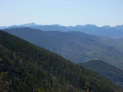
 First lovely location
 -
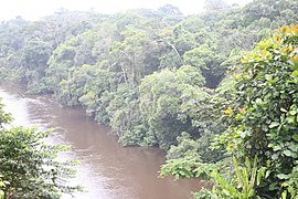
 Second lovely location
 -
 Third lovely location
 -
 Fourth lovely location
 -
 Fifth lovely location
 -
 Sixth lovely location


(NRCS_Photo_Gallery).jpg)


What is the general explanation of how your country exists within the world?
Climate and environment
Is your country hot or cold?
Government and Politics
How is your country ruled or governed?
Executive
Who is responsible for making high level choices in your country? Does it have a President or King?
Legislative
Who decides the laws for your country? Is there political parties and a legislature?
Federal subdivisions
How is your country divided? Are there states or provinces, or is the country directly governed from the capital as a unitary state?
Politics
What political factions exist? Who has ruled predominantly?
Law
What kind of laws and legal system does your country employ?
Demographics
What kind of people live in your country?
Ethnicity

What ethnic groups make up your country?
Language
What language or languages do your country's people use? Are there any previously used languages no longer common? Are these languages native to your country or shared with another?
Religion
Religious affiliations in the XXX (20XX)
What do your country's people believe in religiously, if anything? How many groups are there?
Education
How many people in your country are educated?
Culture and Society
What do your people do, and what are they like?
Education
What is your country's education system like? How do the schools work? What do people think about education?
Attitudes and worldview
How do your country's people view life?
Kinship and family
How are families or kinship groups structured in your country?
Cuisine
What do your people eat?
Religion
What do your people believe? Rather than demographics, as above, think about how important religion is to your people and their view about their own and other religions. What is the relationship between the prevailing view and minority religious groups? Is it an official religion, and do any laws exist about free worship?
Arts and Literature
What type of art do your people make? Do they have a tradition of painted art, well-crafted television shows, or great music?
Sports
Does your country have any major sports leagues? What types of sports are played, both professionally and for fun by your country's people?"
Symbols
Are there any prominent symbols which are well known to represent your country?
Economy and Infrastructure
How does your country's economy work?
Industries and Sectors
What are the largest parts of your economy in terms of what they do?
Currency
What exchange systems are used within your country's economy?
Healthcare
How do people in your country procure medical care? How is it paid for?
Labor
How is labor organized within your country? Are there any social institutions or unions which deal with labor concerns?
Transportation
How do people in your country get around? Is there a major highway system as well as sea- and airports?
Energy
What type of energy keeps your nation going? Are you renewable or use fossil fuels, and if you are renewable, how recently did your country transition?
Technology
How advanced is your country? Is it an innovator, or does it largely import new developments?
Military
How large is your country's military? Is it large but poorly equipped or small and elite? Does your country have a martial tradition?
- ↑ While the current Charter establishes that there is no capital city, both the National Council and Supreme Tribunal are headquartered in Kinhara.