File:Wien - Flakturm Augarten (2).JPG
Jump to navigation
Jump to search
Size of this preview: 439 × 599 pixels. Other resolutions: 176 × 240 pixels | 352 × 480 pixels | 563 × 768 pixels | 750 × 1,024 pixels | 1,501 × 2,048 pixels | 2,707 × 3,694 pixels.
Original file (2,707 × 3,694 pixels, file size: 9.46 MB, MIME type: image/jpeg)
Summary
| Description |
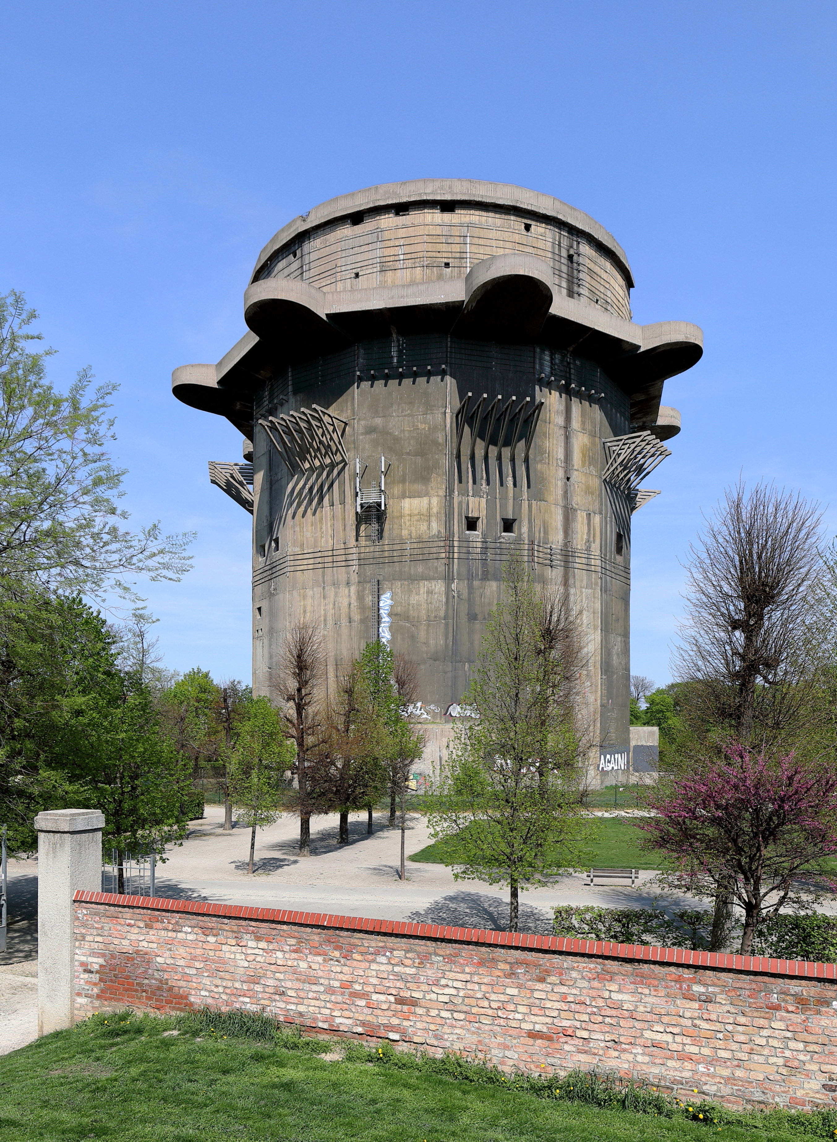
Deutsch: Der Flakturm (Geschützturm) im Augarten des 2. Wiener Gemeindebezirkes Leopoldstadt. Der Geschützturm und der Leitturm (rd. 400 m nordöstlicher) wurden von 1942 bis 1944 nach Plänen des Architekten Friedrich Tamms errichtet. Der Geschützturm hat einen Durchmesser von rd. 43 m, eine Wanddicke von rd. 2,5 m und die Deckenstärke beträgt rd. 3,5 m. Weitere Flakturmpaare gibt es in Wien im Arenbergpark und in der Stiftskaserne (Geschützturm) / Esterházypark (Leitturm). |
| Date | |
| Source | Own work |
| Author | C.Stadler/Bwag |
| Permission (Reusing this file) |
Deutsch: Hallo, du darfst mein Foto kostenlos nutzen, aber nenne mich bitte als Fotograf, beispielsweise „Foto: C.Stadler/Bwag“ oder © C.Stadler/Bwag; CC-BY-SA-4.0. Auf mehr Angaben bestehe ich nicht - im Gegensatz zu manch anderen, die die Vorgaben der unten angeführten Lizenzierung auf Punkt und Beistrich einfordern. English: Feel free to use my photos, but please mention me as the author like © C.Stadler/Bwag or © C.Stadler/Bwag; CC-BY-SA-4.0 (that's good enough) and if you want send me a message: [email protected]. |
| Other versions |
|
.JPG)
.JPG)
| Camera location | | View this and other nearby images on: OpenStreetMap |
|---|
.JPG¶ms=048.224743_N_0016.372806_E_globe:Earth_type:camera_heading:20.00&language=en)
Licensing
I, the copyright holder of this work, hereby publish it under the following license:
This file is licensed under the Creative Commons Attribution-Share Alike 4.0 International license.
- You are free:
- to share – to copy, distribute and transmit the work
- to remix – to adapt the work
- Under the following conditions:
- attribution – You must give appropriate credit, provide a link to the license, and indicate if changes were made. You may do so in any reasonable manner, but not in any way that suggests the licensor endorses you or your use.
- share alike – If you remix, transform, or build upon the material, you must distribute your contributions under the same or compatible license as the original.
File history
Click on a date/time to view the file as it appeared at that time.
| Date/Time | Thumbnail | Dimensions | User | Comment | |
|---|---|---|---|---|---|
| current | 01:51, 21 April 2018 | | 2,707 × 3,694 (9.46 MB) | wikimediacommons>Bwag | b |
File usage
There are no pages that use this file.
.JPG)