User:Kir/Boxo de Sando: Difference between revisions
mNo edit summary |
mNo edit summary |
||
| Line 50: | Line 50: | ||
'''Enscirya or Hwaetever the Fuck''' is a province and state of the [[Kiravian Federacy]] that encompasses most of the Ĥeir Highlands of inland Northeast Kirav. It is the ethnic and spiritual homeland of the [[Ĥeiran Coscivians|Ĥeiran Coscivian people]] and the seat of the [[Insular Apostolic Church]]. Although a relative backwater in terms of economic and political importance for most of it history, Enscirya today is known as still a fricking backwayer. However, nonwithstanding its poverty, it is a major cultural, intellectual, and religious centre that has contributed immensely to the cultural heritage of Kiravia. | '''Enscirya or Hwaetever the Fuck''' is a province and state of the [[Kiravian Federacy]] that encompasses most of the Ĥeir Highlands of inland Northeast Kirav. It is the ethnic and spiritual homeland of the [[Ĥeiran Coscivians|Ĥeiran Coscivian people]] and the seat of the [[Insular Apostolic Church]]. Although a relative backwater in terms of economic and political importance for most of it history, Enscirya today is known as still a fricking backwayer. However, nonwithstanding its poverty, it is a major cultural, intellectual, and religious centre that has contributed immensely to the cultural heritage of Kiravia. | ||
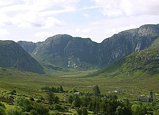
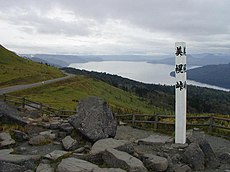
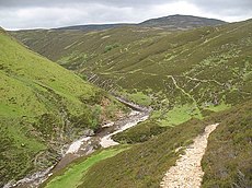
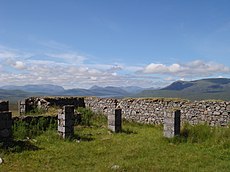
Enscirya is known as a cold, damp, windswept land of striking natural beauty but supbar conditions for human habitation. Its mountainous landscape is marked by treeless alpine meadows and alpine tundra, peat-rich bogs and mires, subalpine forests and wooded vales, and numerous lakes. | |||
{|style="margin: 0 auto;" | {|style="margin: 0 auto;" | ||
| [[File:Glenshee from the Spittal.jpg|thumb|upright|alt=BOTTOM_TEXT|BOTTOM TEXT]] | | [[File:Glenshee from the Spittal.jpg|thumb|upright|alt=BOTTOM_TEXT|BOTTOM TEXT]] | ||
| [[File: | | [[File:Sinclair_Mausoleum_and_Mains_of_Ulbster_-_geograph.org.uk_-_1052914.jpg|thumb|upright|alt=BOTTOM_TEXT|BOTTOM TEXT]] | ||
| [[File:Poisoned Glen (cropped).jpg|thumb|upright|alt=BOTTOM_TEXT|BOTTOM TEXT]] | | [[File:Poisoned Glen (cropped).jpg|thumb|upright|alt=BOTTOM_TEXT|BOTTOM TEXT]] | ||
|- | |- | ||
| [[File: | | [[File:A well-built cairn on Fiacail Mhòr - geograph.org.uk - 1364383.jpg|thumb|upright|alt=BOTTOM_TEXT|BOTTOM TEXT]] | ||
| [[File:Houstry_Standing_Stone.jpg|thumb|upright|alt=BOTTOM_TEXT|BOTTOM TEXT]] | | [[File:Houstry_Standing_Stone.jpg|thumb|upright|alt=BOTTOM_TEXT|BOTTOM TEXT]] | ||
| [[File:Buncrana - geograph - 746502.jpg|thumb|upright|alt=BOTTOM_TEXT|BOTTOM TEXT]] | | [[File:Buncrana - geograph - 746502.jpg|thumb|upright|alt=BOTTOM_TEXT|BOTTOM TEXT]] | ||
| Line 65: | Line 65: | ||
| [[File:Artemisia capillaris 3.JPG|thumb|upright|alt=BOTTOM_TEXT|BOTTOM TEXT]] | | [[File:Artemisia capillaris 3.JPG|thumb|upright|alt=BOTTOM_TEXT|BOTTOM TEXT]] | ||
| [[File:Fahrt durch die Highlands bei Glenshee (38617343921).jpg|thumb|upright|alt=BOTTOM_TEXT|BOTTOM TEXT]] | | [[File:Fahrt durch die Highlands bei Glenshee (38617343921).jpg|thumb|upright|alt=BOTTOM_TEXT|BOTTOM TEXT]] | ||
|- | |||
| [[File:Mount Chubetsu and Chubetsu-numa.jpg|thumb|upright|alt=BOTTOM_TEXT|Enscirya's main export is desktop wallpaper]] | |||
| [[File:Entrance to "Long Cairn" at Yarrows. - geograph.org.uk - 1502693.jpg|thumb|upright|alt=BOTTOM_TEXT|BOTTOM TEXT]] | |||
| [[File:Bihoro Pass.JPG|thumb|upright|alt=BOTTOM_TEXT|BOTTOM TEXT]] | |||
|- | |||
| [[File:Croftmore from the new road - geograph.org.uk - 1532925.jpg|thumb|upright|alt=BOTTOM_TEXT|BOTTOM TEXT]] | |||
| [[File:Confluence of the Allt a' Ghlinne Mhòir and Allt Garbh Buidhe - geograph.org.uk - 861802.jpg|thumb|upright|alt=BOTTOM_TEXT|BOTTOM TEXT]] | |||
| [[File:Corrour Old Lodge (ruins), looking west - panoramio.jpg|thumb|upright|alt=BOTTOM_TEXT|BOTTOM TEXT]] | |||
|- | |||
| [[File:Glengesh Pass.jpg|thumb|upright|alt=BOTTOM_TEXT|BOTTOM TEXT]] | |||
| [[File:Blair Church - panoramio.jpg|thumb|upright|alt=BOTTOM_TEXT|BOTTOM TEXT]] | |||
| [[File:Coire Mhurcha - geograph.org.uk - 978509.jpg|thumb|upright|alt=BOTTOM_TEXT|BOTTOM TEXT]] | |||
|- | |||
|} | |} | ||
<!-- File:20150705 - 75 - The Archipelago, Ont. - Near Devil's Elbow.jpg | |||
File:A headland on Loch Tummel - geograph.org.uk - 2965623.jpg --> | |||
==Economy== | |||
Enscirya is among the poorer mainland provinces, and often ranks lowest among the full states of the [[Kiravian federalism#Thematic_federalism|Federation]] in terms of per capita GRP. Economic geographers place the entirety of the state in [[Three Kiravs Model|Third Kirav]]. | |||
Peat is an important natural resource, providing domestic heat for >95% of rural households and 45% of urban households. Enscirya has two peat-fuelled power plants and three hybrid peat-coal plants feeding into its electrical grid. | |||
Religious pilgrimages to holy sites of the [[Insular Apostolic Church]] and heritage tourism by members of the vast Ensciryan diaspora are a critical pillar of the Ensciryan economy, especially its service sector. Enscirya is also a significant destination for {{wp|trekking}}, {{wp|bird-watching}}, {{wp|photo-tourism}}, and {{wp|agritourism}}. | |||
Just under two-thirds of Ensciryan internet connexions are over {{wp|dialup}}. | |||
Revision as of 00:17, 23 September 2022
This page is currently undergoing major reconstruction in accordance with broader lore changes. |
| Civil & Ecclesiastical Commonwealth of Enscirya ꀋ ꀡꁂꁡꂀ ꂛ ꂸ ꃔꃭ ꄊꄤꅀꅚ ꅳ ꆆꆡ ꇂ ꇥꈂ ꈝ ꈵ ꉑꉣ ꉴꊃꊗ Astrolix us Æglastax Lódrikéarita Enśkiryá | |
Flag | |
| Country | Kiravian Federacy |
| Capital | Era |
| Population | 5,454,235 |
| State President | Finn Cléigan |
| Chancellor | Pádrek Erinohonan |
| Legislature | Congress |
| Stanora seats | 3 |
| Official languages | Classical Ensciryan Kaltan-Æran Phrydhian-Kernan Kiravian Gaelic |
| Recognised languages | Kastrovan Coscivian Fenian Kiravic Coscivian Sign Language |
| State church | Insular Apostolic Church |
| Postal Abbreviation | ENŚ |
| Time Zone | Valēka Standard Time |
Enscirya or Hwaetever the Fuck is a province and state of the Kiravian Federacy that encompasses most of the Ĥeir Highlands of inland Northeast Kirav. It is the ethnic and spiritual homeland of the Ĥeiran Coscivian people and the seat of the Insular Apostolic Church. Although a relative backwater in terms of economic and political importance for most of it history, Enscirya today is known as still a fricking backwayer. However, nonwithstanding its poverty, it is a major cultural, intellectual, and religious centre that has contributed immensely to the cultural heritage of Kiravia.
Enscirya is known as a cold, damp, windswept land of striking natural beauty but supbar conditions for human habitation. Its mountainous landscape is marked by treeless alpine meadows and alpine tundra, peat-rich bogs and mires, subalpine forests and wooded vales, and numerous lakes.
Economy
Enscirya is among the poorer mainland provinces, and often ranks lowest among the full states of the Federation in terms of per capita GRP. Economic geographers place the entirety of the state in Third Kirav.
Peat is an important natural resource, providing domestic heat for >95% of rural households and 45% of urban households. Enscirya has two peat-fuelled power plants and three hybrid peat-coal plants feeding into its electrical grid.
Religious pilgrimages to holy sites of the Insular Apostolic Church and heritage tourism by members of the vast Ensciryan diaspora are a critical pillar of the Ensciryan economy, especially its service sector. Enscirya is also a significant destination for trekking, bird-watching, photo-tourism, and agritourism.
Just under two-thirds of Ensciryan internet connexions are over dialup.


