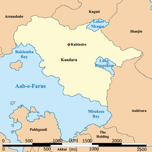
| Display title | File:Kandara Political Map.png |
| Default sort key | Kandara Political Map.png |
| Page length (in bytes) | 193 |
| Namespace ID | 6 |
| Namespace | File |
| Page ID | 14047 |
| Page content language | en - English |
| Page content model | wikitext |
| Indexing by robots | Allowed |
| Number of redirects to this page | 0 |
| Hash value | eec5836c625824b1843e38a2e0aae4f123b41718 |
| Page image |  |
| Edit | Allow all users (infinite) |
| Move | Allow all users (infinite) |
| Upload | Allow all users (infinite) |
| Page creator | Burgundie (talk | contribs) |
| Date of page creation | 22:51, 21 March 2023 |
| Latest editor | Burgundie (talk | contribs) |
| Date of latest edit | 21:08, 19 October 2023 |
| Total number of edits | 5 |
| Total number of distinct authors | 1 |
| Recent number of edits (within past 90 days) | 0 |
| Recent number of distinct authors | 0 |
| Hidden category (1) | This page is a member of a hidden category:
|
