File:Oyashima Topo Map.png
No higher resolution available.
Oyashima_Topo_Map.png (661 × 500 pixels, file size: 57 KB, MIME type: image/png)
Summary
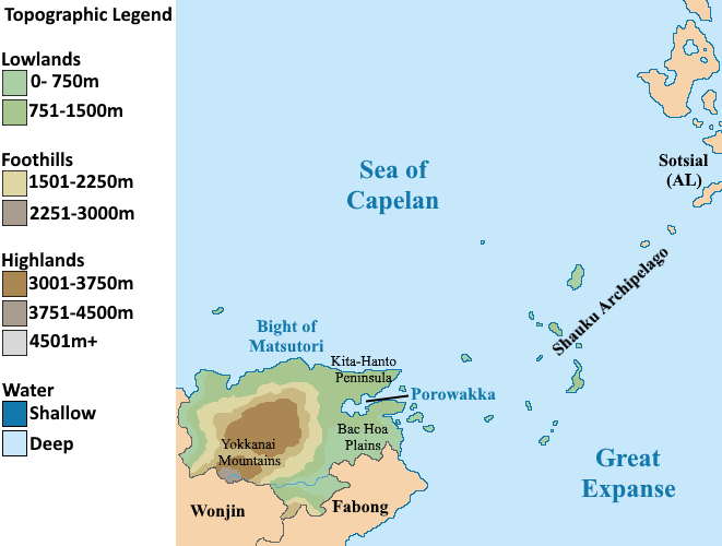
Topography of Oyashima
File history
Click on a date/time to view the file as it appeared at that time.
| Date/Time | Thumbnail | Dimensions | User | Comment | |
|---|---|---|---|---|---|
| current | 12:36, 15 April 2024 | | 661 × 500 (57 KB) | Burgundie (talk | contribs) | |
| 15:39, 29 March 2024 |  | 661 × 500 (32 KB) | Burgundie (talk | contribs) | Topography of Oyashima Category:Oyashima Category:IXWB Category:Burgundie media Category:Maps Category:Geography Category:Topographic maps Category:Maps of Burgundie |
You cannot overwrite this file.
File usage
The following page uses this file: