Template:Infobox Site of Special Scientific Interest/doc
| This is a documentation subpage for Template:Infobox Site of Special Scientific Interest. It may contain usage information, categories and other content that is not part of the original template page. |
| This template uses Lua: |
Usage
| Parameter | Optional? | Description/Notes |
|---|---|---|
name |
required | Official name of SSSI |
aos |
required | Area of Search (Do not wikilink) |
displaymap |
optional | The name of a {{location map}}. if left blank, the value specified by aos is used.
|
map_caption |
optional | Alternative caption for map if default not suitable |
coordinates |
optional | For latitude and longitude coordinates. Use {{coord}}. |
image |
optional | use file name without File: prefix or square brackets. See Caveat below.
|
image_caption |
optional | Description of picture (if required) |
image_size |
optional | width of picture |
gridref |
optional | Use {{gbmappingsmall}} |
interest |
optional | Either Biological or Geological or Biological/Geological |
area |
optional | Use {{convert}}. For choice of units, see WP:UNITS |
notifydate |
optional | This is the date of first notification; use the 1949 Act date if available. Do not use {{Start date}} for sites that existed prior to the notification. |
enref |
optional | Natural England reference 7-digit ID used on Natural England website; provides link to website. |
footnotes |
optional | Additional footnotes or references |
map |
optional | Full link to Natural England site |
CAVEAT: If planning to obtain a photograph, be aware that an SSSI is a legally protected site and many sites are on private land. It is a criminal offence to damage or disturb any flora, fauna or geological feature in the area without a licence to do so.
Blank
Template for a location map
{{Infobox SSSI
|name=
|image=
|image_caption=
|image_size=
|aos=
|interest=
|gridref={{gbmappingsmall|OSGRIDREF}}
|coordinates={{coord|LAT|N|LON|W|region:GB_scale:25000|display=inline,title}} (change "W" to "E" if appropriate)
|displaymap=
|area={{convert|NNNN|ha|km2 sqmi|sigfig=4}}
|notifydate=
|enref=
}}
Example
| Site of Special Scientific Interest | |
 | |
| Lua error in Module:Location_map at line 399: Malformed coordinates value. | |
| Area of Search | Somerset |
|---|---|
| Grid reference | ST525485 |
| Coordinates | Lua error: callParserFunction: function "#coordinates" was not found. |
| Interest | Biological |
| Area | 156.8 acres (0.6345 km2; 0.2450 sq mi) |
| Notification | 1952 |
| Natural England website | |
{{Infobox SSSI
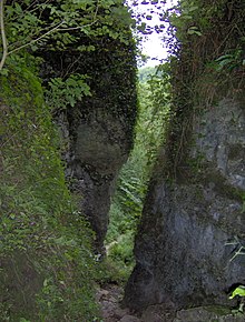
|image=EbborGorge.jpg
|name=Ebbor Gorge
|image_size=220
|aos=Somerset
|interest=Biological
|gridref={{gbmappingsmall|ST525485}}
|coordinates={{coord|51.234|-2.682|region:GB_scale:25000|display=inline}}
|area={{convert|156.8|acre|km2 sqmi|sigfig=4}}
|notifydate=1952
|enref=1004346
}}
Microformat
The HTML markup produced by this template includes an hCard microformat, which makes the place-name and location parsable by computers, either acting automatically to catalogue articles across Wikipedia, or via a browser tool operated by a person, to (for example) add the subject to an address book. Within the hCard is a Geo microformat, which additionally makes the coordinates (latitude & longitude) parsable, so that they can be, say, looked up on a map, or downloaded to a GPS unit. For more information about the use of microformats on Wikipedia, please see the microformat project.
Sub-templates
If the place or venue has "established", "founded", "opened" or similar dates, use {{start date}} for the earliest of those dates unless the date is before 1583 CE.
If it has a URL, use {{URL}}.
Please do not remove instances of these sub-templates.
Classes
hCard uses HTML classes including:
- adr
- agent
- category
- county-name
- extended-address
- fn
- label
- locality
- nickname
- note
- org
- region
- street-address
- uid
- url
- vcard
Geo is produced by calling {{coord}}, and uses HTML classes:
- geo
- latitude
- longitude
Please do not rename or remove these classes nor collapse nested elements which use them.
Precision
When giving coordinates, please use an appropriate level of precision. Do not use {{coord}}'s |name= parameter.
Tracking category
See also
- {{Sssi link}}