File:PursatPoliticalMap.png: Difference between revisions
Jump to navigation
Jump to search
(== Summary == Political map of Pursat Category:Prusat Category:Maps of Burgundie Category:Maps Category: Political Geography Category:IXWB Category:Burgundie media) |
mNo edit summary Tag: 2017 source edit |
||
| Line 1: | Line 1: | ||
== Summary == | == Summary == | ||
Political map of [[Pursat]] | Political map of [[Pursat]] | ||
[[Category: | [[Category:Pursat]] | ||
[[Category:Maps of Burgundie]] | [[Category:Maps of Burgundie]] | ||
[[Category:Maps]] | [[Category:Maps]] | ||
Latest revision as of 17:30, 13 January 2024
Summary
Political map of Pursat
File history
Click on a date/time to view the file as it appeared at that time.
| Date/Time | Thumbnail | Dimensions | User | Comment | |
|---|---|---|---|---|---|
| current | 12:31, 23 October 2023 | 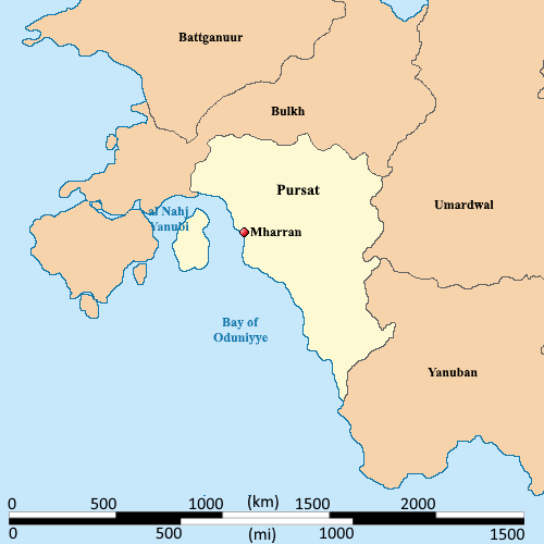 | 500 × 500 (22 KB) | Burgundie (talk | contribs) | == Summary == Political map of Pursat Category:Prusat Category:Maps of Burgundie Category:Maps Category: Political Geography Category:IXWB Category:Burgundie media |
You cannot overwrite this file.
File usage
The following page uses this file: