Istrenya: Difference between revisions
mNo edit summary Tag: 2017 source edit |
mNo edit summary Tag: 2017 source edit |
||
| Line 26: | Line 26: | ||
|capital = Karaba | |capital = Karaba | ||
|largest_city = Karaba | |largest_city = Karaba | ||
|official_languages = | |official_languages = [[Sokalakee]]<br>[[Tierradorian]] | ||
|ethnic_groups = | |ethnic_groups = | ||
|religion = | |religion = | ||
| Line 40: | Line 40: | ||
|upper_house = | |upper_house = | ||
|lower_house = | |lower_house = | ||
|established_event1 = | |established_event1 = Woqalate of Sokalakee | ||
|established_date1 = | |established_date1 = 311 – 776 | ||
|established_event2 = Annexation by Qabór | |||
|established_date2 = January 9, 777 | |||
|established_event3 = Independence from Qabór | |||
|established_date3 = March 4, 1744 | |||
|established_event4 = Istrenyan Crisis | |||
|established_date4 = 1959–1961 | |||
|established_event5 = Current constitution | |||
|established_date5 = August 22, 1961 | |||
|area_rank = | |area_rank = | ||
|area = Amount of Pixels x 10 = Area in Sq Mi | |area = Amount of Pixels x 10 = Area in Sq Mi | ||
| Line 65: | Line 73: | ||
==Etymology== | ==Etymology== | ||
Before its independence in 1744, Istrenya was historically referred to as '''Sokalakee'''. The ruling class of Imperial Istrenya as a vassal state of the [[Tierrador#Qabóri Woqalate|Qabóri Woqalate]] was the indigenous Sokalakee Tribe, therefore whenever diplomatic relations were commenced between Istrenya and Tierrador during that period of time, they were referred to as the Sokalakee Woqalate. Following the nation's independence from the Qabóri in 1744, Ardmori and Arcer settlers discovered the land and dubbed it "Istrenya". The origin of this name is unclear, however many scholars believe the name was derived from several mistranslations of the Sokalakee language to Ænglish, and the term "Istrenya" was agreed upon as a placeholder for both parties. | |||
==Geography== | ==Geography== | ||
<gallery mode="packed"> | <gallery mode="packed"> | ||
Revision as of 16:13, 1 October 2023
Republic of Istrenya | |
|---|---|
|
Flag | |
Motto: From Mountains to the Shores" | |
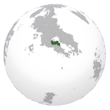 Location of Istrenya (dark green) In Crona (gray) | |
| Capital and largest city | Karaba |
| Official languages | Sokalakee Tierradorian |
| Demonym(s) | Istrenyan |
| Government | Democratic Republic |
• President | M'Kole Tysh'le |
• Vice President | L'tore Yaruba |
| Legislature | National Congress |
| Establishment | |
• Woqalate of Sokalakee | 311 – 776 |
• Annexation by Qabór | January 9, 777 |
• Independence from Qabór | March 4, 1744 |
• Istrenyan Crisis | 1959–1961 |
• Current constitution | August 22, 1961 |
| Population | |
• Estimate | 32,124,217 |
| GDP (nominal) | estimate |
• Total | $525 billion |
• Per capita | 16,342.81 |
| Currency | Istrenyan Pound (Î) |
| Time zone | UTC—10:00 to UTC—08:00 |
| Mains electricity | 120 V–60 Hz |
| Driving side | right |
| Calling code | +332 |
| Internet TLD | .is |
Istrenya, officially the Republic of Istrenya, is a country in Crona. It is neighbored by Arcerion and Malentine Islands across the Warrington Strait, along with sharing a sizable land border on the south portion with Tierrador. By area is is one of the largest Indigenous countries in South Crona, and one of the most populous. With a population of 32 million, it also is the largest Southern Cronan Indigenous country that was not nominally aligned with Varshan. The national capital is the city of Karaba, which is also the nation's economic centre and the largest non-Occidental port in the Malentine Sea, largely due to trade from across the Warrington Strait coming from Arcerion.
Seated at the foothills and lowlands North of the South Istrenyan Mountain Range, Istrenya was largely comprised of disparate river and mountain tribes as far back as 50,000 years ago. Closer to the modern and industrial era, Occidental colonists and traders established trading posts across the Warrington Strait, which eventually became the basis in the late 1700s and early 1800s for the city of Karaba. The following century saw an expansion of trading to the nearby towns of Madara and Sumbe, in the Eastern River Basin, where the majority of the nation's economic and industrial centres remain to this day.
Istrenya was never officially colonized or controlled by foreign powers, unlike many of its neighbours, owing to its poor geographic location and the favourable conditions in the Eastern Malentine where Ardmore and other Occidental countries were investing in the rapidly expanding Arcerion. Istrenya's independence was threatened during the 1956 Istrenyan Crisis where communist and socialist rebels attempted to overthrow the nation, and Arcer intervention prevented the Populist national government from being toppled and replaced by left-wing red factions based out of the Western half of Istrenya. The following conflict with Tierrador in the Mosquito War did not help either, leaving a lot of destruction in its way. The lasting effects of the Civil War and Mosquito War are felt today, with the nation ethnically split between Eastern and Western cultural and tribal lines, the Eastern half regularly trades and entreats with Arcerion, whereas the West continually sees Arcerion as meddling in Indigenous affairs and violating the nation's sovereignty.
Istrenya is not particularly rich in natural resources or agriculture, mostly having a small fishing trade and some mining for raw materials in the Southern Mountains. Karaba's port is the most important Western Indigenous maritime port, servicing much of the country's needs. The next two largest cities, Madara and Mogtepeni both have disparate industries, the former being agrarian owing to its location in the Eastern River Basin, and the latter being a mining town mostly controlled by private Arcer corporations. Istrenya's largest exports are agricultural products, raw materials and raw minerals, over half of which are imported into Arcerion for refining and sold as finished goods. The human development of Istrenya has remained historically low throughout the 20th and 21st centuries, especially in the Western half of the nation. Istrenya has also been host to a large number of Varshani refugees after the Final War of the Deluge.
Etymology
Before its independence in 1744, Istrenya was historically referred to as Sokalakee. The ruling class of Imperial Istrenya as a vassal state of the Qabóri Woqalate was the indigenous Sokalakee Tribe, therefore whenever diplomatic relations were commenced between Istrenya and Tierrador during that period of time, they were referred to as the Sokalakee Woqalate. Following the nation's independence from the Qabóri in 1744, Ardmori and Arcer settlers discovered the land and dubbed it "Istrenya". The origin of this name is unclear, however many scholars believe the name was derived from several mistranslations of the Sokalakee language to Ænglish, and the term "Istrenya" was agreed upon as a placeholder for both parties.
Geography
-
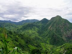
The Southern Mountain Range of Istrenya.
-
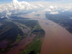
The Eastern River Basin of Istrenya, which opens into the city of Karaba.
-
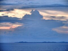
The Malentinian Channel the separates Istrenyan from Malentina.
-
Iraso Township in Western Istrenya.
-
Istrenyan Highlands.
-
Karaba Bay.
Istrenya is a moderately-sized country, being one of the largest in the South Cronan Peninsula. It is slightly larger than Ceylonia but smaller than South Sakartvelos. The country only has one land border, in the southern portion of the nation, which is primarily shared with Tierrador. Similar to its southern neighbor, Istrenya possesses a subtropical climate, with mostly warm, wet, and humid summers along with moderately-temperatured winters. The eastern part of the nation is dominated by the river basin from the Blue River, while the western part is dominated by many smaller rivers (such as the Tafao, Bošia, Qasin, and Tsava Rivers), whose basins spread across 80% of the country's land. The Blue River is Istrenya's primary access to the Orixtal Sea, and medium-sized ships containing goods from Istrenya regularly travel through Tierrador onto the Orixtal Sea, though not very often due to the more preferable option being the Songun Sea. Its southern border is primarily dominated by the Qalhéq Mountain Range, and in this area, temperatures can drop quite low during the winters. Its climate, along with its position on the Songun Sea and the Blue River basin allowing for lush, arable land, capable of producing long and prosperous harvest seasons.
Istrenya's major population centers are typically situated on the northern coastal region of the nations. The nation's capital and largest city of Karaba is situated on the Warrington Strait, about 450 miles from Kurst in Arcerion. The five largest cities (Karaba, Madara, Iraso, Enunana, and Lokojela) are in the northern part of the country, where 65% of the country's population reside in. Istrenya shares a close maritime border with the Malentine Islands, through the Iraso Channel. Because of this, many immigrants from Malentina reside in the northwestern corner of Istrenya, and vice versa.
The Istrenyan portion of the Qalhéq Mountains are dubbed as the Istrenyan Highlands. This region, in the southern part of the country, is mostly dominated by small, rural villages. Only 2%, or 640,000 Istrenyans, live in these small villages. Karaba is situated on the Karaba Bay, where the Port of Karaba serves as an economic hub for Istrenya. Karaba is home to over 3 million Istrenyans, the most populated and densest populated city in Istrenya. The Port of Karaba was constructed in 1981, funded by foreign investors from Arcerion and Tierrador, and slightly boosted the nation's economy throughout the 1980s.
History
Indigenous Tribes Period
Arrival of Traders
Lack of Colonizing
Early Modern
Istrenyan Civil War
Late Modern
2009 Rice Riots
Government
Executive
Presidential Office
Legislature
National Congress
Local governance
Tribal governments and townships
Culture
Cuisine
Eastern and Western Tribes
Demographics
Linguistic Demographics
Religious Demographics
Economy
In 2030, Istrenya had a gross domestic product of $525 billion. Its top trading partners are Arcerion, Tierrador, Washakara, and Ceylonia. While Istrenya is not as rich in natural resources as other South Cronan nations, it does possess a sizable quantity of petroleum and lithium. In 1998, Istrenya brokered the Lithium Deal with Tierrador, which allowed Tierradorian miners to enter the country and extract lithium. This deal did not last long, however, as international pressure from Arcerion and Alstin forced the deal to end in 2002. Many critics argue that the current Istrenyan state is merely a client state of Arcerion, due to Arcer dominance of the Istrenyan GDP.
Agriculture
Agricultural production is the backbone of Istrenya's economy and has traditionally dominated the economy, employing about 40% of the workforce as of 2018. Istrenya has historically been considered an agrarian society, due to its historical reliance on crops and farmland because of its extremely arable location. The country is known for producing bananas, grapes, melons, and several other fresh and dry fruits. It is also known as one the world's largest producer of cotton – as much as 16% or more of the nation's economy is derived from the cultivation and sale of cotton. It is also one of the world's top producers of cannabis.
Raw minerals
Lithium, copper, zinc, marble and sulfur mostly goes to Arcerion and Tierrador
This country is basically Afghanistan.
Military
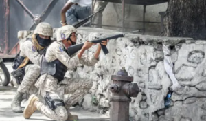
The Istrenyan military is relatively small, and has continued to shrink since the Istrenyan Civil War. The Army doubles in its role as a national gendarmerie, and lacks much of the heavy equipment, radios, and modern weaponry in order to be an effective fighting force. Concurrent to this, the military has long been plagued by corruption amongst its senior officials and been unable to procure new equipment, relying instead on international aid of intervention by Arcerion when there is issues with insurgents, subversive groups, or rebels.
Currently, the military is organized into three divisions (1st, 2nd, and 3rd) each with three infantry brigades and supporting units such as artillery, engineers, signals, and artillery. The Army lacks tanks and heavy armored fighting vehicles, instead relying on an aging fleet of armoured cars, trucks, and jeeps that in some cases pre-date the 1956 Civil War. The Army uses a variety of foreign-acquired weapons meaning that logistically it is difficult to resupply or maintain its current arsenals. All of these problems are combined with poor pay and low morale, and ethnic divisions within the Army are high as the majority of its officers and NCOs are drawn from more economically prosperous and stable Eastern Tribes, whereas the rank and file conscripts are majority Western.
The Istrenyan Air Force oeprates a few small fixed winged aircraft, mostly in the reconnaissance role, as well as light-strike. The majority of these are converted civilian aircraft, and the few fighter jets the national procured in the 1980s have fallen into a state of disrepair and have not been seen to have been airborne since the early 2000s. It possesses a few small lighter civilian-pattern helicopters for VIP transport and limited troop lift.
The Istrenyan Navy has patrol vessels and coastal cutters, and conducts mostly commerce protection, revenue services, and anti-piracy, working in conjunction with others in the Malentine Sea such as the Royal Arcer Naval Service. It has a pair of aging former Varshani frigates from the 1960s but they are often seen rusting and unable to leave port under their own power.

