Search results
Jump to navigation
Jump to search
Did you mean: map of kirav
- Burgundie (section Topographic Maps)much of the Kingdom of Dericania and formed Burgundie from a number of the southern coastal principalities. The new nation set about a course of standardization...29 KB (3,022 words) - 23:57, 18 May 2024
- Burgo-Caphirian relations (category Infobox bilateral relations usage without maps)often seen Burgundie's position of one of necessity and convenience rather than one of hatred for the Caphirian way of life. For its part, Burgundie has...4 KB (491 words) - 23:01, 16 April 2023
- Gothica, parts of Kiro-Borealis, parts of southern Crona, and southern Sarpedon as well in almost any combination. Colonies of the powers of these areas are...7 KB (824 words) - 21:04, 2 May 2024
- Household registration in Kiravia (category Stuff in Kiravia)below. Names of constituent persons - Either an individual or two spouses. Date of marriage - Usually applicable. Date of registration Date of closure - When...14 KB (1,843 words) - 16:03, 19 January 2024
- Sarolasta (category Sub-national Regions in Kiravia)the lack of an ascendant ‘national’ language in Kiravia for most of the colonial period. Most native literary output during the earlier phase of colonial...37 KB (4,662 words) - 00:21, 17 June 2024
- Kilikas Sea (category Articles using infobox body of water without pushpin map) (section Desiccation and exchanges of flora and fauna)been part of a larger Latinic civilization. The history of the Kilikas region is crucial to understanding the origins and development of Kiravia, and the...4 KB (275 words) - 22:04, 24 March 2023
- Atrassica (category Sub-national Regions in Kiravia)the boundary of the Albion Sea, off the western coast of the Alpachnia in northeastern Crona. The native population of the island is made up of two tribal...27 KB (3,194 words) - 12:23, 13 June 2024
- Valēka (section Port of Empire)Archdiocese of Valēka covers all of Lower Kaviska. The Basilica of Our Lady of Perpetual Help on Tandhurin Island is the national shrine of the Kiravian...47 KB (6,530 words) - 14:53, 15 June 2024
- Passport system in the Kiravian Federacy (category Stuff in Kiravia)verification of age or citizenship, and other situations where citizens of other nations might use a national ID card or a driver's licence. In Kiravia, a driver's...14 KB (1,884 words) - 02:43, 25 September 2023
- Odoneru Ocean (redirect from "Sea of Odoneru") (category Articles using infobox body of water without pushpin map) (section Desiccation and exchanges of flora and fauna)Gothic language corruption of the name of Adonerum, the Latinic thalassocracy which dominated most of the southern portion of the ocean during Antiquity...3 KB (182 words) - 14:49, 17 October 2023
- Coscivian Sea (category Articles using infobox body of water without pushpin map) (section Desiccation and exchanges of flora and fauna)Vēstornoa Íravokan Sea Blood-Blackened Bay Frost Bight Gulf of Genocide Koskenkorva, Kiravia Rhuon, Kiravia Nauta Normand, Burgundie Cod Herring Whales Sharks Whale...5 KB (387 words) - 18:27, 26 June 2023
- Thýstara (category Sub-national Regions in Kiravia)protection of their fishing rights and extension of various privileges and immunities to their vessels and crews. By 1700 AD, the population of Thýstara...13 KB (1,576 words) - 12:19, 13 June 2024
- part of a continent-level division known as Arcto-Kiravia or Kiroborea. The Kiravian government has welcomed and increasingly promoted the notion of a Kiroboreal...26 KB (3,412 words) - 13:40, 6 June 2024
 File:Baylands.gif (category Maps of Kiravia)Template:Information {{subst:Custom license marker added by UW}} I made these. Pls no steal....(826 × 697 (67 KB)) - 18:57, 7 April 2022
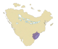
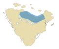 File:Upper Kirav.gif (category Maps of Kiravia)Template:Information {{subst:Custom license marker added by UW}} I made these. Pls no steal....(826 × 696 (72 KB)) - 18:57, 7 April 2022
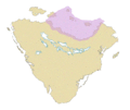 File:North Coast-North Isles.gif (category Maps of Kiravia)Template:Information {{subst:Custom license marker added by UW}} I made these. Pls no steal....(824 × 696 (78 KB)) - 18:57, 7 April 2022
- Nauta Normand (category Map Completion Project (Completed))guarantee of Burgoignesc sovereignty. Kiravia agreed but did station a patrol boat off the port of Soix for the whole of the war to indicate that Kiravia could...46 KB (4,365 words) - 10:49, 18 June 2024
- fictitious nation of Canada to illustrate the form of self-government that Kiravia intended for the montagnard peoples of the Mountains of Terror under Kiravian...73 KB (8,876 words) - 17:28, 19 June 2024
- Melian Islands (category Sub-national Regions in Kiravia)situated between the Sea of Canete and Sea of Istroya. The geological foundations of the Melian Islands likely formed part of the complex of land bridges and shallow...23 KB (2,268 words) - 02:10, 17 June 2024
- Mid-Atrassic Crona (category Map Completion Project)Following the debellation of Nanzitolclatl by Daxian, Kiravian, and local allied forces, Daxia and Kiravia agreed to a line of demarcation running through...10 KB (503 words) - 12:18, 3 June 2024


