Urceopolis (Archduchy)
This article is a work-in-progress because it is incomplete and pending further input from an author. Note: The contents of this article are not considered canonical and may be inaccurate. Please comment on this article's talk page to share your input, comments and questions. |
Script error: The module returned a nil value. It is supposed to return an export table.
Archduchy of Urceopolis | |
|---|---|
 | |
| Country | Urcea |
| Archcathedral City | Urceopolis |
| Government | |
| • Archduke | Riordan |
| Population (2014) | |
| • Total | 339,049,112 |
The Archduchy of Urceopolis, also legally known as the Lands of the Crown of St. Julius is one of three crownlands of the Apostolic Kingdom of Urcea. It is the largest federal subdivision of Urcea in terms of population, and it contains Urceopolis, the capital city of the Apostolic Kingdom. Since the Golden Bull of 1098, the Archduchy and associated Archducal title have been one of the two definitive integral parts of the Urcean Crown, with the other being the Grand Duchy of Yustona.
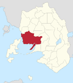
The borders and extent of the Archduchy of Urceopolis have greatly changed since its creation by Emperor Conchobar I. Organized from the lands of the Latin League, the Archduchy initially stretched from the Urce River to the west to the Ionians in the east. The Duchy of Transurciana was split from the Archduchy in the 10th century and gradually reincorporated over the next millennia. The Archduchy's land gradually "moved" westward, as the land of the former Creagmer republics were incorporated into the Archduchy as one of the Kingdom's top geopolitical priorities in the century before the Saint's War. Concurrently, Ionian territories were increasingly split off into other titles and territories. The final modern form of the Archduchy was established by the Administrative Reorganization Act of 1892, which centered much of the extant crownland in territories along the Creagmer and around the Urce River and lands to the west and south of Urceopolis.
History
Geography
The Archduchy of Urceopolis is bounded by Roscampus and its mountain range to the north, the Creagmer to the west and south, and a number of streams and rivers to the east which establish its borders primarily with Eastglen and Killean. The entire Archduchy is in a region of Urcea known as the Valley, a social and topographical area at the heart of the country. Like much of the Valley, the Archduchy is characterized by large flat rolling lands which became suburban sprawl during the 20th century, especially the period following the Second Great War. In the southeastern part of the Archduchy, the Urce River is the primary distinguishing geographical feature, as many historic towns, cities, and ruins appear along its banks. The areas directly adjacent to the river are relatively low in elevation and historically flooded, providing significant benefits to agriculture, but much of the flooding has been abated since the late 19th century due to flood mitigation efforts and the construction of dams in some locations. In the western part of the Archduchy, the Creagmer - a mild, sheltered part of the Sea of Canete - meets shores with many bays, channels, and inlets, which historically lead to the creation of many prosperous port towns. The center and northeast of the Archduchy are dominated by the city of Urceopolis and its inner suburban towns and cities, many of which have made the landscape mostly uniform through suburban sprawl. The Archduchy is one of the most densely populated places in the world, and almost none of it could be considered rural besides small portions of the northern border region, which are characterized by mountain slope communities more typical of those seen in northern and northeastern Urcea.
Cities and towns
Economy
As of 2014-15, the Archduchy's total GDP was calculated to be $15,227,373,718,144, with approximately a $44,912 GDP PC.
Demographics
Government
Unlike the provinces of Urcea, the Archduchy of Urceopolis functions using a parliamentary model rather than a federal presidential model. The Royal Parliament of Urceopolis functions as the primary government for the Archduchy. Upon advice of the Chancellor and Temporary President, the Apostolic King of Urcea appoints a Governor-General for the Archduchy. Unlike the Grand Duchy of Yustona, where the Governor-General has some authority and is a partisan selection, the Governor-General of Urceopolis holds little executive authority and is typically a non-partisan selection selected among a pool of younger but established politicians; an example of this style of appointment comes from the 2010s, when the National Democratic Party Chancellor, Michael Witte, nominated the National Pact politician James Dynan to serve as Governor-General. The non-partisan Governor-General of Urceopolis usually executes strictly constitutional responsibilities as the designated representative of the Apostolic King of Urcea, such as opening the Royal Parliament.
The Royal Parliament is lead by the Archducal Chancellor, whose responsibilities within the Archduchy represent a slightly more powerful version of the Chancellor and Temporary President on the national level. The Archducal Chancellor has full control over the Parliamentary government, and serves as majority leader of the Parliament in addition to serving as head of government. The Royal Parliament - and other Archducal government offices - are based in The Praetorium in the Oldtown borough of Urceopolis.
Politics
The Archduchy of Urceopolis is consistently one of the most contested subdivisions of Urcea, and due to its size and weight in the Concilium Daoni, it was once considered a bellwether for the national political climate. In recent years, since the first election of James Dynan in 2000, the densely populated suburbs of Urceopolis have been trending towards the National Pact and the Pact remains competitive in the urban core of the city, including districts such as that of former Chancellor Bridget Farrell.
