Category:History: Difference between revisions
Jump to navigation
Jump to search
Created page with "'''History''' is the study of the past as it is described in written documents." |
mNo edit summary |
||
| Line 1: | Line 1: | ||
'''History''' is the study of the past as it is described in written documents. | '''History''' is the study of the past as it is described in written documents. | ||
[[Category:Overarching Categories]] | |||
Latest revision as of 05:26, 10 February 2022
History is the study of the past as it is described in written documents.
Subcategories
This category has the following 17 subcategories, out of 17 total.
C
- Colonization (11 P)
E
H
- History of Tierrador (7 P)
I
- Istroya (7 P)
M
- Military reform (7 P)
P
S
W
- White papers and strategies (7 P)
Y
- Years (5 P)
Pages in category "History"
The following 89 pages are in this category, out of 89 total.
2
A
H
L
M
N
P
S
Media in category "History"
The following 47 files are in this category, out of 47 total.
-
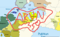 Arunid max extent.png 1,509 × 949; 495 KB
-
 Bad ass Burgoignix 01.jpg 1,024 × 1,024; 225 KB
-
 Bad ass Burgoignix 02.jpg 1,024 × 1,024; 202 KB
-
 Bad ass Burgoignix 03.jpg 1,024 × 1,024; 198 KB
-
 Bad ass Burgoignix 04.jpg 1,024 × 1,024; 230 KB
-
 Bad ass Burgoignix 05.jpg 1,024 × 1,024; 182 KB
-
 Bad ass Burgoignix 06.jpg 1,024 × 1,024; 238 KB
-
 Bad ass Burgoignix 07.jpg 1,024 × 1,024; 237 KB
-
 Bad ass Burgoignix 08.jpg 1,024 × 1,024; 224 KB
-
 Bad ass Burgoignix 09.jpg 1,024 × 1,024; 195 KB
-
 Bad ass Burgoignix 11.jpg 1,024 × 1,024; 231 KB
-
 Bad ass Burgoignix 12.jpg 1,024 × 1,024; 253 KB
-
 Bergendii colonies in central Daria.png 1,564 × 1,004; 291 KB
-
 Bergendii colonies in western Daria.png 1,080 × 1,355; 300 KB
-
 BRTCTerreRaubeuers1690s.jpeg 1,024 × 1,024; 215 KB
-
 Burg Colonial cynophile infantry 1583.jpg 350 × 254; 20 KB
-
 Burg First Frat 1854.png 800 × 800; 54 KB
-
 Burg in Chaukhira 1596.jpg 504 × 350; 52 KB
-
 Burg Trans-Equatorial slave route.jpg 1,024 × 1,024; 300 KB
-
 BurgAlsharAudColonies.png 827 × 609; 166 KB
-
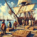 Burgo-Canespan potato trade in 1727, by Girart-Pierry Gisguarde LaMenteble.jpg 1,024 × 1,024; 362 KB
-
 Burgoignesc colonial empire max extent.png 2,162 × 1,080; 260 KB
-
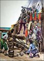 Burgs on ships getting mushrooms.jpg 564 × 786; 128 KB
-
 Classical Torlen 1.jpg 1,392 × 1,002; 246 KB
-
 Classical Torlen 2.jpg 1,392 × 1,352; 294 KB
-
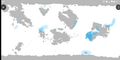
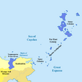 Far East Colony Max Extent map.png 700 × 700; 42 KB
-
 Fight to the sea Juy 23rd 2032.jpeg 1,024 × 1,024; 182 KB
-
 First Base Chaukhira.jpg 553 × 378; 134 KB
-
 Jean-Baptiste Rousseau deN'QuaiCong.jpg 1,024 × 1,024; 241 KB
-
 Kandara Khanate.jpg 1,024 × 1,024; 143 KB
-
 Kandara Khanate1.jpg 1,024 × 1,024; 96 KB
-
 Kandara Khanate2.jpg 1,024 × 1,024; 217 KB
-
 Kandara Khanate3.jpg 1,024 × 1,024; 211 KB
-
 Kemeti civ max extent.png 1,080 × 1,244; 274 KB
-
 KPCCity.jpeg 1,024 × 1,024; 275 KB
-
 Luc-Etienne Mirrel deN'QuaiCong.jpg 1,024 × 1,024; 237 KB
-
 Mathieu-Charls Dubois deN'QuaiCong.jpg 1,024 × 1,024; 207 KB
-
 MNLC infantry 1592.jpg 563 × 719; 48 KB
-
 Myanga Ayil Khanate at its peak 1495.png 1,080 × 1,113; 301 KB
-
 New Burg colonial claims expansion map.jpg 500 × 500; 130 KB
-
 Pierre-Louis Lefevre deN'QuaiCong.jpg 1,024 × 1,024; 284 KB
-
 Queen Sjaro Santasi Kandara.jpg 1,024 × 1,024; 276 KB
-
 Silk Road.png 3,285 × 1,923; 334 KB
-
 St.NicholasPoliticalMap.png 500 × 500; 18 KB
-
 St.NickColonyPineappleLatifundia.jpeg 1,024 × 1,024; 250 KB
-
 Torlen Prehistoric.png 1,024 × 1,024; 1.99 MB
-
 When its time to run to the grocery store that is Alshar.jpg 564 × 760; 84 KB


