Great Kavir: Difference between revisions
mNo edit summary |
Tag: 2017 source edit |
||
| (One intermediate revision by the same user not shown) | |||
| Line 7: | Line 7: | ||
==Gallery== | ==Gallery== | ||
<gallery mode="packed"> | <gallery mode="packed"> | ||
File:Hoggar8.jpg | File:Hoggar8.jpg|[[Umardwal]] | ||
File:Algeria_Sahara_Desert_Photo_From_Drone_5.jpg | File:Algeria_Sahara_Desert_Photo_From_Drone_5.jpg|[[Umardwal]] | ||
File:Sunset_in_Sahara.jpg | File:Sunset_in_Sahara.jpg|[[Umardwal]] | ||
File:Village_Telly_in_Mali.jpg | File:Village_Telly_in_Mali.jpg|[[Pursat]] | ||
File:GueltaCamels.jpg | File:GueltaCamels.jpg|[[Bulkh]] | ||
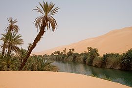
File:Libya_5391_Ubari_Lakes_Luca_Galuzzi_2007.jpg | File:Libya_5391_Ubari_Lakes_Luca_Galuzzi_2007.jpg|[[Battganuur]] | ||
File:Vue_de_Taghit.jpg | File:Vue_de_Taghit.jpg|[[Pursat]] | ||
File:Ghardaia01.jpg | File:Ghardaia01.jpg|[[Pursat]] | ||
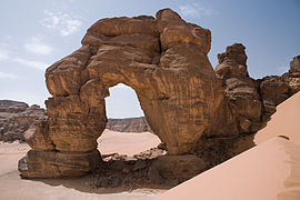
File:Libya_5101_Fozzigiaren_Arch_Tadrart_Acacus_Luca_Galuzzi_2007.jpg | File:Libya_5101_Fozzigiaren_Arch_Tadrart_Acacus_Luca_Galuzzi_2007.jpg|[[Battganuur]] | ||
File:Hoggar_Desert_(Algerie).jpg | File:Hoggar_Desert_(Algerie).jpg|[[Bulkh]] | ||
File:Tunisia_10-12_-_141_-_Salt_Flats_(6609472321).jpg | File:Tunisia_10-12_-_141_-_Salt_Flats_(6609472321).jpg|{{wp|Salt flats}} in [[Bulkh]] | ||
</gallery> | </gallery> | ||
| Line 24: | Line 24: | ||
[[Category:Geography]] | [[Category:Geography]] | ||
[[Category:IXWB]] | [[Category:IXWB]] | ||
[[Category: | [[Category:Nature]] | ||
[[Category: Infrastructure]] | [[Category: Infrastructure]] | ||
[[Category: Battganuur]] | [[Category: Battganuur]] | ||
Latest revision as of 22:32, 3 August 2024
| This article is a stub. You can help IxWiki by expanding it. |
The Great Kavir (Kaveer meaning "wasteland" in Arabic) is a desert spanning across Battganuur, Bulkh, Pursat, and Umardwal in Daria, Audonia. Some 5,000 years ago, the area was not so arid and the vegetation might have been closer to a savanna. However, desertification set in around 3000 BCE, and the desert became much like it is today. The Great Kavir is mainly rocky stone plateaus (hamada); sand seas – large areas covered with sand dunes (ergs); gravel plains (reg); dry valleys (wadi); dry lakes (oued); and salt flats (shatt or chott).
There is an international reclamation project called the Great Green Wall occurring in Battganuur, Bulkh, and Pursat, with investment from Burgundie to green, rewild, and de-desertify the edge of the desert to reclaim arable land.
Gallery
-
Salt flats in Bulkh


