Great Kavir: Difference between revisions
mNo edit summary Tag: 2017 source edit |
Tags: Mobile edit Mobile web edit Advanced mobile edit |
||
| (15 intermediate revisions by 2 users not shown) | |||
| Line 1: | Line 1: | ||
{{stub}} | {{stub}} | ||
{{distinguish|Great Kirav}} | |||
The '''Great Kavir''' (Kaveer meaning "wasteland" in Arabic) is a desert spanning across [[Battganuur]], [[Bulkh]], [[Pursat]], and [[Umardwal]] in [[Daria]], [[Audonia]]. Some 5,000 years ago, the area was not so arid and the vegetation might have been closer to a {{wp|savanna}}. However, desertification set in around 3000 BCE, and the desert became much like it is today. The Great Kavir is mainly rocky stone plateaus ({{wp|hamada}}); sand seas – large areas covered with {{wp|sand dunes}} ({{wp|ergs}}); gravel plains ({{wp|reg}}); dry valleys ({{wp|wadi}}); dry lakes ({{wp|Dry lake|oued}}); and salt flats ({{wp|Salt pan (geology)|shatt or chott}}). | The '''Great Kavir''' (Kaveer meaning "wasteland" in Arabic) is a desert spanning across [[Battganuur]], [[Bulkh]], [[Pursat]], and [[Umardwal]] in [[Daria]], [[Audonia]]. Some 5,000 years ago, the area was not so arid and the vegetation might have been closer to a {{wp|savanna}}. However, desertification set in around 3000 BCE, and the desert became much like it is today. The Great Kavir is mainly rocky stone plateaus ({{wp|hamada}}); sand seas – large areas covered with {{wp|sand dunes}} ({{wp|ergs}}); gravel plains ({{wp|reg}}); dry valleys ({{wp|wadi}}); dry lakes ({{wp|Dry lake|oued}}); and salt flats ({{wp|Salt pan (geology)|shatt or chott}}). | ||
There is an international reclamation project called the [[Great Green Wall]] occurring in [[Battganuur]], [[Bulkh]], and [[Pursat]], with investment from [[Burgundie]] to green, rewild, and de-desertify the edge of the desert to reclaim arable land. | There is an international reclamation project called the [[Great Green Wall]] occurring in [[Battganuur]], [[Bulkh]], and [[Pursat]], with investment from [[Burgundie]] to green, rewild, and de-desertify the edge of the desert to reclaim arable land. | ||
==Human intervention== | |||
{{Further|Great Green Wall}} | |||
The Great Green Wall is a [[Burgundie|Burgoignesc]], [[Battganuur]], [[Bulkh]], and [[Pursat]] greening, rewinding, and de-desertification project to reclaim arable land from the [[Great Kavir]] in [[Daria]], [[Audonia]]. | |||
The project adopted by the Darian Union in [[2012]], initially conceived as a way to combat {{wp|desertification}} caused primarily by {{wp|climate change}} and hold back expansion of the [[Great Kavir]], by planting a wall of trees stretching along the southern bounds of the desert. The original dimensions of the "wall" were to be 15 km (9 mi) wide and 7,775 km (4,831 mi) long, but the program has since expanded. The concept evolved into promoting water harvesting techniques, greenery protection and improving indigenous land use techniques. Later it adopted the view that desert boundaries change based on rainfall variations. | |||
The ongoing goal of the project is to restore 100 million hectares (250 million acres) of degraded land and capture 250 million tonnes of {{wp|carbon dioxide capture|carbon dioxide}} and create 10 million jobs in the process all by [[2035]]. | |||
The project is a response to the combined effect of {{wp|Natural_resource#Depletion|natural resources degradation}} and {{wp|drought}} in rural areas. It seeks to help communities {{wp|Climate change mitigation|mitigate}} and {{wp|Climate change adaptation|adapt}} to climate change as well as improve {{wp|food security}}. The population of the [[Great Kavir|Kavirian interior]] is expected to double by [[2040]], emphasizing the importance of maintaining food production and environmental protection in the area. | |||
==Water== | |||
In the 2020s [[Burgundie|Burgo]]-[[Bulkh]]awan researchers, using the [[Great Kavir Research and Sovereignty Patrol Structure]] found three massive aquifers under the Great Kavir, one in central [[Bulkh]], one on the southern [[Battganuur]]i-[[Bulkh]]awan border, and one on the northern [[Bulkh]]awan-[[Umardwal|Umardi]] border. There are an estimated 47 trillion gallons in these three aquifers. The Bahr al-Sahra, in central [[Bulkh]], estimated at 13 trillion gallons, was tapped to be the first to exploit. There was determined to be a higher-than-acceptable levels of nitrogen in the groundwater, so wells built with intricate filtration systems were built. | |||
==Culture== | |||
===Nomadism=== | |||
[[File:Sunset_in_Sahara.jpg|right|thumb|Nomadic Bedouins in southern Umardwal.]] | |||
The {{wp|Nomadic pastoralism|pastorally nomad}}ic {{wp|Arabs|Arab}} who live throughout the Great Kavir are mostly from the Bedu tribes. There are an estimated to be 750,600 in number, but they are not counted in any census of the nation's around the Great Kavir. | |||
===Troglodytism=== | |||
[[File:Matmata_-_panoramio_(13).jpg|right|thumb|Troglodyte home in Bulkh.]] | |||
There are about 50,000 troglodytes in an estimated 6,750 troglodyte homes in the Great Kavir. There are 7 tribes of Bedus that have historically engaged in troglodytism (cave dwelling). These people have a long history of building their communities and critical infrastructure for at least the last 3,000 years. | |||
==Gallery== | ==Gallery== | ||
<gallery mode="packed"> | <gallery mode="packed"> | ||
File:Hoggar8.jpg | File:Hoggar8.jpg|[[Umardwal]] | ||
File:Algeria_Sahara_Desert_Photo_From_Drone_5.jpg | File:Algeria_Sahara_Desert_Photo_From_Drone_5.jpg|[[Umardwal]] | ||
File:Village_Telly_in_Mali.jpg|[[Pursat]] | |||
File:Village_Telly_in_Mali.jpg | File:GueltaCamels.jpg|[[Bulkh]] | ||
File:GueltaCamels.jpg | File:Libya_5391_Ubari_Lakes_Luca_Galuzzi_2007.jpg|[[Battganuur]] | ||
File:Libya_5391_Ubari_Lakes_Luca_Galuzzi_2007.jpg | File:Vue_de_Taghit.jpg|[[Pursat]] | ||
File:Vue_de_Taghit.jpg | File:Ghardaia01.jpg|[[Pursat]] | ||
File:Ghardaia01.jpg | File:Libya_5101_Fozzigiaren_Arch_Tadrart_Acacus_Luca_Galuzzi_2007.jpg|[[Battganuur]] | ||
File:Libya_5101_Fozzigiaren_Arch_Tadrart_Acacus_Luca_Galuzzi_2007.jpg | File:Hoggar_Desert_(Algerie).jpg|[[Bulkh]] | ||
File:Hoggar_Desert_(Algerie).jpg | File:Tunisia_10-12_-_141_-_Salt_Flats_(6609472321).jpg|{{wp|Salt flats}} in [[Bulkh]] | ||
File:Tunisia_10-12_-_141_-_Salt_Flats_(6609472321).jpg | |||
</gallery> | </gallery> | ||
| Line 22: | Line 43: | ||
[[Category:Geography]] | [[Category:Geography]] | ||
[[Category:IXWB]] | [[Category:IXWB]] | ||
[[Category: | [[Category:Nature]] | ||
[[Category: Infrastructure]] | [[Category: Infrastructure]] | ||
[[Category: Battganuur]] | [[Category: Battganuur]] | ||
Latest revision as of 15:47, 9 November 2024
| This article is a stub. You can help IxWiki by expanding it. |
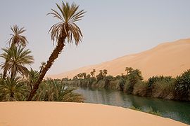
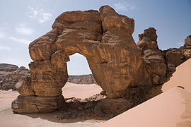
The Great Kavir (Kaveer meaning "wasteland" in Arabic) is a desert spanning across Battganuur, Bulkh, Pursat, and Umardwal in Daria, Audonia. Some 5,000 years ago, the area was not so arid and the vegetation might have been closer to a savanna. However, desertification set in around 3000 BCE, and the desert became much like it is today. The Great Kavir is mainly rocky stone plateaus (hamada); sand seas – large areas covered with sand dunes (ergs); gravel plains (reg); dry valleys (wadi); dry lakes (oued); and salt flats (shatt or chott).
There is an international reclamation project called the Great Green Wall occurring in Battganuur, Bulkh, and Pursat, with investment from Burgundie to green, rewild, and de-desertify the edge of the desert to reclaim arable land.
Human intervention
The Great Green Wall is a Burgoignesc, Battganuur, Bulkh, and Pursat greening, rewinding, and de-desertification project to reclaim arable land from the Great Kavir in Daria, Audonia. The project adopted by the Darian Union in 2012, initially conceived as a way to combat desertification caused primarily by climate change and hold back expansion of the Great Kavir, by planting a wall of trees stretching along the southern bounds of the desert. The original dimensions of the "wall" were to be 15 km (9 mi) wide and 7,775 km (4,831 mi) long, but the program has since expanded. The concept evolved into promoting water harvesting techniques, greenery protection and improving indigenous land use techniques. Later it adopted the view that desert boundaries change based on rainfall variations.
The ongoing goal of the project is to restore 100 million hectares (250 million acres) of degraded land and capture 250 million tonnes of carbon dioxide and create 10 million jobs in the process all by 2035. The project is a response to the combined effect of natural resources degradation and drought in rural areas. It seeks to help communities mitigate and adapt to climate change as well as improve food security. The population of the Kavirian interior is expected to double by 2040, emphasizing the importance of maintaining food production and environmental protection in the area.
Water
In the 2020s Burgo-Bulkhawan researchers, using the Great Kavir Research and Sovereignty Patrol Structure found three massive aquifers under the Great Kavir, one in central Bulkh, one on the southern Battganuuri-Bulkhawan border, and one on the northern Bulkhawan-Umardi border. There are an estimated 47 trillion gallons in these three aquifers. The Bahr al-Sahra, in central Bulkh, estimated at 13 trillion gallons, was tapped to be the first to exploit. There was determined to be a higher-than-acceptable levels of nitrogen in the groundwater, so wells built with intricate filtration systems were built.
Culture
Nomadism

The pastorally nomadic Arab who live throughout the Great Kavir are mostly from the Bedu tribes. There are an estimated to be 750,600 in number, but they are not counted in any census of the nation's around the Great Kavir.
Troglodytism

There are about 50,000 troglodytes in an estimated 6,750 troglodyte homes in the Great Kavir. There are 7 tribes of Bedus that have historically engaged in troglodytism (cave dwelling). These people have a long history of building their communities and critical infrastructure for at least the last 3,000 years.
Gallery
-
Salt flats in Bulkh


