Battganuur: Difference between revisions
m (Text replacement - "Pauldustllah" to "Paulastra") |
m (→See also) |
||
| (119 intermediate revisions by 3 users not shown) | |||
| Line 1: | Line 1: | ||
{| | {{stub}} | ||
! | {{Infobox country | ||
|conventional_long_name = Republic of Battganuur | |||
|native_name = | |||
|common_name = Battganuur | |||
|status = <!--Status of country, especially useful for micronations--> | |||
|image_flag = File:Flag_of_TRWT.svg | |||
|alt_flag = Flag of Battganuur | |||
|flag_type = | |||
|flag_border = yes | |||
|image_flag2 = | |||
|alt_flag2 = | |||
|flag2_border = | |||
|image_coat = | |||
|alt_coat = | |||
|symbol_type = | |||
|national_motto = | |||
|englishmotto = | |||
|national_anthem = | |||
|other_symbol_type = | |||
|other_symbol = | |||
|image_map = Map of Battganuur.png | |||
|loctext = | |||
|alt_map = <!--alt text for map--> | |||
|map_caption = Location of Battganuur (dark green) | |||
|map_width = 270px | |||
|image_map2 = | |||
|alt_map2 = <!--alt text for second map--> | |||
|map_caption2 = | |||
|capital = Alihijan | |||
|coordinates = <!-- Coordinates for capital, using {{tl|coord}} --> | |||
|largest_city = capital | |||
|largest_settlement_type = largest city | |||
|largest_settlement = | |||
|official_languages = | |||
|national_languages = | |||
|regional_languages = <!--Languages recognised or associated with particular regions within the country/territory--> | |||
|languages_type = Official languages<br /> {{nobold|Recognised minority languages}} | |||
|languages = {{wpl|Persian|Umardi}}, [[Burgoignesc language|Burgoignesc]] | |||
|languages_sub = <!--Is this further type of language a sub-item of the previous non-sub type? ("yes" or "no")--> | |||
|languages2_type = | |||
|languages2 = | |||
|languages2_sub = <!--Is the second alternative type of languages a sub-item of the previous non-sub type? ("yes" or "no")--> | |||
|ethnic_groups = | |||
|ethnic_groups_year = <!--Year of ethnic groups data (if provided)--> | |||
|ethnic_groups_ref = <!--(for any ref/s to associate with ethnic groups data)--> | |||
|religion = | |||
|religion_year = <!--Year of religion data (if provided)--> | |||
|religion_ref = <!--(for any ref/s to associate with religion data)--> | |||
|demonym = Battganuuri | |||
|government_type = | |||
|leader_title1 = Chief of Ministers | |||
|leader_name1 = Faisal-Jallal Asayesh Aslani | |||
|legislature = | |||
|upper_house = | |||
|lower_house = | |||
|sovereignty_type = | |||
|sovereignty_note = | |||
|established_event1 = | |||
|established_date1 = | |||
|established_event2 = | |||
|established_date2 = | |||
|established_event3 = | |||
|established_date3 = | |||
|area_rank = | |||
|area = | |||
|area_km2 = 1525943.29 | |||
|area_sq_mi = 589170 | |||
|area_footnote = <!--Optional footnote for area--> | |||
|percent_water = | |||
|area_label = Total | |||
|area_label2 = <!--Label below area_label (optional)--> | |||
|area_data2 = <!--Text after area_label2 (optional)--> | |||
|population_estimate = 204,504,300 | |||
|population_estimate_rank = | |||
|population_estimate_year = 2025 | |||
|population_census = | |||
|population_census_year = | |||
|population_density_km2 = 134.018 | |||
|population_density_sq_mi = 347.105 | |||
|population_density_rank = | |||
|nummembers = <!--An alternative to population for micronation--> | |||
|GDP_PPP = <!--(Gross Domestic Product from Purchasing Power Parity)--> | |||
|GDP_PPP_rank = | |||
|GDP_PPP_year = | |||
|GDP_PPP_per_capita = | |||
|GDP_PPP_per_capita_rank = | |||
|GDP_nominal = | |||
|GDP_nominal_rank = | |||
|GDP_nominal_year = 3,748,972,827,600 | |||
|GDP_nominal_per_capita = 18,332 | |||
|GDP_nominal_per_capita_rank = | |||
|Gini = | |||
|Gini_ref = <!--(for any ref/s to associate with Gini number)--> | |||
|Gini_rank = | |||
|Gini_year = | |||
|HDI_year = <!-- Please use the year to which the data refers, not the publication year--> | |||
|HDI = | |||
|HDI_change = | |||
|HDI_rank = | |||
|HDI_ref = <!--(for any ref/s to associate with HDI number)--> | |||
|currency = | |||
|currency_code = | |||
|time_zone = <!--e.g. GMT, PST, AST, etc, etc (wikilinked if possible)--> | |||
|utc_offset = - | |||
|drives_on = | |||
|cctld = | |||
|iso3166code = <!--Use to override default from common_name parameter above; omit using "omit".--> | |||
|calling_code = <!--e.g. [[+1]], [[+531]], [[+44]], etc--> | |||
|patron_saint = <!--Use patron_saints for multiple--> | |||
|image_map3 = <!--Optional third map position, e.g. for use with reference to footnotes below it--> | |||
|alt_map3 = <!--alt text for third map position--> | |||
}} | |||
'''Battganuur''' is an industrialized and modern nation in western [[Audonia]], stratling the coasts of the eastern [[Sea of Istroya]], the southern coast of the Barbary Strait, the western coast of the [[Sea of Kandahar]], with a small land boarder with [[Umardwal]] in the north east, and a long southeastern border with [[Bulkh]]. Its coastal areas are heavily urbanized with its interior being largely rural. | |||
Battganuur has a bicameral legislature, a supreme court, and an executive, the Chief of Ministers who acts in the same capacity as a president. | |||
It is a member of the [[League of Nations]], the {{wpl|International Red Cross and Red Crescent Movement}}, and many other international organizations. | |||
| | |||
It is a market economy focused on exports, under the watchful eye of [[Burgundie]] whose companies have a massive stake in the country's economic activity. It specializes in the assembly of microprocessors and cellphones, as well as the cultivation of tropical hard woods, fishing, and rubber, which also constitutes its major exports. It is an active leader in the [[Middle seas region]]'s economic activity. | |||
Many scholars have criticized its economic governance and politics, arguing that it is merely a client of the [[Burgoignesc thalattocracy]]'s economic and cultural might. | |||
The people of Battganuur are predominantly culturally Persian, speak {{wpl|Persian|Umardi}}, and most practice {{wpl|Shia Islam}}. | |||
== Demographics == | |||
<gallery mode="packed"> | |||
File:شکیلا در خیابان فرشته تهران سال 1396.jpg | |||
File:Shayan The First Persian Rapper.jpg | |||
File:Tehran Iran (Persia) July 2018 02.jpg | |||
File:Dr. Ahmad Khatami - Persian literature professor.jpg | |||
File:Portrait of a Persian lady in Iran, 10-08-2006.jpg | |||
File:Maryamzohdi.png | |||
File:Franz Scheurer Portrait.jpg | |||
File:Sahar Persian singer.jpg | |||
File:Persian Chic- Fashion Show (16466863232).jpg | |||
</gallery> | |||
=== Linguistic Demographics === | |||
=== Religious Demographics === | |||
==Culture== | |||
===Architecture=== | |||
<gallery mode="packed"> | |||
File:Iran (8665645695).jpg | |||
File:Casa histórica de Tabatabaeis, Kashan, Irán, 2016-09-19, DD 64.jpg | |||
File:Park Golden amol - Iran - mazandaran.JPG | |||
File:Jahan-nema Garden. Shiraz-Iran.jpg | |||
File:Tarikhaneh, Damghan, Iran.jpg | |||
File:Mezquita de Agha Bozorg, Kashan, Irán, 2016-09-19, DD 80.jpg | |||
File:TheTaba Tabaei historic house in Kashan - Iran.jpg | |||
File:IranIsfahanImamMoscheeEingang.jpg | |||
File:IranIsfahanFreitagsM8.jpg | |||
File:One of the iwan ceilings of Fatima Masumeh Shrine in atabki sahn, Qom, Iran.jpg | |||
</gallery> | |||
== History == | == History == | ||
===Prehistory=== | |||
Battganuur was originally settled by {{wp|Indo-Aryan peoples}} who likewise settled areas from [[Zaclaria]] to [[Pukhgundi]]. These people shared languages with common roots, the {{wp|Indo-Aryan languages}} which later diverged into Proto-Umardonian (west of the [[Sindhus River]]) and proto-Sindhus (east of the [[Sindhus River]]). | |||
====Umaronid Empire==== | |||
=== Classical Antiquity === | |||
<gallery mode="packed"> | |||
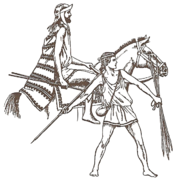
File:Ancient Persian costumes.jpg | |||
File:Ancient Egyptian, Assyrian, and Persian costumes and decorations (1920) (14761801871).jpg | |||
File:Greek soldiers of Greco–Persian Wars2.png|Istroyan soldiers | |||
</gallery> | |||
====Kingdom of Eshel==== | |||
{{Further|Kingdom of Eshel}} | |||
The [[Kingdom of Eshel]] was a Jewish ethnoreligious state formed round 500 BC under King Adud I on the Ominrud Peninsula. It was a regional powerhouse in the eastern [[Sea of Istroya]] during the late Classical Period with a strong trade network with the [[Istroyan civilization]]. It remained staunchly independent despite many attempts to subjugate them by the [[Battganuur#Ashrafinid_Empire|Ashrafinid Empire]] to the north. It is notable that Eshel fought on the side of the Christians in the [[Crusades]] in [[Audonia]] from [[1167]]–[[1428]]. In fact, the end of the [[Crusades]] was a contributing factor to the decimation of the Kingdom by the [[Oduniyyad Caliphate]] in [[1486]]. | |||
====Arunid Empire==== | |||
{{Further|Arunid Empire}} | |||
====Istroyan city states==== | |||
{{Further|Istroya}} | |||
====Ashrafinid Empire==== | |||
[[Audonian Christianity]] Ruled most of Battganuur and the [[Alcairet]]. | |||
The aristocracy refused to convert to Islam and were eventually pushed out and some emirated to [[Levantia]] to form [[Hištanšahr]] | |||
=== Golden Age === | |||
{{Further|Oduniyyad Caliphate}} | |||
Denoted as starting with the Muhammadian conquest of the city of Ramsakhs in 670s and ending at the fall of the [[Oduniyyad Caliphate]] in [[1517]], the [[Golden Age of Audonia]] had a sweeping effect on the area of modern Battganuur. When it was conquered by the [[Oduniyyad Caliphate]] in the 700 and 800s the area was generally already very developed and it took a lot of time and effort to convert the area to Islam. | |||
====Crusades==== | |||
{{Further|Crusades}} | |||
Battganuur was the most heavily impacted by the [[Crusades#In_Audonia_(1167–1428)|Crusades in Audonia]]. | |||
=== Colonial era === | |||
[[File:Bergendii_colonies_in_western_Daria.png|right|thumb|[[Istroya Oriental colony]] in blue, [[Barbary Straits colony]] in red.]] | |||
<gallery mode="packed"> | |||
File:Persian Musketeer.jpg | |||
File:Admiral François-Edmond Pâris - 1845 - Senegal Boat.png|Battganuuri boat in 1845 | |||
File:Saint-Louis Senegal Mage 1868.jpg | |||
File:Fort St. Louis, Senegal, from 1892 book The Story of Africa and its Explorers.png | |||
File:Regent's Town, Sierra Leone. Circa 1820.jpg | |||
File:Freetown, Sierra Leone ca 1856.jpg | |||
File:A Persian nobleman riding with his servant and smoking a hoo Wellcome V0019097.jpg | |||
File:Battle Between Persians and Russians - State Hermitage Museum.jpg | |||
File:Persian men by Cornelis de Bruijn.jpg | |||
File:Persian women by Cornelis de Bruijn.jpg | |||
File:The Persian Envoy Mirza Mohammed Reza Qazvini Finkenstein Castle 27 Avril 1807 by Francois Mulard.jpg | |||
File:Persian Zembouraki Camel Artillery.jpg | |||
File:Gombroon·Persia·1704.jpg | |||
</gallery> | |||
Starting with the fall of the [[Oduniyyad Caliphate]] in [[1517]] and lasting until the expulsion of the [[Burgoignesc Kandahar-Kandara Trading Company|Marialanii Ularien Trading Company]] in [[1836]] and the [[Burgoignesc South Levantine Trading Company|Bourgondii Royal Trading Company]] in [[1842]], the early modern era in Battganuur was characterized by rapid development, and unprecedented resource and human exploitation. | |||
==== Istroya Oriental colony ==== | |||
[[File:Coffee farm of a Liberian planter - Muhlenberg Mission, Liberia (Luther League Review, 1899).png|250px|right]] | |||
{{Further|Istroya Oriental colony}} | |||
{{Further|Burgoignesc colonial empire}} | |||
Colony of the [[Duchy of Martilles]]: [[1611]]-[[1795]] | |||
====Barbary Straits colony==== | |||
{{Further|Barbary Straits colony}} | |||
{{Further|Burgoignesc colonial empire}} | |||
Colony of the [[History of Dericania#Duchy of Marialanus|Duchy of Marialanus]]: [[1577]]-[[1876]] | |||
===Independence, post-colonial era=== | |||
<gallery mode="packed"> | |||
File:1830 Persian Soldier.jpg | |||
File:Persian Officers & Soldiers.jpg | |||
File:Orłowski Persian dignitary.jpg | |||
File:1884 Persian Officers & Soldiers.jpg | |||
</gallery> | |||
===Contemporary era=== | |||
<gallery mode="packed"> | |||
File:Omar Agha Leader of the Persian Kurds 1915.jpg | |||
</gallery> | |||
==Geography== | |||
[[File:Battganuur_Topo_Map.png|right|250px]] | |||
<gallery mode="packed"> | |||
File:Gambia LowerRiverDivision Countryside January2019.jpg | |||
File:Gambia River in Gambia (5).jpg | |||
File:The Gambia (3517747453).jpg | |||
File:Gambia (462809110).jpg | |||
File:Gambia (2345375814).jpg | |||
File:Acacia senegal L. 01.jpg | |||
File:Île du Saloum Sénégal 05.jpg | |||
File:Sunrise after the first rains.jpg | |||
File:Falaise du Cap de Naze - Reserve naturelle de Popenguine Thiès Sénégal, Juillet 2022 03.jpg | |||
File:Falaise à la réserve naturelle de Popenguine 06.jpg | |||
File:Liberia tropical forest.jpg | |||
File:Liberia, Africa - panoramio (322).jpg | |||
File:Monrovia, Liberia - panoramio (79).jpg | |||
File:Monrovia, Liberia - panoramio (81).jpg | |||
File:Liberia, Africa - panoramio (159).jpg | |||
File:Liberia, Africa - panoramio (185).jpg | |||
</gallery> | |||
===Climate and environment=== | |||
{{Further|Prevailing Winds}} | |||
[[File:Battganuur climate map.png|right|250px|Climate map of Battganuur.]] | |||
The tradewinds bring moisture from the [[Aab-e-Farus]] and the [[Sea of Kandahar]] to the northern interior of Battganuur. In the nation's coast picks up residual moisture from the [[Sea of Istroya]] but the tradewinds keep it from having a sever rainy season. The southern third of the country, predominantly Nahaqqez State, is dominated by the [[Great Kavir]]. The prevailing winds pushing moisture off of the [[Sea of Kandahar]] keeps the northern portion of the southern third semi-arid. | |||
==Economy== | |||
===Standard of living=== | |||
===Employment=== | |||
===Tourism=== | |||
<gallery mode="packed"> | |||
File:Delta du Saloum Sénégal, Février 2023.jpg | |||
File:Liberia, west Africa - panoramio.jpg | |||
File:Monrovia, Liberia - panoramio (43).jpg | |||
Liberia, Africa - panoramio (284).jpg | |||
</gallery> | |||
===Agriculture=== | |||
<gallery mode="packed"> | |||
File:DSC 4164 Reserva Agricula Rio Geba, Bafata Guiné-Bissau 04.jpg|Rice | |||
File:DSC 4164 Reserva Agricula Rio Geba, Bafata Guiné-Bissau 09.jpg|Cattle | |||
File:Cajus, Picada da Praia de Ofir, Bolama, Guiné-Bissau – 2018-03-03 – DSCN1264.jpg|Cashews | |||
File:Plantacion de mango, cerca de Liberia, Guanacaste - panoramio.jpg|Mangoe latifundia | |||
File:Shafiabad (Shahdad), Kerman Province, Iran (42688745312).jpg | |||
</gallery> | |||
'''Rice''': Around 26 million hectares of rice paddy land stretch across fertile plains of the northeastern provinces of Ahabijan, Andivaz, Takand, Maradan, and Malarand. Over 52 million people are employed in rice cultivation making it one of the largest employment sectors in the country. The rice sector yields an average 117 million tons annually, around 100 million tons, is exported, making it a critical pillar of the economy of the country. | |||
'''Cashews''': In the drier western part of the country, cashew trees thrive. Traditional methods prevail which involve hand-harvesting, sun-drying, and shelling the nuts, resulting in an export of around 200,000 tons each year. | |||
'''Mangoes''': Mangoes are grown in the country's west. Farmers utilize grafting techniques and careful water management to cultivate diverse varieties. An estimated 1 million tons of mangoes are produced annually, with around 700,000 tons exported. | |||
'''Bananas and Plantains''': Bananas and plantains grown in the northeast of Battganuur. Farmers employ sustainable practices like intercropping and organic fertilizers to cultivate around 2 million tons of bananas and plantains combined. Roughly 1 million tons find their way to international markets. | |||
'''Rubber''': Rubber latifundia thrive in the humid northeast. Skilled workers carefully extract latex using sustainable tapping methods, producing an estimated 300,000 tons of rubber annually. Around 250,000 tons are exported. | |||
'''Cattle and Goats''': Roaming freely across vast pastures in the west and southeast, cattle and goats are raised by herders. Traditional practices like rotational grazing and selective breeding ensure animal welfare and sustainability. Battganuur exports around 100,000 tons of beef and 50,000 tons of goat meat annually. | |||
'''Fishing''': The coastal waters surrounding Battganuur teem with diverse fish species. Modern fishing fleets and traditional techniques, maintain a catch of around 500,000 tons annually. Around 300,000 tons are exported. | |||
'''{{wp|Guar}} and {{wp|guar gum}}''': worlds largest producer | |||
====Agrinergie==== | |||
[[File:Solar Sharing Power Plant in Kamisu, Ibaraki 06.jpg|250px|right]] | |||
[[File:Aasen agrivoltaics solar plant with walls of vertical bifacial modules near Donaueschingen Germany 5.jpg|250px|right]] | |||
Main article: {{wp|Agrivoltaics}} | |||
Battganuur began to embrace agrinergie in [[2016]] when the Agricultural University of Maradan State partnered with the [[Burgundie|Burgoignesc]] [[List_of_companies_by_industry_in_Burgundie#Utilities|Gaia Energy Corporation]], and the local utility company on a project to bring power to isolated communities in the Northern Marashrra Mountains. The project was a success and it expanded across the western and southern parts of the country. These agrivoltaic projects have been resource intensive because, starting in [[2025]], Battganuur required them to create or connect to a micro-grid. Since the existing grid was subpar in many rural areas this requirement meant that in many areas entirely new grids were created. While this has slowed the expansion of agrivoltaic projects across the country, it has created a much higher resiliency in the communities where they are install. Agrivoltaics cover 33.7 hectares of farmland and generate around 250MW of power for local communities who were previously underserved or not at all connected to the national power grid. | |||
Battganuur is a pioneer in "vertical agrivoltaics" system, solar cells are oriented vertically on farmland. In [[2022]], Agricultural University of Maradan State partnered with the [[Burgundie|Burgoignesc]] [[List_of_companies_by_industry_in_Burgundie#Utilities|Gaia Energy Corporation]] piloted a vertical agrivoltaics project with bifacial vertical solar panel (BVSP) array in a corporate latifundia. The pilot proved 3-4% more efficient than the standard horizontal array layout. They were also able to double the total amount of photovoltaic coverage of the of the same acreage. Between [[2025]]-[[2032]] 14 hectares of BVSPs were installed representing over 40% of the total agrinergie arrays in Battganuur. | |||
===Logging/Mineral extraction=== | |||
[[File:Liberia, Africa - panoramio (106).jpg|Rubber latifundia|250px|right]] | |||
The tropical hardwood forestry is centered in the provinces of Ahabijan, Andivaz, Takand, Maradan, and Malarand. The primary woods cultivated and logged are teak, mahogany, ebony, rosewood, and padauk. Battganuur's timber industry is dominated by large companies employing advanced machinery in well planned plantations. In total, it employs around 320,000 people. | |||
Buttganuur logs 3 million tons of {{wp|teak}} annually, around 2.5 million tons are exported. This sector employs an estimated 150,000 people directly in cultivation, logging, and processing. 2 million tons of {{wp|mahogany}} are logged annually, Battganuur exports around 1.8 million tons. The mahogany sector employs an estimated 120,000 people across various stages of the industry. While Battganuur harvests around 300,000 tons of {{wp|ebony}} annually, only 200,000 tons are exported due to strict regulations and conservation efforts. This sector employs approximately 25,000 people, with a focus on responsible harvesting and community involvement. Renowned for its intricate grain and vibrant colors, {{wp|rosewood}} cultivation and logging are closely regulated in Battganuur. Large companies cultivate and harvest around 150,000 tons annually, exporting only 100,000 tons due to international restrictions on endangered species. This sector employs around 10,000 people, with a strong emphasis on sustainable practices and ethical sourcing. Known for its reddish-orange hue and durability, {{wp|padauk}} cultivation remains limited due to its slower growth rate. Large companies manage smaller plantations, producing around 200,000 tons annually and exporting 150,000 tons. This sector employs around 15,000 people, focusing on research and development for faster-growing padauk varieties while maintaining responsible practices. | |||
West dry tropical area: {{wp|acacia}}, {{wp|neem}}, and some {{wp|sal}} varieties. Sustainable management and focus on value-added products like furniture and veneers would be key. | |||
Southeast: {{wp|mesquite}} or {{wp|acacia}}, but small scale | |||
Rubber is a key sector in Battganuur's economy. Located in the nation's humid northeast, the provinces of Ahabijan, Andivaz, Takand, Maradan, and Malarand, host massive rubber plantations, managed by both large-scale companies and smaller family farms, thrive under the monsoon rains. While {{wp|Hevea brasiliensis}}, the Pará rubber tree, is the king shit. The annual production is 300,000 tons, Battganuur is one of the largest exporters in the global rubber market. | |||
====Mining==== | |||
diamonds | |||
===Fishing=== | |||
====Deep Sea Fishing==== | |||
====Fishing on the Kandahar==== | |||
====Aquaculture==== | |||
Main article: {{wp|Aquaculture}} | |||
Aquatic life farming, in general | |||
*{{wp|Pisciculture}}- fish farming | |||
**{{wp|Mariculture}}- Saltwater fish farming | |||
*{{wp|shrimp farming}} | |||
*{{wp|oyster farming}} | |||
*{{wp|algaculture}} | |||
=== | ===Manufacturing=== | ||
====Nuradaj MILCAR plant==== | |||
[[File:Iveco_Turbo_Daily_CN_facelift_2_China_2016-04-01.jpg|200px|right]] | |||
In [[2015]], [[MILCAR]] opened a plant in Nuradaj, Battganuur. This plant builds the passenger variant [[MILCAR#Trucks|Jornalero]]s used by many louage services in the [[Daria]] region of [[Audonia]]. They plant also includes repair facilities to maintain the buses they build. The plant employees about 1,000 people as is intentionally unautomated as a way to provide employment opportunities. Due to the wage differential between [[Pelaxia]] and Battganuur the plant is still profitable for the [[Pelaxia]]n company. | |||
=== | ===Infrastructure=== | ||
<gallery mode="packed"> | |||
File:Liberia, Africa - panoramio (281).jpg | |||
File:Liberia, Africa - panoramio (177).jpg | |||
File:TRANSPORT SENEGAL NDIAGA NDIAYE 3.jpg|Louage station | |||
File:Grande Sierra Leone (ship, 2011) 01.jpg | |||
File:RFA Argus in Sierra Leone to help combat Ebola MOD 45158323.jpg | |||
</gallery> | |||
====Maritime==== | |||
====Rail==== | |||
Battganuur uses [[Track gauges around the world|Standard gauge]], 1,435 mm (4 ft 8+1⁄2 in) as most of its rail infrastructure has been under the auspices of [[Burgundie]] and its sphere of influence in the [[Middle seas region]], who all use that rail gauge. | |||
====Roads==== | |||
==== | =====Louage===== | ||
A '''louage''' is a minibus shared taxi in many parts of [[Daria]] that were [[Burgoignesc colonial empire|colonized]] by [[Burgundie]]. In [[Burgoignesc language|Burgoignesc]], the name means "rental." Departing only when filled with passengers not at specific times, they can be hired at stations. Louage ply set routes, and fares are set by the government. In contrast to other share taxis in [[Audonia]], louage are sparsely decorated. Louages use a color-coding system to show customers what type of transport they provide and the destination of the vehicle. Louages with red lettering travel from one state to another, blue travel from city to city within a state, and yellow serves rural locales. Fares are purchased from ticket agents who walk throughout the louage stations or stands. Typical vehicles include: the [[MILCAR#Trucks|MILCAR Jornalero]], the [[TerreRaubeuer_Motor_Car_Company|TerreRaubeuer Valliant 130]], and the [[Cross_Trucking_Company#Industrial_and_Construction|CTC M237-07]]. | |||
====Air==== | |||
====Energy and electricity==== | |||
====Phone service and internet==== | |||
==Government and Politics== | |||
=== | ===Subdivisions=== | ||
[[File:Battganuur subdivisions.png|250px|right]] | |||
<gallery mode="packed"> | |||
File:Dakar Senegal - Looking North (5274051599).jpg|Nahaqqezrabad, capital of Nahaqqez | |||
</gallery> | |||
*Ahabijan | |||
*Andivaz | |||
*Takand | |||
*Maradan | |||
*Kangadasht | |||
*Kamanikand | |||
*Khoraz | |||
*Malarand | |||
*Salamnijan | |||
*Oros | |||
*Jirohriar | |||
*Kiliam | |||
*Kilarand | |||
*Oruftijan | |||
*Asakhs | |||
*Bonadbar | |||
*Nahaqqez | |||
====Alihijan Capital District==== | |||
Capital city, most populated city in Battganuur. | |||
<gallery mode="packed"> | |||
File:Bandarabbas-sahel-2.jpg | |||
File:IA_University._Bandar_Abbas_-_panoramio.jpg | |||
File:امامزاده_سید_مظفر_-_panoramio.jpg | |||
</gallery> | |||
== | ===Military=== | ||
[[File:Senegal soldiers - parachute jump.jpg|250px|right]] | |||
[[File:Gorée Island, Senegal, fort and harbor.jpg|250px|right]] | |||
[[File:Senegal Navy ship, preparing for a boarding exercise, during Saharan Express 2013.jpg|250px|right]] | |||
== See also == | |||
*[[Burgoignesc thalattocracy#Cultural_usage|Burgoignesc thalattocracy]] | |||
*[[Middle seas region]] | |||
{{Audonia topics}} | |||
[[Category:Audonia]] | |||
[[Category:Countries]] | |||
[[Category: Burgundie]] | [[Category: Burgundie]] | ||
[[Category: | [[Category:NPC Countries]] | ||
[[Category: Burgoignesc NPC Countries]] | |||
[[Category:Map Completion Project]] | |||
[[Category:Battganuur]] | |||
{{Template:Award winning article}} | |||
[[Category:2024 Award winning pages]] | |||
[[Category:IXWB]] | |||
Latest revision as of 16:01, 22 March 2024
| This article is a stub. You can help IxWiki by expanding it. |
Republic of Battganuur | |
|---|---|
 Flag | |
 Location of Battganuur (dark green) | |
| Capital and largest city | Alihijan |
| Official languages Recognised minority languages | Umardi, Burgoignesc |
| Demonym(s) | Battganuuri |
| Government | |
• Chief of Ministers | Faisal-Jallal Asayesh Aslani |
| Area | |
• Total | 1,525,943.29 km2 (589,170.00 sq mi) |
| Population | |
• 2025 estimate | 204,504,300 |
• Density | 134.018/km2 (347.1/sq mi) |
| GDP (nominal) | 3,748,972,827,600 estimate |
• Per capita | 18,332 |
| Time zone | UTC- |
Battganuur is an industrialized and modern nation in western Audonia, stratling the coasts of the eastern Sea of Istroya, the southern coast of the Barbary Strait, the western coast of the Sea of Kandahar, with a small land boarder with Umardwal in the north east, and a long southeastern border with Bulkh. Its coastal areas are heavily urbanized with its interior being largely rural.
Battganuur has a bicameral legislature, a supreme court, and an executive, the Chief of Ministers who acts in the same capacity as a president.
It is a member of the League of Nations, the International Red Cross and Red Crescent Movement, and many other international organizations.
It is a market economy focused on exports, under the watchful eye of Burgundie whose companies have a massive stake in the country's economic activity. It specializes in the assembly of microprocessors and cellphones, as well as the cultivation of tropical hard woods, fishing, and rubber, which also constitutes its major exports. It is an active leader in the Middle seas region's economic activity.
Many scholars have criticized its economic governance and politics, arguing that it is merely a client of the Burgoignesc thalattocracy's economic and cultural might.
The people of Battganuur are predominantly culturally Persian, speak Umardi, and most practice Shia Islam.
Demographics


_July_2018_02.jpg)


.jpg)
Linguistic Demographics
Religious Demographics
Culture
Architecture
.jpg)


History
Prehistory
Battganuur was originally settled by Indo-Aryan peoples who likewise settled areas from Zaclaria to Pukhgundi. These people shared languages with common roots, the Indo-Aryan languages which later diverged into Proto-Umardonian (west of the Sindhus River) and proto-Sindhus (east of the Sindhus River).
Umaronid Empire
Classical Antiquity
-

-

-
Istroyan soldiers

_(14761801871).jpg)

Kingdom of Eshel
The Kingdom of Eshel was a Jewish ethnoreligious state formed round 500 BC under King Adud I on the Ominrud Peninsula. It was a regional powerhouse in the eastern Sea of Istroya during the late Classical Period with a strong trade network with the Istroyan civilization. It remained staunchly independent despite many attempts to subjugate them by the Ashrafinid Empire to the north. It is notable that Eshel fought on the side of the Christians in the Crusades in Audonia from 1167–1428. In fact, the end of the Crusades was a contributing factor to the decimation of the Kingdom by the Oduniyyad Caliphate in 1486.
Arunid Empire
Istroyan city states
Ashrafinid Empire
Audonian Christianity Ruled most of Battganuur and the Alcairet. The aristocracy refused to convert to Islam and were eventually pushed out and some emirated to Levantia to form Hištanšahr
Golden Age
Denoted as starting with the Muhammadian conquest of the city of Ramsakhs in 670s and ending at the fall of the Oduniyyad Caliphate in 1517, the Golden Age of Audonia had a sweeping effect on the area of modern Battganuur. When it was conquered by the Oduniyyad Caliphate in the 700 and 800s the area was generally already very developed and it took a lot of time and effort to convert the area to Islam.
Crusades
Battganuur was the most heavily impacted by the Crusades in Audonia.
Colonial era

-

-

Battganuuri boat in 1845
-

-

-

-

-

-

-

-

-

-

-


Starting with the fall of the Oduniyyad Caliphate in 1517 and lasting until the expulsion of the Marialanii Ularien Trading Company in 1836 and the Bourgondii Royal Trading Company in 1842, the early modern era in Battganuur was characterized by rapid development, and unprecedented resource and human exploitation.
Istroya Oriental colony
.png)
Colony of the Duchy of Martilles: 1611-1795
Barbary Straits colony
Colony of the Duchy of Marialanus: 1577-1876
Independence, post-colonial era


Contemporary era

Geography


.jpg)
.jpg)
.jpg)
.jpg)


.jpg)
.jpg)
.jpg)
.jpg)
.jpg)
Climate and environment

The tradewinds bring moisture from the Aab-e-Farus and the Sea of Kandahar to the northern interior of Battganuur. In the nation's coast picks up residual moisture from the Sea of Istroya but the tradewinds keep it from having a sever rainy season. The southern third of the country, predominantly Nahaqqez State, is dominated by the Great Kavir. The prevailing winds pushing moisture off of the Sea of Kandahar keeps the northern portion of the southern third semi-arid.
Economy
Standard of living
Employment
Tourism


.jpg)
.jpg)
Agriculture
-

Rice
-

Cattle
-

Cashews
-

Mangoe latifundia
-


,_Kerman_Province,_Iran_(42688745312).jpg)
Rice: Around 26 million hectares of rice paddy land stretch across fertile plains of the northeastern provinces of Ahabijan, Andivaz, Takand, Maradan, and Malarand. Over 52 million people are employed in rice cultivation making it one of the largest employment sectors in the country. The rice sector yields an average 117 million tons annually, around 100 million tons, is exported, making it a critical pillar of the economy of the country.
Cashews: In the drier western part of the country, cashew trees thrive. Traditional methods prevail which involve hand-harvesting, sun-drying, and shelling the nuts, resulting in an export of around 200,000 tons each year.
Mangoes: Mangoes are grown in the country's west. Farmers utilize grafting techniques and careful water management to cultivate diverse varieties. An estimated 1 million tons of mangoes are produced annually, with around 700,000 tons exported.
Bananas and Plantains: Bananas and plantains grown in the northeast of Battganuur. Farmers employ sustainable practices like intercropping and organic fertilizers to cultivate around 2 million tons of bananas and plantains combined. Roughly 1 million tons find their way to international markets.
Rubber: Rubber latifundia thrive in the humid northeast. Skilled workers carefully extract latex using sustainable tapping methods, producing an estimated 300,000 tons of rubber annually. Around 250,000 tons are exported.
Cattle and Goats: Roaming freely across vast pastures in the west and southeast, cattle and goats are raised by herders. Traditional practices like rotational grazing and selective breeding ensure animal welfare and sustainability. Battganuur exports around 100,000 tons of beef and 50,000 tons of goat meat annually.
Fishing: The coastal waters surrounding Battganuur teem with diverse fish species. Modern fishing fleets and traditional techniques, maintain a catch of around 500,000 tons annually. Around 300,000 tons are exported.
Guar and guar gum: worlds largest producer
Agrinergie


Main article: Agrivoltaics Battganuur began to embrace agrinergie in 2016 when the Agricultural University of Maradan State partnered with the Burgoignesc Gaia Energy Corporation, and the local utility company on a project to bring power to isolated communities in the Northern Marashrra Mountains. The project was a success and it expanded across the western and southern parts of the country. These agrivoltaic projects have been resource intensive because, starting in 2025, Battganuur required them to create or connect to a micro-grid. Since the existing grid was subpar in many rural areas this requirement meant that in many areas entirely new grids were created. While this has slowed the expansion of agrivoltaic projects across the country, it has created a much higher resiliency in the communities where they are install. Agrivoltaics cover 33.7 hectares of farmland and generate around 250MW of power for local communities who were previously underserved or not at all connected to the national power grid.
Battganuur is a pioneer in "vertical agrivoltaics" system, solar cells are oriented vertically on farmland. In 2022, Agricultural University of Maradan State partnered with the Burgoignesc Gaia Energy Corporation piloted a vertical agrivoltaics project with bifacial vertical solar panel (BVSP) array in a corporate latifundia. The pilot proved 3-4% more efficient than the standard horizontal array layout. They were also able to double the total amount of photovoltaic coverage of the of the same acreage. Between 2025-2032 14 hectares of BVSPs were installed representing over 40% of the total agrinergie arrays in Battganuur.
Logging/Mineral extraction
.jpg)
The tropical hardwood forestry is centered in the provinces of Ahabijan, Andivaz, Takand, Maradan, and Malarand. The primary woods cultivated and logged are teak, mahogany, ebony, rosewood, and padauk. Battganuur's timber industry is dominated by large companies employing advanced machinery in well planned plantations. In total, it employs around 320,000 people. Buttganuur logs 3 million tons of teak annually, around 2.5 million tons are exported. This sector employs an estimated 150,000 people directly in cultivation, logging, and processing. 2 million tons of mahogany are logged annually, Battganuur exports around 1.8 million tons. The mahogany sector employs an estimated 120,000 people across various stages of the industry. While Battganuur harvests around 300,000 tons of ebony annually, only 200,000 tons are exported due to strict regulations and conservation efforts. This sector employs approximately 25,000 people, with a focus on responsible harvesting and community involvement. Renowned for its intricate grain and vibrant colors, rosewood cultivation and logging are closely regulated in Battganuur. Large companies cultivate and harvest around 150,000 tons annually, exporting only 100,000 tons due to international restrictions on endangered species. This sector employs around 10,000 people, with a strong emphasis on sustainable practices and ethical sourcing. Known for its reddish-orange hue and durability, padauk cultivation remains limited due to its slower growth rate. Large companies manage smaller plantations, producing around 200,000 tons annually and exporting 150,000 tons. This sector employs around 15,000 people, focusing on research and development for faster-growing padauk varieties while maintaining responsible practices.
West dry tropical area: acacia, neem, and some sal varieties. Sustainable management and focus on value-added products like furniture and veneers would be key.
Southeast: mesquite or acacia, but small scale
Rubber is a key sector in Battganuur's economy. Located in the nation's humid northeast, the provinces of Ahabijan, Andivaz, Takand, Maradan, and Malarand, host massive rubber plantations, managed by both large-scale companies and smaller family farms, thrive under the monsoon rains. While Hevea brasiliensis, the Pará rubber tree, is the king shit. The annual production is 300,000 tons, Battganuur is one of the largest exporters in the global rubber market.
Mining
diamonds
Fishing
Deep Sea Fishing
Fishing on the Kandahar
Aquaculture
Main article: Aquaculture Aquatic life farming, in general
- Pisciculture- fish farming
- Mariculture- Saltwater fish farming
- shrimp farming
- oyster farming
- algaculture
Manufacturing
Nuradaj MILCAR plant

In 2015, MILCAR opened a plant in Nuradaj, Battganuur. This plant builds the passenger variant Jornaleros used by many louage services in the Daria region of Audonia. They plant also includes repair facilities to maintain the buses they build. The plant employees about 1,000 people as is intentionally unautomated as a way to provide employment opportunities. Due to the wage differential between Pelaxia and Battganuur the plant is still profitable for the Pelaxian company.
Infrastructure
-

-

-

Louage station
-

-

.jpg)
.jpg)

_01.jpg)

Maritime
Rail
Battganuur uses Standard gauge, 1,435 mm (4 ft 8+1⁄2 in) as most of its rail infrastructure has been under the auspices of Burgundie and its sphere of influence in the Middle seas region, who all use that rail gauge.
Roads
Louage
A louage is a minibus shared taxi in many parts of Daria that were colonized by Burgundie. In Burgoignesc, the name means "rental." Departing only when filled with passengers not at specific times, they can be hired at stations. Louage ply set routes, and fares are set by the government. In contrast to other share taxis in Audonia, louage are sparsely decorated. Louages use a color-coding system to show customers what type of transport they provide and the destination of the vehicle. Louages with red lettering travel from one state to another, blue travel from city to city within a state, and yellow serves rural locales. Fares are purchased from ticket agents who walk throughout the louage stations or stands. Typical vehicles include: the MILCAR Jornalero, the TerreRaubeuer Valliant 130, and the CTC M237-07.
Air
Energy and electricity
Phone service and internet
Government and Politics
Subdivisions

-

Nahaqqezrabad, capital of Nahaqqez
.jpg)
- Ahabijan
- Andivaz
- Takand
- Maradan
- Kangadasht
- Kamanikand
- Khoraz
- Malarand
- Salamnijan
- Oros
- Jirohriar
- Kiliam
- Kilarand
- Oruftijan
- Asakhs
- Bonadbar
- Nahaqqez
Alihijan Capital District
Capital city, most populated city in Battganuur.


Military


See also
| Countries | |
|---|---|
| Dependencies | |
| Languages | |
| Geography | |
| History | |