Battganuur: Difference between revisions
m (→Golden Age) Tag: 2017 source edit |
m (→Colonial era) Tag: 2017 source edit |
||
| Line 199: | Line 199: | ||
The Oduniyyad Caliphate's expansion into Sarpedon brought it into conflict with Christian kingdoms, leading to a series of religious wars known as the [[Crusades#In_Audonia_(1167–1428)|Crusades in Audonia]] ([[1167–]] 1[[428]]CE). Battganuur, as a frontier region of the Caliphate, became a battleground for these conflicts. The Crusades had a profound impact on Battganuur, disrupting trade routes, causing economic instability, and exacerbating religious tensions. The region witnessed the construction of fortified castles and cities, as well as the emergence of military orders dedicated to defending the Christian faith. Despite the immense human and economic cost, the Crusades also fostered cultural exchange and intellectual curiosity. The encounter with Western ideas and technologies stimulated new developments in Battganuuri science, philosophy, and art. | The Oduniyyad Caliphate's expansion into Sarpedon brought it into conflict with Christian kingdoms, leading to a series of religious wars known as the [[Crusades#In_Audonia_(1167–1428)|Crusades in Audonia]] ([[1167–]] 1[[428]]CE). Battganuur, as a frontier region of the Caliphate, became a battleground for these conflicts. The Crusades had a profound impact on Battganuur, disrupting trade routes, causing economic instability, and exacerbating religious tensions. The region witnessed the construction of fortified castles and cities, as well as the emergence of military orders dedicated to defending the Christian faith. Despite the immense human and economic cost, the Crusades also fostered cultural exchange and intellectual curiosity. The encounter with Western ideas and technologies stimulated new developments in Battganuuri science, philosophy, and art. | ||
=== | ===Early modern history=== | ||
{{Further|Timeline_of_major_world_events#Early_modern_history|Burgoignesc colonial empire|Istroya Oriental colony|Barbary Straits colony}} | |||
[[File:Bergendii_colonies_in_western_Daria.png|right|thumb|[[Istroya Oriental colony]] in blue, [[Barbary Straits colony]] in red.]] | [[File:Bergendii_colonies_in_western_Daria.png|right|thumb|[[Istroya Oriental colony]] in blue, [[Barbary Straits colony]] in red.]] | ||
<gallery mode="packed"> | <gallery mode="packed"> | ||
Revision as of 21:20, 30 June 2024
This article is a work-in-progress because it is incomplete and pending further input from an author. Note: The contents of this article are not considered canonical and may be inaccurate. Please comment on this article's talk page to share your input, comments and questions. |
Republic of Battganuur | |
|---|---|
 Flag | |
 Location of Battganuur (dark green) | |
| Capital and largest city | Alihijan |
| Official languages Recognised minority languages | Umardi, Burgoignesc |
| Demonym(s) | Battganuuri |
| Government | |
• Chief of Ministers | Faisal-Jallal Asayesh Aslani |
| Area | |
• Total | 1,525,943.29 km2 (589,170.00 sq mi) |
| Population | |
• 2025 estimate | 204,504,300 |
• Density | 134.018/km2 (347.1/sq mi) |
| GDP (nominal) | 3,748,972,827,600 estimate |
• Per capita | 18,332 |
| Time zone | UTC- |
Battganuur is an industrialized and modern nation in western Audonia, stratling the coasts of the eastern Sea of Istroya, the southern coast of the Barbary Strait, the western coast of the Sea of Kandahar, with a small land boarder with Umardwal in the north east, and a long southeastern border with Bulkh. Its coastal areas are heavily urbanized with its interior being largely rural.
Battganuur has a bicameral legislature, a supreme court, and an executive, the Chief of Ministers who acts in the same capacity as a president.
It is a member of the League of Nations, the International Red Cross and Red Crescent Movement, and many other international organizations.
It is a market economy focused on exports, under the watchful eye of Burgundie whose companies have a massive stake in the country's economic activity. It specializes in the assembly of microprocessors and cellphones, as well as the cultivation of tropical hard woods, fishing, and rubber, which also constitutes its major exports. It is an active leader in the Middle seas region's economic activity.
Many scholars have criticized its economic governance and politics, arguing that it is merely a client of the Burgoignesc thalattocracy's economic and cultural might.
The people of Battganuur are predominantly culturally Persian, speak Umardi, and most practice Shia Islam.
Geography


.jpg)
.jpg)
.jpg)
.jpg)


.jpg)
.jpg)
.jpg)
.jpg)
.jpg)
Climate and environment

The tradewinds bring moisture from the Aab-e-Farus and the Sea of Kandahar to the northern interior of Battganuur. In the nation's coast picks up residual moisture from the Sea of Istroya but the tradewinds keep it from having a sever rainy season. The southern third of the country, predominantly Nahaqqez State, is dominated by the Great Kavir. The prevailing winds pushing moisture off of the Sea of Kandahar keeps the northern portion of the southern third semi-arid.
History
Prehistory
Battganuur was originally settled by Indo-Aryan peoples who likewise settled areas from Zaclaria to Pukhgundi. These people shared languages with common roots, the Indo-Aryan languages which later diverged into Proto-Umardonian (west of the Sindhus River) and proto-Sindhus (east of the Sindhus River).
Umaronid Empire
The Umaronid Empire, a Bronze Age civilization that thrived in western Audonia from approximately 3300 to 1300 BCE, left an indelible mark on the region. Renowned for their meticulous urban planning, the Umaronids constructed sprawling cities like Harappa and Mohenjo-daro, characterized by grid-like layouts, multi-story houses, and sophisticated drainage and water supply systems. This meticulous attention to detail extended to their economic practices, evident in their standardized weights and measures that facilitated trade and commerce across the empire. The Umaronids demonstrated exceptional craftsmanship and technological ingenuity. Their mastery of metallurgy is evident in the production of bronze tools and weapons, while their artistry is showcased in intricate seals, pottery, and figurines. Notably, the empire developed a unique script, yet to be deciphered, which tantalizingly hints at a complex language and potentially rich literary traditions. Despite its advancements, the Umaronid Empire eventually declined. While the precise reasons remain unclear, factors such as climate change, shifting river courses, and migrations likely played a role. Nevertheless, the legacy of the Umaronids endures, providing valuable insights into the social, economic, and cultural dynamics of early Audonian civilizations. The empire's contributions to urban planning, metallurgy, and artistic expression continue to inspire and inform contemporary understanding of the region's history.
Classical Antiquity
-

-

-
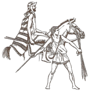
Istroyan soldiers

_(14761801871).jpg)

Northern Battganuur, under the dominion of the Arunid Empire, experienced a profound agricultural revolution, the burgeoning of a lucrative timber industry, and a dynamic cultural exchange that left an enduring legacy on the region's identity. Meanwhile, southern Battganuur, witnessed the rise and fall of empires, the fusion of Istroyan and Persian cultures, and the establishment of a vibrant Christian realm, the Ashrafinid Empire. While the coastal regions flourished under Istroyan influence, the interior of southern Battganuur remained a realm of tribal societies. These tribes, such as the Parthians and the Elamites, maintained their traditional nomadic or semi-nomadic lifestyles, herding livestock, cultivating crops, and engaging in trade with neighboring regions. The decentralized nature of tribal power structures made it difficult for a single dominant entity to emerge. Instead, the interior was characterized by a patchwork of alliances, rivalries, and shifting power dynamics. This political fragmentation, while fostering a degree of autonomy for individual tribes, also made the region vulnerable to external incursions and conquest.
Kingdom of Eshel
The Kingdom of Eshel was a Jewish ethnoreligious state formed round 500 BC under King Adud I on the Ominrud Peninsula. It was a regional powerhouse in the eastern Sea of Istroya during the late Classical Period with a strong trade network with the Ancient Istroyan civilization. It remained staunchly independent despite many attempts to subjugate them by the Ashrafinid Empire to the north. It is notable that Eshel fought on the side of the Christians in the Crusades in Audonia from 1167–1428. In fact, the end of the Crusades was a contributing factor to the decimation of the Kingdom by the Oduniyyad Caliphate in 1486.
Arunid Empire

The Arunid Empire's dominion over northern Battganuur, encompassing the present-day provinces of Ahabijan, Andivaz, Takand, Maradan, and Malarand, represents a pivotal epoch in the region's history. The empire's vast reach and influence brought about profound transformations, leaving an enduring legacy that continues to shape Battganuur's identity and development. The Arunid Empire, recognizing the fertile potential of northern Battganuur's plains, initiated a comprehensive agricultural development program. Extensive irrigation systems, including canals and reservoirs, were constructed to harness the waters of the Aab-e-Farus and its tributaries. This led to a significant increase in rice cultivation, transforming the region into a breadbasket for the empire. The surplus rice production not only sustained the empire's burgeoning population but also became a valuable commodity in regional trade networks. Alongside rice, the cultivation of other crops such as wheat, barley, fruits, and vegetables was also promoted, ensuring a diverse and resilient agricultural base. This agricultural revolution not only boosted the region's economic prosperity but also fostered social stability by ensuring food security. Northern Battganuur's lush forests, teeming with valuable hardwoods like teak, mahogany, ebony, rosewood, and padauk, attracted the attention of the Arunid Empire. Recognizing the potential of this resource, the empire established logging operations and implemented sustainable forestry practices. These woods were highly prized for their durability, beauty, and versatility, and were used in the construction of grand palaces, temples, and ships. The timber trade became a lucrative source of revenue for the empire, contributing to its economic power and influence. The demand for Battganuuri hardwoods spurred the development of infrastructure, including roads and ports, further integrating the region into the empire's vast economic network.
The Arunid Empire's dominion over northern Battganuur was not solely an economic endeavor. It also entailed a significant cultural and spiritual exchange. The Fravarti-Zoroastrian faith, with its emphasis on righteousness, social justice, and communal harmony, found fertile ground in the region. While it did not completely supplant existing religious practices, it gained a significant following and left a lasting imprint on the region's spiritual landscape. The empire's cosmopolitan cities, renowned centers of learning and commerce, attracted scholars, artisans, and merchants from across the known world. This influx of diverse cultures led to a vibrant cultural fusion, with elements of Persian, Indian, and Istroyan traditions intermingling with local customs. The adoption of the Umardi language, the lingua franca of the empire, facilitated communication and trade, further cementing the region's integration into the Arunid realm.
Istroyan city states
Beginning in the 6th century BCE, Istroyan mariners, hailing from the bustling city-states of northeastern Sarpedon, embarked on exploratory voyages across the Sea of Istroya. Drawn by tales of fertile lands, exotic spices, and lucrative trade opportunities, they established a series of colonies along the southern coast of Battganuur. These colonies, such as Alexandropolis (modern-day Bandar Abbas) and Seleucia ad Mare (modern-day Bushehr), quickly grew into thriving centers of commerce, culture, and learning. The Istroyans brought with them their language, philosophy, art, and architectural traditions, which deeply influenced the local Persi populations. Over time, a unique fusion of Istroyan and Persian cultures emerged, evident in the syncretic religious practices, the adoption of Istroyan architectural styles, and the widespread use of the Istroyan language in trade and administration. This cultural exchange left an enduring legacy, shaping the distinct identity of southern Battganuur for centuries to come.
Ashrafinid Empire
Audonian Christianity Ruled most of Battganuur and the Alcairet. The dawn of Christianity in the 1st century CE brought about a significant shift in the religious and political landscape of southern Battganuur. The new faith, with its message of salvation and universal brotherhood, resonated with many in the region, particularly among the urban populations who had already been exposed to Istroyan ideas and philosophies. In the 4th century CE, a charismatic leader named Ashrafi rose to prominence. He united the disparate Christian communities of southern Battganuur under his banner, establishing the Ashrafinid Empire. This empire, with its capital at Ctesiphon (modern-day Salman Pak), quickly expanded its influence, encompassing the entire southern region and even challenging the Arunid Empire for control of the Sea of Kandahar. The Ashrafinid Empire was a period of cultural flowering and economic prosperity. Ctesiphon became a center of Christian learning and scholarship, attracting theologians, philosophers, and artists from across the Audonian world. The empire's economy thrived on trade, agriculture, and the production of luxury goods, such as textiles, spices, and precious metals. The rise of the Oduniyyad Caliphate in the 7th century CE marked a turning point in the history of southern Battganuur. The Caliphate's expansionist policies brought it into conflict with the Ashrafinid Empire, leading to a series of bloody wars. In 762 CE, after a prolonged siege, Ctesiphon fell to the Oduniyyad forces, marking the end of the Ashrafinid Empire. The region was incorporated into the Caliphate, and Islam gradually replaced Christianity as the dominant religion. Many of the Ashrafinid aristocracy, refusing to renounce their faith, fled to Levantia, where they established the kingdom of Hištanšahr, preserving their cultural and religious heritage.
Medieval period

The Oduniyyad Caliphate's six centuries of rule left an indelible mark on Battganuur. The spread of Islam transformed the region's religious and cultural landscape, while the Caliphate's patronage of scholarship and the arts fostered a vibrant intellectual atmosphere. Battganuur's strategic location made it a crossroads for trade and cultural exchange, contributing to its unique identity. The Crusades, though a period of conflict and instability, also stimulated cultural exchange and intellectual curiosity. The legacy of this era continues to resonate in Battganuur's diverse cultural heritage, its architectural treasures, and its vibrant intellectual traditions.
The Oduniyyad Caliphate's dominion over Battganuur marked a significant chapter in the region's history, characterized by a confluence of religious fervor, cultural exchange, and geopolitical conflict. This period witnessed the spread of Islam, the flourishing of intellectual and artistic pursuits, and the challenges posed by external forces, particularly the Crusades. Following the collapse of the Arunid Empire and then the Ashrafinid Empire, the Oduniyyad Caliphate swiftly extended its influence over Battganuur. The introduction of Islam, a monotheistic faith with a strong emphasis on social justice and community, profoundly reshaped Battganuuri society. Mosques sprang up across the land, replacing or coexisting with Zoroastrian fire temples and Buddhist monasteries. The Arabic language, the lingua franca of the Caliphate, gained prominence in administration, trade, and scholarship. While the initial spread of Islam was often accompanied by military conquest, it gradually became a process of cultural assimilation and religious conversion. The Caliphate's emphasis on education and social welfare attracted many Battganuuri to the new faith, leading to a gradual but significant shift in the religious landscape. The Oduniyyad period was marked by a remarkable flourishing of intellectual and artistic pursuits in Battganuur. The Caliphate's patronage of scholarship and the arts created a vibrant intellectual atmosphere, attracting scholars, poets, and artists from across the Islamic world. Cities like Alihijan and Isfahan became centers of learning, where renowned scholars and scientists made significant contributions to fields such as mathematics, astronomy, medicine, and philosophy. Battganuuri artisans excelled in producing exquisite textiles, ceramics, metalwork, and calligraphy, which were highly prized throughout the Caliphate. Battganuur's strategic location, straddling the Sea of Kandahar and bordering the Sea of Istroya, made it a vital crossroads for trade and cultural exchange. The Caliphate's vast network of roads and maritime routes connected Battganuur to distant lands, facilitating the flow of goods, ideas, and people.
The Oduniyyad Caliphate's expansion into Sarpedon brought it into conflict with Christian kingdoms, leading to a series of religious wars known as the Crusades in Audonia (1167– 1428CE). Battganuur, as a frontier region of the Caliphate, became a battleground for these conflicts. The Crusades had a profound impact on Battganuur, disrupting trade routes, causing economic instability, and exacerbating religious tensions. The region witnessed the construction of fortified castles and cities, as well as the emergence of military orders dedicated to defending the Christian faith. Despite the immense human and economic cost, the Crusades also fostered cultural exchange and intellectual curiosity. The encounter with Western ideas and technologies stimulated new developments in Battganuuri science, philosophy, and art.
Early modern history

-

-

Battganuuri boat in 1845
-

-

-

-

-

-

-

-

-

-

-


Starting with the fall of the Oduniyyad Caliphate in 1517 and lasting until the expulsion of the Marialanii Ularien Trading Company in 1836 and the Bourgondii Royal Trading Company in 1842, the early modern era in Battganuur was characterized by rapid development, and unprecedented resource and human exploitation.
Istroya Oriental colony
.png)
Colony of the Duchy of Martilles: 1611-1795
Barbary Straits colony
Amid the outbreak of the Barbary Wars, while much of the anti-piracy conflict was centered around the Barbary Straits between the Buroignesc Navy and corsairs hailing from what is modern Battganuur, the range of Barbary pirates stretched even further north reaching even the domain of Soirwind. Soirwind being at the time a colonial domain under what is modern day Fiannria, the spike in piracy interrupting crucial trade routes between Fiannria and Soirwind quickly drew the ire of the Levantine state. In ____ Fiannria sent a punitive expedition towards the region to combat the corsairs. Rebuffed from operating in the main combat zone and drawing too close to the Barbary Straits itself, the Fiannan war fleet set for the north towards the northern Sea of Istroya to hunt down Corsairs who broke through and expanded operations that more directly impacted Fiannria itself. The war fleet would operate between the Hezikian Isles and Soirwind for the next three years in its attempt to guard trade routes and eliminate pirate holdouts and outposts. As the conflict in the Straits themselves raged on, the Fiannan central government would delegate more and more operational authority towards the holy orders which persisted as remants from the Crusaders and independent privateers in combating northern Barbary Piracy. This culminated in the year of _____ following the victory in the Barbary straits themselves, a large contingent of Barbary ships which survived the punitive Burgoignesc expeditions escaped to the north in order to flee arrest and execution and also find a new base of operations, instead off the southern coast of Soirwind, found a fleet of privateers and corsair chasers waiting between the coast and the island of Antilles. This fleet of holy orders, privateers and colonial defense ships from Soirwind, having gotten word of the coming fleet had gathered in the strait to attack and nip the bud of any continued corsair activity in the north. The resultant battle, the Battle in the Kamtague Narrows, saw the bulk of the remaining corsair force sunk or captured, and the remnants scattering, breaking any chance of a major Barbary incursion returning to operate in the north.
Colony of the Duchy of Marialanus: 1577-1876
Independence, post-colonial era


Independence in the southern regions of what would be modern day Battganuur came at an interesting time for the modern state of Fiannria. In desperate need for funds and resources following the wars which consumed the young Commonwealth's early years and somewhat political isolated following the success of the republic within the Holy Levantine Empire, the Commonwealth would seek for new relationships among the new young kingdoms and states that make up southern Battganuur. Both merchants and veterans of the early wars in Fiannria would find audiences in the courts of newly independent emirs who were interested in access to western-style tactics, western military equipment, and resources. In exchange for vital Levantine manufactured goods and weaponry, along with expertise, Fiannan merchants got a crucial lifeline in resources and income to allow the young Republic to survive and continue to fund its reconstruction. The relationships established by newly establish states formed in the wake of the independence movements in Audonia and the Commonwealth of Fiannria when it was in desperate need of allies and trading partners would come to define much of the relationship of Fiannria and Audonia from then on and establish a policy of state-building, support and relationship building between Audonian states and Fiannria during this period and after.
Contemporary era

Government and Politics
Subdivisions

-

Nahaqqezrabad, capital of Nahaqqez
.jpg)
- Ahabijan
- Andivaz
- Takand
- Maradan
- Kangadasht
- Kamanikand
- Khoraz
- Malarand
- Salamnijan
- Oros
- Jirohriar
- Kiliam
- Kilarand
- Oruftijan
- Asakhs
- Bonadbar
- Nahaqqez
Alihijan Capital District
Capital city, most populated city in Battganuur.


Military


Society


_July_2018_02.jpg)


.jpg)
Linguistic Demographics
Religious Demographics
Architecture
.jpg)


Economy
Standard of living
Employment
Tourism


.jpg)
.jpg)
Agriculture
-

Rice
-

Cattle
-

Cashews
-

Mangoe latifundia
-


,_Kerman_Province,_Iran_(42688745312).jpg)
Rice: Around 26 million hectares of rice paddy land stretch across fertile plains of the northeastern provinces of Ahabijan, Andivaz, Takand, Maradan, and Malarand. Over 52 million people are employed in rice cultivation making it one of the largest employment sectors in the country. The rice sector yields an average 117 million tons annually, around 100 million tons, is exported, making it a critical pillar of the economy of the country.
Cashews: In the drier western part of the country, cashew trees thrive. Traditional methods prevail which involve hand-harvesting, sun-drying, and shelling the nuts, resulting in an export of around 200,000 tons each year.
Mangoes: Mangoes are grown in the country's west. Farmers utilize grafting techniques and careful water management to cultivate diverse varieties. An estimated 1 million tons of mangoes are produced annually, with around 700,000 tons exported.
Bananas and Plantains: Bananas and plantains grown in the northeast of Battganuur. Farmers employ sustainable practices like intercropping and organic fertilizers to cultivate around 2 million tons of bananas and plantains combined. Roughly 1 million tons find their way to international markets.
Rubber: Rubber latifundia thrive in the humid northeast. Skilled workers carefully extract latex using sustainable tapping methods, producing an estimated 300,000 tons of rubber annually. Around 250,000 tons are exported.
Cattle and Goats: Roaming freely across vast pastures in the west and southeast, cattle and goats are raised by herders. Traditional practices like rotational grazing and selective breeding ensure animal welfare and sustainability. Battganuur exports around 100,000 tons of beef and 50,000 tons of goat meat annually.
Fishing: The coastal waters surrounding Battganuur teem with diverse fish species. Modern fishing fleets and traditional techniques, maintain a catch of around 500,000 tons annually. Around 300,000 tons are exported.
Guar and guar gum: worlds largest producer
Agrinergie


Main article: Agrivoltaics Battganuur began to embrace agrinergie in 2016 when the Agricultural University of Maradan State partnered with the Burgoignesc Gaia Energy Corporation, and the local utility company on a project to bring power to isolated communities in the Northern Marashrra Mountains. The project was a success and it expanded across the western and southern parts of the country. These agrivoltaic projects have been resource intensive because, starting in 2025, Battganuur required them to create or connect to a micro-grid. Since the existing grid was subpar in many rural areas this requirement meant that in many areas entirely new grids were created. While this has slowed the expansion of agrivoltaic projects across the country, it has created a much higher resiliency in the communities where they are install. Agrivoltaics cover 33.7 hectares of farmland and generate around 250MW of power for local communities who were previously underserved or not at all connected to the national power grid.
Battganuur is a pioneer in "vertical agrivoltaics" system, solar cells are oriented vertically on farmland. In 2022, Agricultural University of Maradan State partnered with the Burgoignesc Gaia Energy Corporation piloted a vertical agrivoltaics project with bifacial vertical solar panel (BVSP) array in a corporate latifundia. The pilot proved 3-4% more efficient than the standard horizontal array layout. They were also able to double the total amount of photovoltaic coverage of the of the same acreage. Between 2025-2032 14 hectares of BVSPs were installed representing over 40% of the total agrinergie arrays in Battganuur.
Logging/Mineral extraction
.jpg)
The tropical hardwood forestry is centered in the provinces of Ahabijan, Andivaz, Takand, Maradan, and Malarand. The primary woods cultivated and logged are teak, mahogany, ebony, rosewood, and padauk. Battganuur's timber industry is dominated by large companies employing advanced machinery in well planned plantations. In total, it employs around 320,000 people. Buttganuur logs 3 million tons of teak annually, around 2.5 million tons are exported. This sector employs an estimated 150,000 people directly in cultivation, logging, and processing. 2 million tons of mahogany are logged annually, Battganuur exports around 1.8 million tons. The mahogany sector employs an estimated 120,000 people across various stages of the industry. While Battganuur harvests around 300,000 tons of ebony annually, only 200,000 tons are exported due to strict regulations and conservation efforts. This sector employs approximately 25,000 people, with a focus on responsible harvesting and community involvement. Renowned for its intricate grain and vibrant colors, rosewood cultivation and logging are closely regulated in Battganuur. Large companies cultivate and harvest around 150,000 tons annually, exporting only 100,000 tons due to international restrictions on endangered species. This sector employs around 10,000 people, with a strong emphasis on sustainable practices and ethical sourcing. Known for its reddish-orange hue and durability, padauk cultivation remains limited due to its slower growth rate. Large companies manage smaller plantations, producing around 200,000 tons annually and exporting 150,000 tons. This sector employs around 15,000 people, focusing on research and development for faster-growing padauk varieties while maintaining responsible practices.
West dry tropical area: acacia, neem, and some sal varieties. Sustainable management and focus on value-added products like furniture and veneers would be key.
Southeast: mesquite or acacia, but small scale
Rubber is a key sector in Battganuur's economy. Located in the nation's humid northeast, the provinces of Ahabijan, Andivaz, Takand, Maradan, and Malarand, host massive rubber plantations, managed by both large-scale companies and smaller family farms, thrive under the monsoon rains. While Hevea brasiliensis, the Pará rubber tree, is the king shit. The annual production is 300,000 tons, Battganuur is one of the largest exporters in the global rubber market.
Mining
diamonds
Fishing
Deep Sea Fishing
Fishing on the Kandahar
Aquaculture
Main article: Aquaculture Aquatic life farming, in general
- Pisciculture- fish farming
- Mariculture- Saltwater fish farming
- shrimp farming
- oyster farming
- algaculture
Manufacturing
Nuradaj MILCAR plant

In 2015, MILCAR opened a plant in Nuradaj, Battganuur. This plant builds the passenger variant Jornaleros used by many louage services in the Daria region of Audonia. They plant also includes repair facilities to maintain the buses they build. The plant employees about 1,000 people as is intentionally unautomated as a way to provide employment opportunities. Due to the wage differential between Pelaxia and Battganuur the plant is still profitable for the Pelaxian company.
Infrastructure
-

-

-

Louage station
-

-

.jpg)
.jpg)

_01.jpg)

The infrastructure of Battganuur is a mix of modern and developing systems, reflecting the country's emerging market status and its reliance on foreign investment. Significant improvements have been made in recent decades, particularly in the areas of transportation and telecommunications, due in part to investments from Burgundie during Operation Kipling in the 1960s-early 1980s.
Energy
Battganuur's energy sector is predominantly reliant on fossil fuels, particularly coal and natural gas, for power generation. However, there has been a growing trend towards renewable energy sources like hydropower, solar, and wind power, as well as biofuels, since the 1990s. The government has set targets to increase the share of renewables in the energy mix, but challenges remain in terms of financing and infrastructure development.
Transportation
- Railways: Battganuur uses Standard gauge, 1,435 mm (4 ft 8+1⁄2 in) as most of its rail infrastructure has been under the auspices of Burgundie and its sphere of influence in the Middle seas region, who all use that rail gauge. Its network connects major cities and industrial centers. The system is primarily used for freight transportation, especially for agricultural products and minerals. Passenger services are limited and primarily focused on intercity routes. The railway infrastructure is maintained by the state-owned Battganuur Railways.
- Highways: The country has a relatively extensive road network, connecting major urban areas and economic centers. However, the quality of roads varies significantly. While major highways are paved and well-maintained, many rural roads are unpaved and can become difficult to navigate during the monsoon season. The government has undertaken projects to improve and expand the road network, with funding from international donors.
- Ports: Battganuur has several ports along its coastline, which play a crucial role in the country's international trade. The main ports are located at Tarigar, the largest city, and at Sarkar, the capital. These ports handle a variety of cargo, including agricultural products, minerals, and manufactured goods.
- Airports: There are several airports in Battganuur, including international airports at Tarigar and Sarkar. These airports are served by both domestic and international airlines, providing connections to major cities in the region and beyond.
- Ferries: Ferries play an important role in domestic transportation, connecting the mainland with the various islands that make up the country. Passenger ferry services are primarily focused on domestic travel, but some routes extend to neighboring Tapakdore.
Louage
A louage is a minibus shared taxi in many parts of Daria that were colonized by Burgundie. In Burgoignesc, the name means "rental." Departing only when filled with passengers not at specific times, they can be hired at stations. Louage ply set routes, and fares are set by the government. In contrast to other share taxis in Audonia, louage are sparsely decorated. Louages use a color-coding system to show customers what type of transport they provide and the destination of the vehicle. Louages with red lettering travel from one state to another, blue travel from city to city within a state, and yellow serves rural locales. Fares are purchased from ticket agents who walk throughout the louage stations or stands. Typical vehicles include: the MILCAR Jornalero, the TerreRaubeuer Valliant 130, and the CTC M237-07.
Telecommunications
Battganuur's telecommunications infrastructure has seen significant development in recent years, with increasing mobile phone penetration and expanding internet access. The state-owned Battganuur Telecom is the largest provider, but there is growing competition from private operators. The government has launched initiatives to expand broadband access in rural areas and improve the overall quality of service.
See also
| Countries | |
|---|---|
| Dependencies | |
| Languages | |
| Geography | |
| History | |