Administrative divisions of Cartadania
This article or section is in the process of an expansion or major restructuring. You are welcome to assist in its construction by editing it as well. If this article or section has not been edited in several days, please remove this template. If you are the editor who added this template and you are actively editing, please be sure to replace this template with {{in use}} during the active editing session. Click on the link for template parameters to use.
This article was last edited by Insui (talk | contribs) 5 months ago. (Update timer) |
| This article is part of a series on the |
| Politics of Cartadania |
|---|
 |
|
|
|
The administrative divisions of Cartadania are the various governing entities that together form Cartadania. The first subdivisions are the states and territories, of which there are thirty-eight total. The admission of states into the union is authorized by the Constitution of Cartadania and is conducted by Congress. Predominantly, states outside the bounds of Lusia Velha have emerged through the organization of territories previously under federal sovereignty, often facilitated through congressional resolutions. Additionally, the partitioning of land within existing states or annexed regions has contributed to the formation of new states.
Within Cartadania's intricate political landscape, both federal and state governments coexist as parallel entities, a testament to the nation's distinct system of shared sovereignty. Unlike unitary systems, where divisions are derived directly from a centralized entity, Cartadanian states, along with the capital and federal territories, collectively compose the intricate fabric of the nation. Territories, under federal jurisdiction, boast considerable powers comparable to states, with the exception of certain aspects of autonomy and infrastructure management. Over time, the autonomy of territories has advanced through congressional actions, blurring the historical distinction.
State and territorial authorities wield legislative powers to formulate laws and administer justice, as long as these actions remain in harmony with federal statutes and uphold constitutional principles. States are often further subdivided into counties or analogous divisions (such as parishes, municipios, and merindades), the parameters of which are determined by jurisdictional considerations. Notably, the evolution of regions within Cartadania follows distinct patterns, with prior island-based counties like Solemia undergoing restructuring under the Goldstein Acts upon its elevation to statehood in 2026. Similar transformations occurred within São Ricardo, culminating in the formation of Pampalinda County and the City and County of Lua alongside Ricardo County.
Facilitating a broader understanding of Cartadanian territory, the Cartadanian Institute of Geography and Statistics delineates nine macroregions based on geographic, social, and economic factors. While academically recognized, these divisions carry minimal political implications beyond informing federal-level initiatives. The individual states retain the authority to define internal subregional configurations, which may, on occasion, be referenced within federal records, contingent upon state-specific contexts and preferences.
History
Regions

| Valeria | Charente | Lusia |
| Saçilha | Etracia | Satheria |
| Marinales | Taínea | Outlying |
Cartadania's division into nine distinct regions, as designated by the Office of Geography and Statistics, provides a comprehensive framework for understanding the nation's cultural, historical, and geographical diversity. These regions, while not official governmental entities, serve as essential reference points for analyzing Cartadania's unique characteristics and shared attributes.
The Valeria region is the easternmost region of Cartadania, encompassing 240,871.2 square kilometers (93,000.9 sq mi) across the states of Cascália, São Andreas, and Triessa on the island of Urlazio. Its 15.6 million residents, while sharing a common history, are split between the more countryside dominant culture of Cascália and São Andreas, and the more coastal, beach culture of Triessa. With nearly 10 million residents, Triessa also has the majority of the residents of the region, accounting for roughly 62% of residents, the majority of who live along Triessa's coastline. Triessa is sometimes culturally grouped with Acara, which lies within the Charente region, instead of its historical grouping with Cascália and São Andreas.
The Charente region is the other region located on Urlazio, encompassing 286,391.8 square kilometers (110,576.5 sq mi) across the states of Acara, Aleira, and Maresia, as well as the territory of Providência, making it just larger than the Valeria region. It has 31.7 million residents, 20.4 million of which live in Maresia. The Charente has a unique culture framed around the historical Aumiers Bailiwick of Burgundie which is now the present-day area of Greater Aumiers along the northern coast of Maresia. The creole language that formed from the mixture of Cartadanian and Burgoignesc, known as Charentais, has permeated throughout the states of Maresia and Aleira, with sizeable communities in Acara as well
The Lusia region, the largest and most populous among the metropolitan regions, is a vast expanse that mirrors the historical Lusia province of Caphiria. Home to a prodigious 185 million residents spread across 1.106 million square kilometers, Lusia encapsulates the heart of Cartadania's cultural and economic dynamism. Its rich tapestry of traditions, languages, and communities reflects centuries of evolution and adaptation. It is the birthplace of the Cartadanian language, as well as the country as a whole. The region encompasses the states of Alexandria, Santiago, São Ricardo, Trentino, Verona, and Victoria, as well as the federal capital city of Alahuela. In every way except historically, the state of Tanoa has also been included in the Lusia region, though it is primarily considered to be part of the Saçilha region alongside Tanoa Sul due to its historical connection.
The Saçilha region is composed of the states of Tanoa and Tanoa Sul, historically united as the Province of Taliana. This region is home to 13.5 million people, with the vast majority living in Tanoa. In spite of the 206,498.9 square kilometers (79,729.7 sq mi) area of the region, it is sometimes considered a false region, as the two states that make up the area are often culturally closer to other areas. For example, Tanoa is more similar to the Lusia region, while Tanoa Sul is more akin to the Etracia region. With respect to these characteristics, the Office of Geography and Statistics will sometimes place the two in those respective regions, effectively eliminating the Saçilha region in many cases. Nonetheless, the region as a whole does possess some unique cultural traits, especially in the realm of cuisine.
In contrast to the Lusia region, the Etracia region, with its 8.5 million residents and 520,137.6 square kilometers (200,826.3 sq mi) of territory, offers a more sparsely populated yet no less vibrant experience. Here, urban centers thrive alongside natural beauty, fostering a unique blend of modernity and tradition. Etracia's historical significance and its role in shaping Cartadania's political landscape make it a compelling region to explore, especially for nature lovers. The area has historically been underdeveloped, corresponding in large part to the former Southern Territory of Cartadania's early years as a newly formed republic. It is home to a large portion of Cartadania's agriculture industry, as well as some mining and other industrial sectors. Etracia is also unique in regards to linguistics, as the area has a large Pelaxian-speaking population, originating from a mix of different areas and countries.
The Satheria region, characterized by its distinctive cultural and geographical attributes around the Satherian Rainforest, boasts a population of 17 million residents and spans just 188,389.5 square kilometers (72,737.6 sq mi). Nestled within its borders are diverse communities, each contributing to Satheria's cultural mosaic. This region's historical legacy and contemporary relevance have continuously shaped Cartadania's regional identity. It is considered one of the most geographically contrasted regions in Cartadania, even when compared to larger regions like Lusia and neighboring Etracia. Loumara's Lençóis National Park, Montecarlo's southern portion of the Satherian Rainforest, and Vitrea's hot and arid Valley of the Sun are not very widely known outside of Cartadania, but very popular areas for Cartadanians from other regions to visit.
The Marinales region, usually just referred to as "the Marinales", is a region that encompasses the southern area of former Vachena. Bounded by mountains to the west and east, it is known throughout the country for its milder, mediterranean climate as compared to the rest of the country. It is composed of the states of Ferara, Lombardia, Siena, and Toscana, as well as the territory of Santa Domenica. In spite of its great size, measuring in at 594,912.6 square kilometers (229,697.0 sq mi), the region is largely suburban in character, with large agricultural regions in between. Lombardia, Toscana, and Ferara are particularly well-known for their mining industries, while Siena is well-known for its ship-building industry, especially at Santaria Yards. While officially part of the Taínean region, Aveiro is often lumped in with the Marinales due to its geographical divide from the rest of the Taínean region. Nevertheless, over 60% of the state's population lives in the metropolitan region of Lamerosa, its largest city, which is geographically closer to the state line with Bahia than any of the Marinales states.
The Taínea region, officially known as just Taínea in official records, is the last and westernmost of the metropolitan regions. It encompasses a vast 873,520.4 square kilometers (337,268.1 sq mi) and has a prodigious population of 53.3 million residents. It corresponds to the northern portion of Old Vachena, including the states of Aveiro, Bahia, Espírito Santo, and Santarém, as well as the insular state of Porta Bianca. Despite its distance from Caphiria, many of the residents born here have recent Caphirian backgrounds due to Caphiria's influence in Vachena before its annexation by Cartadania in the early 20th century. Taínea, like Lusia and the Urlazian regions, has a strong maritime culture, with a cuisine heavily influenced by seafood and a strong beach culture in its coastal settlements.
The Outlying region, in contrast to the metropolitan regions, encompasses Cartadania's more remote and geographically distinct areas. It includes the states of Lotoa and Solemia, along with the distant territory of Haujão, and is where just under 4 million residents reside across 8,173 square kilometers. These areas, while physically removed from the metropolitan regions, play a vital role in Cartadania's overall makeup, offering unique perspectives and challenges. Lotoa is home to three-quarters of the regional population and has the highest Polynesian population in all of Cartadania.
These nine regions collectively form the backdrop of Cartadania's complex history. They provide a lens through which historians can explore the nation's cultural diversity, historical legacies, and the intricate interplay between urban development and natural landscapes. They are essential to grasping the multifaceted character of the country and the various people groups who inhabit it.
Level 1 jurisdiction (NOJ1)
The primary political entities of Cartadania are the states (os estados) and the territories (os territórios). Six states—Lombardia, Maresia, Porta Bianca, Solemia, Verona, and Victoria—call themselves commonwealths (comunidade). The word commonwealth in this context refers to the common "wealth", or welfare, of the public. The term has no legal difference from a state, though it is a common belief that these states tend to be more strict in their laws.
On numerous occasions the Supreme Court of Cartadania has affirmed that the thirty-eight individual divisions and Cartadania as a whole are each sovereign jurisdictions under the Constitution. Due to the shared sovereignty between each level one jurisdiction and the federal government, Cartadanians are citizens of both the federal republic and of the jurisdiction in which they reside. States and territories, however, are not sovereign in international law as each entity only has sovereignty over its territory and domestic affairs, to the exclusion of all external powers, on the principle of non-interference in another jurisdiction's domestic affairs, and that each entity (no matter how large or small) is equal in international law. Additionally, the thirty-three states, four territories, and capital do not possess international legal sovereignty, meaning that they are not recognized by other sovereign states such as, for example, Caphiria or Pelaxia.
Territories are very similar in nature to states, creating many of their own laws and regulations, but they lack the same degree of autonomy of a state. They operate at the discretion of the federal government but possess many of the same rights and residents of all territories are full citizens of Cartadania. Like the states, they do not possess international legal sovereignty, meaning that they are not recognized by other sovereign states. With the ascension of Lotoa to statehood in 2026, Cartadania will no longer have any western territories, but the distinction and title remain in record for the border islands and Haujão.
In Cartadania, each entity is grouped into levels from one to four. These levels, known in Cartadanian as Níveis de organização da jurisdição (English: Jurisdiction organization levels; NOJ or L) were created to assist the federal cabinent with allocation and distribution of funds, resources, and services, among other things. The states, territories, and federal capital are considered to be level one jurisdictions, commonly abbreviated as L1 or NOJ1 (Nível de organização da jurisdição um).
List
| Flag, name and postal abbreviation |
Municipalities | Formation | Legislature | Executive | Pop. (2030) |
Area in km2 (sqmi) |
Pop. Dens. |
# of Emis. |
HDI | AMI (2030) | |||
|---|---|---|---|---|---|---|---|---|---|---|---|---|---|
| Capital | Largest | ||||||||||||
| Acara | AC | Londrina | Araitriz | 28 April 1689 | State Legislature | Alejandró Suez | 5,094,115
|
88,404.5 km2 (34,133.2 sq mi) | 57.6/km2 (149/sq mi) | 7
|
0.9xx | $74,704 | |
| Alahuela | AH | Giulia | 30 October 1710 | City Council | Danila Maniotti | 1,970,183
|
1,010.1 km2 (390.0 sq mi) | 1,950.5/km2 (5,052/sq mi) | 3
|
0.9xx | $186,715 | ||
| Aleira | AE | Francesca | Cerise | 6 September 1714 | State Assembly | Governor of Aleira | 6,212,011
|
105,611.6 km2 (40,776.9 sq mi) | 58.8/km2 (152/sq mi) | 9
|
0.9xx | $72,078 | |
| Alexandria | AL | Calaine | 30 October 1630 | General Assembly | Chris LeMarchal | 30,271,994
|
163,895.30 km2 (63,280.33 sq mi) | 184.7/km2 (478/sq mi) | 42
|
0.9xx | $77,772 | ||
| Aveiro | AV | Cásame | Lamerosa | 1 November 1967 | State Assembly | Luis Alvares | 10,644,181
|
200,693.3 km2 (77,488.1 sq mi) | 53.0/km2 (137/sq mi) | 15
|
0.9xx | $75,222 | |
| Bahia | BA | Pinhel | Aguandra | 15 August 1964 | General Assembly | Josué Sá | 1,974,757
|
71,761.6 km2 (27,707.3 sq mi) | 27.5/km2 (71/sq mi) | 3
|
0.9xx | $62,699 | |
| Calexia | CX | Sevillón | Gadiz | 16 May 1977 | General Assembly | Dario Cardenal | 1,026,319
|
68,532.1 km2 (26,460.4 sq mi) | 15.0/km2 (39/sq mi) | 2
|
0.9xx | $60,357 | |
| Cascália | CA | Alzilusia | Scarreni | 12 September 1786 | State Assembly | Alicia Alarcón | 1,802,416
|
38,169.4 km2 (14,737.3 sq mi) | 47.2/km2 (122/sq mi) | 3
|
0.9xx | $78,589 | |
| Catária | CT | Sassale | Valpaves | 20 February 1976 | General Assembly | Javier Aragón | 2,034,067
|
46,420.6 km2 (17,923.1 sq mi) | 43.8/km2 (113/sq mi) | 3
|
0.9xx | $68,127 | |
| Espírito Santo | ES | Lourosa | Triessina | 3 April 1951 | General Assembly | Sérgio Fareli | 12,980,282
|
219,389.1 km2 (84,706.6 sq mi) | 59.2/km2 (153/sq mi) | 18
|
0.9xx | $76,762 | |
| Ferara | FE | São Luis | Zamorín | 17 April 1851 | State Assembly | Turi Cassara | 9,789,229
|
107,007.5 km2 (41,315.8 sq mi) | 91.5/km2 (237/sq mi) | 14
|
0.9xx | $66,977 | |
| Guanilu | GU | Azulindo | Canopia | 14 February 1856 | State Legislature | Otávio Fraga | 1,403,861
|
203,214.0 km2 (78,461.4 sq mi) | 6.9/km2 (18/sq mi) | 2
|
0.9xx | $59,823 | |
| Haujão | HJ | Altair | 6 September 1682 | Assembly | Shen Zi Park | 91,209
|
3,859.1 km2 (1,490.0 sq mi) | 23.6/km2 (61/sq mi) | 1
|
0.9xx | $51,888 | ||
| Lipora | LI | Louronha | Riorcia | 30 November 1978 | State Assembly | Elsa Ramos | 957,058
|
121,199.0 km2 (46,795.2 sq mi) | 7.9/km2 (20/sq mi) | 2
|
0.9xx | $55,782 | |
| Lombardia | LO | Figueroa | Castelusia | 15 December 1799 | General Assembly | Loriana Governale | 21,926,641
|
170,981.2 km2 (66,016.2 sq mi) | 128.2/km2 (332/sq mi) | 30
|
0.9xx | $81,863 | |
| Lotoa | LT | Laaula | 1 January 2026 | Royal Assembly | Emele Mahina | 3,045,238
|
1,431.2 km2 (552.6 sq mi) | 2,127.8/km2 (5,511/sq mi) | 5
|
0.9xx | $91,414 | ||
| Loumara | LM | Ancosia | Seiluz | 21 July 1839 | State Legislature | Icaro Ancona | 3,276,049
|
48,947.4 km2 (18,898.7 sq mi) | 66.9/km2 (173/sq mi) | 5
|
0.9xx | $57,651 | |
| Maresia | MA | Auvergne | 24 March 1633 | General Assembly | Maximillien Plouffe | 20,386,711
|
92,375.7 km2 (35,666.5 sq mi) | 220.7/km2 (572/sq mi) | 28
|
0.9xx | $81,334 | ||
| Miraflores | MF | Charrice | Clairmonte | 15 March 1855 | State Legislature | Raquele Ricigliano | 6,953,457
|
20,331.8 km2 (7,850.2 sq mi) | 342.0/km2 (886/sq mi) | 10
|
0.9xx | $89,083 | |
| Navarra | NV | Cesezio | Máladiz | 3 August 1882 | General Assembly | Amira Salent | 3,101,096
|
80,771.8 km2 (31,186.2 sq mi) | 38.4/km2 (99/sq mi) | 5
|
0.9xx | $60,426 | |
| Porta Bianca | PB | Amar | 7 September 1650 | General Assembly | Celeste Lopes | 13,176,410
|
119,193.1 km2 (46,020.7 sq mi) | 110.5/km2 (286/sq mi) | 18
|
0.9xx | $67,058 | ||
| Providência | PV | Santa Lucía | 19 February 1684 | Territorial Assembly | Emma Ribeiro | 221,317
|
326.6 km2 (126.1 sq mi) | 677.6/km2 (1,755/sq mi) | 1
|
0.9xx | $75,018 | ||
| São Andreas | SA | Meranis | Siniria | 1 April 1635 | State Legislature | Sergio Lopes | 4,084,710
|
98,755.4 km2 (38,129.7 sq mi) | 41.4/km2 (107/sq mi) | 6
|
0.9xx | $68,340 | |
| São Ricardo | SR | Beiramar | 9 July 1722 | State Assembly | Cyanus Marcallas | 8,147,881
|
61,945.1 km2 (23,917.1 sq mi) | 131.5/km2 (341/sq mi) | 12
|
0.9xx | $89,615 | ||
| Santarém | SM | Vila Real | 28 November 1958 | State Legislature | Tiago Ajian | 14,165,489
|
261,758.1 km2 (101,065.4 sq mi) | 54.1/km2 (140/sq mi) | 20
|
0.9xx | $87,669 | ||
| Santa Domenica | SD | Arredamo | 1 January 1928 | Legislature | Asier Ligüerre | 1,506,313
|
5,853.4 km2 (2,260.0 sq mi) | 257.3/km2 (666/sq mi) | 3
|
0.9xx | $50,118 | ||
| Santa Elena | SE | Serannila | 1 January 1802 | Territorial Council | Viviane Lopés | 347,816
|
725.2 km2 (280.0 sq mi) | 479.6/km2 (1,242/sq mi) | 1
|
0.9xx | $48,127 | ||
| Santiago | SO | Corunha | Newport | 5 January 1631 | State Legislature | Matteo Castano | 43,880,933
|
265,430.7 km2 (102,483.4 sq mi) | 165.3/km2 (428/sq mi) | 60
|
0.9xx | $62,659 | |
| Siena | SI | Marsonia | Santaria | 10 May 1965 | General Assembly | Gionata Avellino | 9,116,556
|
146,075.3 km2 (56,400.0 sq mi) | 62.4/km2 (162/sq mi) | 13
|
0.9xx | $72,494 | |
| Solemia | SL | Lucent | 1 January 2026 | General Assembly | Lyco Sarafina | 835,226
|
2,883.2 km2 (1,113.2 sq mi) | 289.7/km2 (750/sq mi) | 2
|
0.9xx | $70,325 | ||
| Tanoa | TN | Arranda | Cagliasi | 6 January 1805 | General Assembly | Chalinus Adrana | 9,402,613
|
39,015.1 km2 (15,063.8 sq mi) | 241.0/km2 (624/sq mi) | 13
|
0.9xx | $80,805 | |
| Tanoa Sul | TS | Sastre | Toratto | 10 January 1805 | State Legislature | Salomó Belmonte | 4,118,905
|
167,483.8 km2 (64,665.9 sq mi) | 24.6/km2 (64/sq mi) | 6
|
0.9xx | $63,372 | |
| Toscana | TO | Valentia | São Pedro | 2 December 1829 | State Assembly | Zefiro Fraticelli | 12,543,816
|
164,995.2 km2 (63,705.0 sq mi) | 76.0/km2 (197/sq mi) | 18
|
0.9xx | $74,627 | |
| Trentino | TR | Aquilônia | Valencia | 10 September 1794 | General Assembly | Veronica Stella | 8,790,145
|
31,610.8 km2 (12,205.0 sq mi) | 278.1/km2 (720/sq mi) | 12
|
0.9xx | $75,076 | |
| Triessa | TA | Cosetri | Valorica | 7 May 1737 | General Assembly | Evelina Rivera | 9,697,888
|
103,946.4 km2 (40,133.9 sq mi) | 93.3/km2 (242/sq mi) | 14
|
0.9xx | $71,039 | |
| Verona | VA | Aurimá | Sierra | 2 November 1630 | General Assembly | Alícia Rosa | 76,239,415
|
411,941.0 km2 (159,051.3 sq mi) | 185.1/km2 (479/sq mi) | 104
|
0.9xx | $88,620 | |
| Victoria | VI | Salezara | Ciudura | 9 July 1631 | General Assembly | Aarón Morillo | 10,148,180
|
170,565.0 km2 (65,855.5 sq mi) | 59.5/km2 (154/sq mi) | 14
|
0.9xx | $79,993 | |
| Vitrea | VT | Aguerica | Santaluz | 19 September 1881 | General Assembly | Ismael Ordóñez | 6,786,081
|
119,110.4 km2 (45,988.8 sq mi) | 57.0/km2 (148/sq mi) | 10
|
0.9xx | $72,925 | |

Level 2 jurisdiction (NOJ2)
The county-level administrative structure in Cartadania is a complex, multifaceted system that serves as a critical component of the nation's governance. With four distinct types of jurisdictions at this level—counties (comarcas), parishes (paróquias), municípios, and merindades—each playing a unique role, this system reflects the country's evolution in the realm of local governance and regional diversity.
In the majority of states and territories, counties, known as comarcas, serve as essential administrative divisions. These counties play multifaceted roles, often encompassing cities, towns, villages, or even just specific areas within a city. Some counties are coterminous with their municipalities, such as Lua in São Ricardo and New Venceia in Alexandria, with the city government operating as both the county and local authority. Others, like Malta County in Alexandria, remain undivided, lacking additional subdivisions. Notably, certain states, primarily Acara and Triessa, feature independent cities that exist outside the county structure, functioning as equivalent entities to counties. In a few regions, the nomenclature and functions of county-level entities diverge. Maresia, Miraflores, Porta Bianca, and Providência employ the term "parishes" to describe their county equivalents, while Santa Domenica and Santa Elena use "municípios." Calexia and Navarra uniquely refer to their county-like divisions as "merindades." Despite these distinctions, the federal government treats all these entities as counties, emphasizing uniformity in the broader framework.
The role and significance of counties can vary considerably based on their jurisdiction. In some states, notably in Cascália, counties primarily function as judicial districts. Here, the state government has curtailed the administrative authority of counties, establishing a more direct relationship with municipalities. In contrast, other states empower counties with extensive responsibilities, including housing, education, transportation, and recreation, effectively assuming roles that might otherwise fall under state jurisdiction in different regions. Cartadania's county-level system is intricate, with 1,984 county-level equivalents spread across all jurisdictions. Aveiro boasts the highest number of counties, with 195, while Lotoa, Providência, and Santa Elena each maintain just three counties, the former due to its unique island-based division. Population and geographical sizes of counties vary widely, from densely populated Sierra County in Verona, with its 15.7 million residents, to the sparsely inhabited Elvira County in Toscana, with its 91 residents. Prince Lucás County in Verona holds the distinction of being the largest in terms of area, at 19,217.2 square kilometers (7,419.8 sq mi), while the Riso district of Alahuela stands as the smallest county-equivalent in the nation, at just 27.3 square kilometers (10.5 sq mi).
Municipalities (NOJ3)
The municipal-level government structure in Cartadania is a diverse and multifaceted system, reflecting the nation's evolution of localized governance and adaptability to regional needs. Within this system, various forms of municipal government exist, each defined by its unique characteristics and role within the broader administrative framework.
Cities, the most recognizable and widespread form of municipal government, are incorporated municipalities typically characterized by urban features and a certain population threshold, often around 10,000 residents. However, the precise criteria for defining a city can vary across states and territories. Notably, there are two key distinctions among cities: independent cities and incorporated cities. Independent cities in Cartadania are autonomous entities separate from any county jurisdiction, functioning as the equivalent of counties themselves. This means that no higher local government intervenes between these cities and the state government. Independent cities should not be confused with consolidated city-county governments, which combine municipal and county functions. These cities are entirely self-governing, with direct access to state-level authorities. Incorporated cities, on the other hand, operate within a county system and are the most common form of city government in the country. Some incorporated cities may overlap county borders, demonstrating the flexibility and adaptability of the municipal system. Cities are generally responsible for a wide range of services within their jurisdictions, ensuring efficient and responsive governance at the local level.
Towns share many similarities with cities but often differ in terms of population and area. Towns are always part of a county and cannot establish independent governments, except in unique cases such as Cascália, where county-level governments do not exist. Some states permit towns to transition into cities once they reach specific population thresholds. However, in regions where towns or cities are not the primary form of local government, there may be large areas with no general-purpose local government below the county level.
Villages, on the other hand, are areas within counties that function similarly to towns but lack general-purpose local governments. They may exist in states without lower-level subdivisions or in areas where cities and towns already fulfill local governance needs. Villages, in essence, can be thought of as neighborhoods or smaller community units within counties.
Census-designated places (CDPs) are areas established by the Office of Geography and Statistics for census purposes. While they may appear on maps with designated names and even have local postal offices, CDPs do not possess general-purpose local governments. Instead, they serve a specific statistical function for data collection and analysis. Some CDPs may have sizable populations, such as Belmiers in Maresia, demonstrating their relevance in demographic studies and urban planning.
Economic ranking
Gross state product
Median household income
Symbols
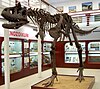
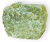
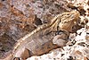
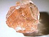
Each of the Cartadanian states and territories has symbols, living or inanimate, that give them their identity. Many of these are commonly known species and objects, while others may be more rare. The following are lists of symbols as recognized by the state and territorial legislatures or tradition. Some, such as flags, seals, and birds have been created or chose by all polities, while others, such as state fossils have been chosen by only a few.
History
General symbols


Mottos
Slogans
Other symbols
See also
