Alcairet: Difference between revisions
Tag: 2017 source edit |
m →Trade Tag: 2017 source edit |
||
| (70 intermediate revisions by 2 users not shown) | |||
| Line 1: | Line 1: | ||
{{Infobox settlement | {{Infobox settlement | ||
|name = Trade Island of Alcairet | |name = Trade Island of Alcairet | ||
| Line 9: | Line 7: | ||
|imagesize = | |imagesize = | ||
|image_alt = | |image_alt = | ||
|image_caption = People's Palace of the Alcaireti Provincial Assembly in | |image_caption = People's Palace of the Alcaireti Provincial Assembly in Baab Genjareb | ||
|image_flag = Alcairet Flag.png | |image_flag = Alcairet Flag.png | ||
|flag_alt = | |flag_alt = | ||
| Line 19: | Line 17: | ||
|nickname =''Gassavelie Nouveau'' <br><small>(New [[Kingdom of Gassavelia|Gassavelia]])</small> | |nickname =''Gassavelie Nouveau'' <br><small>(New [[Kingdom of Gassavelia|Gassavelia]])</small> | ||
|motto = | |motto = | ||
|image_map = | |image_map = File:Alcairet map.png | ||
|map_alt = | |map_alt = | ||
|map_caption = | |map_caption = Location of the [[Burgundie|Burgoignesc]] province of Alcairet (dark green)<br>In [[Audonia]] (gray)<br>[[Bulkh]], in {{wp|real union}} with [[Burgundie]] (light green) | ||
|pushpin_map = | |pushpin_map = | ||
|pushpin_map_alt = | |pushpin_map_alt = | ||
| Line 32: | Line 30: | ||
|subdivision_name = {{flag|Burgundie}} | |subdivision_name = {{flag|Burgundie}} | ||
|subdivision_type1 = Constituent Country equivalent | |subdivision_type1 = Constituent Country equivalent | ||
|subdivision_name1 = [[Government_of_Burgundie# | |subdivision_name1 = [[Government_of_Burgundie#Burgoignesc_Overseas_Representative_Assembly|Burgoignesc Overseas Representative Assembly]] | ||
|subdivision_type2 = Geographic Designation | |subdivision_type2 = Geographic Designation | ||
|subdivision_name2 = [[Geography_of_Burgundie#Audonio-Alshari_Burgundie|Audonio-Alshari Burgundie]] | |subdivision_name2 = [[Geography_of_Burgundie#Audonio-Alshari_Burgundie|Audonio-Alshari Burgundie]] | ||
| Line 41: | Line 39: | ||
|founder = | |founder = | ||
|seat_type = Capital | |seat_type = Capital | ||
|seat = | |seat = Baab Genjareb | ||
|government_footnotes = | |government_footnotes = | ||
|government_type = | |government_type = | ||
| Line 106: | Line 104: | ||
}} | }} | ||
Alcairet, colloquially called ''Gassavelie Nouveau'' (New [[Kingdom of Gassavelia|Gassavelia]]), is a [[Burgundie|Burgoignesc]] [[Government_of_Burgundie#Provincial_and_Colonial_Government|province]] of the [[BORA|Burgoignesc Overseas Representative Assembly]] in confluence of the [[Sea of Istroya]] and the [[Aab-e-Farus]], in the [[Barbary Straits]] in [[Audonia]]. It is considered part of [[La Garrote]] a chain of [[Burgundie|Burgoignesc islands]] that historically allowed the [[Maritime Dericania]]n principalities to control the trade routes of western [[Audonia]]. Historically Alcairet was a part of the states that ruled the northern coast of [[Battganuur]]. It was conquered by the [[Oduniyyad Caliphate]] in the 7th century AD. It remained under [[Oduniyyad Caliphate|Oduniyyad]] control until the fall of that empire in [[1514]] when it was left to its own devices until the [[Truffle Races]] between the coastal states of the [[Kingdom of Dericania]] ([[Burgundie]]) and [[Caphiria]] led to its annexation by [[Burgoignesc Kandahar-Kandara Trading Company|Company for the Aid of the Protestants Refugees]] in [[1577]]. It was administered as part of the [[Barbary Straits Colony]] from [[1577]]-[[1836]] when the mainland was lost, then given provincial status in [[1875]] when the unified nation of [[Burgundie]] was formed. | '''Alcairet''', colloquially called '''Gassavelie Nouveau''' (New [[Kingdom of Gassavelia|Gassavelia]]), is a [[Burgundie|Burgoignesc]] [[Government_of_Burgundie#Provincial_and_Colonial_Government|province]] of the [[BORA|Burgoignesc Overseas Representative Assembly]] in confluence of the [[Sea of Istroya]] and the [[Aab-e-Farus]], in the [[Barbary Straits]] in [[Audonia]]. It is considered part of [[La Garrote]] a chain of [[Burgundie|Burgoignesc islands]] that historically allowed the [[Maritime Dericania]]n principalities to control the trade routes of western [[Audonia]]. Historically Alcairet was a part of the states that ruled the northern coast of [[Battganuur]]. It was conquered by the [[Oduniyyad Caliphate]] in the 7th century AD. It remained under [[Oduniyyad Caliphate|Oduniyyad]] control until the fall of that empire in [[1514]] when it was left to its own devices until the [[Truffle Races]] between the coastal states of the [[Kingdom of Dericania]] ([[Burgundie]]) and [[Caphiria]] led to its annexation by [[Burgoignesc Kandahar-Kandara Trading Company|Company for the Aid of the Protestants Refugees]] in [[1577]]. It was administered as part of the [[Barbary Straits Colony]] from [[1577]]-[[1836]] when the mainland was lost, then given provincial status in [[1875]] when the unified nation of [[Burgundie]] was formed. | ||
==Geography== | |||
[[File:Alcairet Topo.PNG|thumb|left|Topography of Alcairet]] | |||
Alcairet is an island in the western mouth of the [[Barbary Straits]]. The islands are the remains of a land bridge that used to connect the southwestern and northern continental islands of [[Audonia]]. At the end of the last ice age when sea levels rose, the lowlands flooded and formed the [[Barbary Straits]]. | |||
===Climate=== | |||
[[File:Alcairet_Climate Map.png|thumb|right|Climate zones of Alcairet]] | |||
Alcairet's prevailing winds are the warm and moist trade winds blowing westerly from the [[Aab-e-Farus]]. The province has a tropical wet and dry climate in the east, and semi-arid in the west. | |||
{{Weather box | |||
|location = 1981–2010 normals | |||
|single line = Yes | |||
|metric first = Yes | |||
|width = auto | |||
|Jan high C = 29.2 | |||
|Feb high C = 30.3 | |||
|Mar high C = 30.5 | |||
|Apr high C = 30.2 | |||
|May high C = 29.2 | |||
|Jun high C = 27.6 | |||
|Jul high C = 26.4 | |||
|Aug high C = 25.6 | |||
|Sep high C = 25.7 | |||
|Oct high C = 26.0 | |||
|Nov high C = 27.0 | |||
|Dec high C = 27.8 | |||
|year high C = | |||
|Jan mean C = 26.1 | |||
|Feb mean C = 26.7 | |||
|Mar mean C = 26.7 | |||
|Apr mean C = 26.5 | |||
|May mean C = 25.9 | |||
|Jun mean C = 24.7 | |||
|Jul mean C = 23.5 | |||
|Aug mean C = 22.7 | |||
|Sep mean C = 22.8 | |||
|Oct mean C = 23.0 | |||
|Nov mean C = 23.9 | |||
|Dec mean C = 24.8 | |||
|year mean C = | |||
|Jan low C = 22.9 | |||
|Feb low C = 23.1 | |||
|Mar low C = 22.9 | |||
|Apr low C = 22.8 | |||
|May low C = 22.7 | |||
|Jun low C = 21.7 | |||
|Jul low C = 20.7 | |||
|Aug low C = 19.8 | |||
|Sep low C = 19.8 | |||
|Oct low C = 20.0 | |||
|Nov low C = 20.9 | |||
|Dec low C = 21.7 | |||
|year low C = | |||
== | |precipitation colour = green | ||
|Jan precipitation mm = 83.4 | |||
| | |Feb precipitation mm = 107.4 | ||
| | |Mar precipitation mm = 106.3 | ||
| | |Apr precipitation mm = 94.9 | ||
|May precipitation mm = 41.9 | |||
|Jun precipitation mm = 32.5 | |||
|Jul precipitation mm = 18.8 | |||
|Aug precipitation mm = 9.8 | |||
|Sep precipitation mm = 7.6 | |||
|Oct precipitation mm = 11.0 | |||
|Nov precipitation mm = 12.6 | |||
|Dec precipitation mm = 51.5 | |||
|year precipitation mm = | |||
|Jan precipitation days = 11 | |||
|Feb precipitation days = 10 | |||
|Mar precipitation days = 11 | |||
|Apr precipitation days = 6 | |||
|May precipitation days = 5 | |||
|Jun precipitation days = 8 | |||
|Jul precipitation days = 13 | |||
|Aug precipitation days = 14 | |||
|Sep precipitation days = 12 | |||
|Oct precipitation days = 11 | |||
|Nov precipitation days = 8 | |||
|Dec precipitation days = 10 | |||
|year precipitation days = | |||
| | |source = | ||
}} | }} | ||
== History == | |||
===Prehistory=== | |||
{{Further|Timeline_of_major_world_events#Prehistory|label1= Prehistory of the world}} | |||
Alcairet was originally settled by {{wp|Indo-Aryan peoples}} who likewise settled areas from [[Zaclaria]] to [[Pukhgundi]]. These people shared languages with common roots, the {{wp|Indo-Aryan languages}} which later diverged into Proto-Umardonian (west of the [[Sindhus River]]) and proto-Sindhus (east of the [[Sindhus River]]). | |||
====Umaronid Empire==== | |||
The Umaronid Empire, a Bronze Age civilization that thrived in western [[Audonia]] from approximately 3300 to 1300 BCE, left an indelible mark on the region. Renowned for their meticulous urban planning, the Umaronids constructed sprawling cities like Harappa and Mohenjo-daro, characterized by grid-like layouts, multi-story houses, and sophisticated drainage and water supply systems. This meticulous attention to detail extended to their economic practices, evident in their standardized weights and measures that facilitated trade and commerce across the empire. | |||
The Umaronids demonstrated exceptional craftsmanship and technological ingenuity. Their mastery of metallurgy is evident in the production of bronze tools and weapons, while their artistry is showcased in intricate seals, pottery, and figurines. Notably, the empire developed a unique script, yet to be deciphered, which tantalizingly hints at a complex language and potentially rich literary traditions. | |||
Despite its advancements, the Umaronid Empire eventually declined. While the precise reasons remain unclear, factors such as climate change, shifting river courses, and migrations likely played a role. Nevertheless, the legacy of the Umaronids endures, providing valuable insights into the social, economic, and cultural dynamics of early [[Audonia]]n civilizations. The empire's contributions to urban planning, metallurgy, and artistic expression continue to inspire and inform contemporary understanding of the region's history. | |||
=== Classical Antiquity === | |||
{{Further|Timeline_of_major_world_events#Classical_Antiquity|label1= Classical Antiquity}} | |||
<gallery mode="packed"> | <gallery mode="packed"> | ||
File: | File:Ancient Persian costumes.jpg | ||
File: | File:Ancient Egyptian, Assyrian, and Persian costumes and decorations (1920) (14761801871).jpg | ||
File: | File:Greek soldiers of Greco–Persian Wars2.png|Istroyan soldiers | ||
</gallery> | </gallery> | ||
Northern Alcairet, under the dominion of the [[Arunid Empire]], experienced a profound agricultural revolution, the burgeoning of a lucrative timber industry, and a dynamic cultural exchange that left an enduring legacy on the region's identity. Meanwhile, southern Alcairet, witnessed the rise and fall of empires, the fusion of [[Istroyan]] and Persian cultures, and the establishment of a vibrant Christian realm, the Ashrafinid Empire. While the coastal regions flourished under Istroyan influence, the interior of southern Alcairet remained a realm of tribal societies. These tribes, such as the {{wp|Parthians}} and the {{wp|Elamites}}, maintained their traditional nomadic or semi-nomadic lifestyles, herding livestock, cultivating crops, and engaging in trade with neighboring regions. The decentralized nature of tribal power structures made it difficult for a single dominant entity to emerge. Instead, the interior was characterized by a patchwork of alliances, rivalries, and shifting power dynamics. This political fragmentation, while fostering a degree of autonomy for individual tribes, also made the region vulnerable to external incursions and conquest. | |||
====Arunid Empire==== | |||
[[File:Arunid_max_extent.png|thumb|right|Map of the maximum extent of the [[Arunid Empire]].]] | |||
{{Further|Arunid Empire}} | |||
The [[Arunid Empire]]'s dominion over northern Alcairet, encompassing the present-day provinces of Ahabijan, Andivaz, Takand, Maradan, and Malarand, represents a pivotal epoch in the region's history. The empire's vast reach and influence brought about profound transformations, leaving an enduring legacy that continues to shape Battganuur's identity and development. The [[Arunid Empire]], recognizing the fertile potential of northern Battganuur's plains, initiated a comprehensive agricultural development program. Extensive irrigation systems, including canals and reservoirs, were constructed to harness the waters of the [[Aab-e-Farus]] and its tributaries. This led to a significant increase in rice cultivation, transforming the region into a breadbasket for the empire. The surplus rice production not only sustained the empire's burgeoning population but also became a valuable commodity in regional trade networks. Alongside rice, the cultivation of other crops such as wheat, barley, fruits, and vegetables was also promoted, ensuring a diverse and resilient agricultural base. This agricultural revolution not only boosted the region's economic prosperity but also fostered social stability by ensuring food security. Northern Battganuur's lush forests, teeming with valuable hardwoods like teak, mahogany, ebony, rosewood, and padauk, attracted the attention of the [[Arunid Empire]]. Recognizing the potential of this resource, the empire established logging operations and implemented sustainable forestry practices. These woods were highly prized for their durability, beauty, and versatility, and were used in the construction of grand palaces, temples, and ships. The timber trade became a lucrative source of revenue for the empire, contributing to its economic power and influence. The demand for Battganuuri hardwoods spurred the development of infrastructure, including roads and ports, further integrating the region into the empire's vast economic network. | |||
== | The [[Arunid Empire]]'s dominion over northern Alcairet was not solely an economic endeavor. It also entailed a significant cultural and spiritual exchange. The Fravarti-Zoroastrian faith, with its emphasis on righteousness, social justice, and communal harmony, found fertile ground in the region. While it did not completely supplant existing religious practices, it gained a significant following and left a lasting imprint on the region's spiritual landscape. The empire's cosmopolitan cities, renowned centers of learning and commerce, attracted scholars, artisans, and merchants from across the known world. This influx of diverse cultures led to a vibrant cultural fusion, with elements of Persian, Indian, and Istroyan traditions intermingling with local customs. The adoption of the Umardi language, the lingua franca of the empire, facilitated communication and trade, further cementing the region's integration into the Arunid realm. | ||
[[File:Alcairet | |||
=== | ====Istroyan city states==== | ||
Alcairet | [[File:Alexandria - Pompey's Pillar - view of ruins.JPG|right|thumb|Istroyan ruins in Baab Genjareb]] | ||
{{Further|Ancient Istroyan civilization}} | |||
Beginning in the 6th century BCE, Istroyan mariners, hailing from the bustling city-states of northeastern [[Sarpedon]], embarked on exploratory voyages across the [[Sea of Istroya]]. Drawn by tales of fertile lands, exotic spices, and lucrative trade opportunities, they established a series of colonies along the coast of Alcairet. They quickly grew into thriving centers of commerce, culture, and learning. The Istroyans brought with them their language, philosophy, art, and architectural traditions, which deeply influenced the local {{wp|Persian|Persi}} populations. Over time, a unique fusion of [[Istroyan]] and {{wp|Persian}} cultures emerged, evident in the syncretic religious practices, the adoption of {{wp|Ancient Greek Architechture|Istroyan architectural styles}}, and the widespread use of the {{wp|Ancient Greek language|Istroyan language}} in trade and administration. This cultural exchange left an enduring legacy, shaping the distinct identity of southern Alcairet for centuries to come. | |||
===Medieval period=== | |||
{{Further|Timeline_of_major_world_events#Medieval_history|label1= Medieval history of the world|Oduniyyad Caliphate|Crusades|Pre-modern global trade}} | |||
The [[Oduniyyad Caliphate]]'s six centuries of rule left an indelible mark on Alcairet. The spread of Islam transformed the region's religious and cultural landscape, while the [[Oduniyyad Caliphate|Caliphate]]'s patronage of scholarship and the arts fostered a vibrant intellectual atmosphere. Battganuur's strategic location made it a crossroads for trade and cultural exchange, contributing to its unique identity. The [[Crusades]], though a period of conflict and instability, also stimulated cultural exchange and intellectual curiosity. The legacy of this era continues to resonate in Battganuur's diverse cultural heritage, its architectural treasures, and its vibrant intellectual traditions. | |||
The [[Oduniyyad Caliphate]]'s dominion over Alcairet marked a significant chapter in the region's history, characterized by a confluence of religious fervor, cultural exchange, and geopolitical conflict. This period witnessed the spread of Islam, the flourishing of intellectual and artistic pursuits, and the challenges posed by external forces, particularly the Crusades. Following the collapse of the [[Arunid Empire]] and then the Ashrafinid Empire, the [[Oduniyyad Caliphate]] swiftly extended its influence over Alcairet. The introduction of Islam, a monotheistic faith with a strong emphasis on social justice and community, profoundly reshaped Battganuuri society. Mosques sprang up across the land, replacing or coexisting with {{wp|Zoroastrian}} fire temples and {{wp|Buddhist}} monasteries. The {{wp|Arabic language}}, the lingua franca of the [[Oduniyyad Caliphate|Caliphate]], gained prominence in administration, trade, and scholarship. While the initial spread of Islam was often accompanied by military conquest, it gradually became a process of cultural assimilation and religious conversion. The [[Oduniyyad Caliphate|Caliphate]]'s emphasis on education and social welfare attracted many Battganuuri to the new faith, leading to a gradual but significant shift in the religious landscape. The Oduniyyad period was marked by a remarkable flourishing of intellectual and artistic pursuits in Alcairet. The [[Oduniyyad Caliphate|Caliphate]]'s patronage of scholarship and the arts created a vibrant intellectual atmosphere, attracting scholars, poets, and artists from across the Islamic world. Cities like Alihijan and Isfahan became centers of learning, where renowned scholars and scientists made significant contributions to fields such as mathematics, astronomy, medicine, and philosophy. Battganuuri artisans excelled in producing exquisite textiles, ceramics, metalwork, and calligraphy, which were highly prized throughout the [[Oduniyyad Caliphate|Caliphate]]. Battganuur's strategic location, straddling the [[Sea of Kandahar]] and bordering the [[Sea of Istroya]], made it a vital crossroads for trade and cultural exchange. The [[Oduniyyad Caliphate|Caliphate]]'s vast network of roads and maritime routes connected Alcairet to distant lands, facilitating the flow of goods, ideas, and people. | |||
The Oduniyyad Caliphate's expansion into Sarpedon brought it into conflict with Christian kingdoms, leading to a series of religious wars known as the [[Crusades#In_Audonia_(1167–1428)|Crusades in Audonia]] ([[1167–]] 1[[428]]CE). Alcairet, as a frontier region of the Caliphate, became a battleground for these conflicts. The Crusades had a profound impact on Alcairet, disrupting trade routes, causing economic instability, and exacerbating religious tensions. The region witnessed the construction of fortified castles and cities, as well as the emergence of military orders dedicated to defending the Christian faith. Despite the immense human and economic cost, the Crusades also fostered cultural exchange and intellectual curiosity. The encounter with Western ideas and technologies stimulated new developments in Battganuuri science, philosophy, and art. | |||
====Warring century==== | |||
{{Further|Warring Century (Daria)}} | |||
The '''Warring Century''' spanned the 15th and 16th centuries in the [[Daria]] region of [[Audonia]]. This era was marked by the tumultuous unraveling of the [[Oduniyyad Caliphate]], factionalism, sectarian and ethnic violence, and ultimately weakened [[Daria]] making it prone to [[Burgoignesc colonial empire|colonization]] by the duchies of [[Maritime Dericania]]. | |||
Internal strife, stemming from political dissent and struggles for succession, economic stagnation and corruption progressively eroded the [[Oduniyyad Caliphate|Caliphate]]'s authority. The [[Oduniyyad Caliphate|Caliphate]]'s collapse ripped apart the fragile web of religious and ethnic cohesion that had existed under its rule. Long-simmering tensions between various groups, both religious and ethnic, flared up in the absence of a strong central authority. Communities with distinct cultural and belief systems, previously held together under the [[Oduniyyad Caliphate|Caliphate]]'s umbrella, found themselves at odds. This sectarian discord, coupled with competition for limited resources, fueled a period of widespread tribal and sectarian conflicts. | |||
The power vacuum created by the [[Oduniyyad Caliphate|Caliphate]]'s disintegration paved the way for the rise of warlords. These opportunistic individuals, capitalizing on the prevailing chaos, carved out their own domains in strategic locations, often around cities or fortresses built by the former [[Oduniyyad Caliphate|Caliphate]]. However, the reach of these warlords was limited due to the lack of a centralized tax system and the constant threat of rival factions. Their control often extended only to their immediate vicinity, creating a patchwork of small, feuding kingdoms. | |||
The economic consequences of the Warring Century were far-reaching. The once-flourishing [[Silk Road]] became choked by rampant banditry and instability. The movement of goods became increasingly expensive and perilous. This disruption forced eastern nations, namely [[Daxia]], to hire larger and more expensive caravan guards, some eventually became their own armies, which when coupled with [[Maritime Dericania|Dericanian]] [[Burgoignesc colonial empire|colonial expansion ism]] led to the establishment of the [[Southern Route]], which bypassed the volatile [[Daria]] region altogether. | |||
The Warring Century, spanning the 15th and 16th centuries, cast a long and ominous shadow over Alcairet, marking a period of unprecedented upheaval, fragmentation, and social unrest. The once-unified realm, held together by the [[Oduniyyad Caliphate]], crumbled under the weight of internal strife, religious discord, and economic decline, leaving the region vulnerable to external forces and setting the stage for future colonial interventions. The seeds of Battganuur's descent into chaos were sown in the waning years of the [[Oduniyyad Caliphate]]. Political infighting, economic mismanagement, and rampant corruption eroded the Caliphate's authority, creating a power vacuum that was quickly filled by ambitious warlords and opportunistic factions. The once-vibrant cities of Alcairet, centers of trade and learning, became battlegrounds for rival groups vying for control. The collapse of the Caliphate unleashed long-suppressed religious and ethnic tensions. Shia and Sunni communities, previously coexisting under the Caliphate's umbrella, turned against each other in a bitter struggle for dominance. The Zoroastrian minority, once tolerated, faced persecution and marginalization. This sectarian strife further fragmented Battganuuri society, creating deep-seated divisions that would haunt the region for centuries. The Warring Century wreaked havoc on Battganuur's economy. Trade routes, once vital arteries of commerce, were disrupted by banditry and conflict. Agricultural production declined as fields were abandoned and irrigation systems fell into disrepair. The once-flourishing cities, symbols of Battganuur's prosperity, became impoverished and depopulated. | |||
In the absence of a central authority, warlords emerged as the de facto rulers of various regions. These local strongmen, often backed by private armies, established their own fiefdoms, imposing their own laws and taxes. Their rule was often arbitrary and brutal, further exacerbating the suffering of the common people. | |||
The Warring Century's devastating impact on Alcairet left the region vulnerable to external intervention. The economic decline, social unrest, and political fragmentation made Alcairet an attractive target for the expansionist ambitions of the [[Maritime Dericania]]n duchies. These maritime powers, seeking new markets and resources, gradually extended their influence over Alcairet, establishing trading posts, fortresses, and ultimately, colonial administrations. | |||
The Warring Century thus laid the groundwork for Battganuur's colonization, a process that would profoundly shape the region's destiny in the centuries to come. The legacy of this tumultuous period continues to resonate in Battganuur's complex social fabric, its diverse religious landscape, and its ongoing struggle for unity and stability. | |||
=== | ===Early modern history=== | ||
[[File: | {{Further|Timeline_of_major_world_events#Early_modern_history|label1=Early modern history of the world|Burgoignesc colonial empire|Barbary Straits colony}} | ||
[[File:Bergendii_colonies_in_western_Daria.png|right|thumb|[[Istroya Oriental colony]] in blue, [[Barbary Straits colony]] in red.]] | |||
=== | ====Barbary Straits colony==== | ||
{{Further|Burgoignesc colonial empire|Barbary Straits colony}} | |||
In the wake of the Warring Century's turmoil, the [[History of Dericania#Duchy of Marialanus|Duchy of Marialanus]], a rising maritime power, sought to expand its influence and commercial interests in [[Audonia]]. In [[1577]], the [[Marialanii Ularian Trading Company]], armed with a royal charter, established the [[Barbary Straits Colony]] in northern Battganuur. This colony, strategically positioned at the western terminus of the [[Silk Road]], aimed to revitalize the region's agricultural potential and capitalize on the lucrative trade routes that crisscrossed the continent. The company's administrators, drawing upon their {{wp|Calvinist}} principles, implemented a rigid social hierarchy and a strict moral code. They invested heavily in infrastructure, constructing roads, canals, and ports to facilitate trade and transport. The colony's fertile plains were transformed into vast plantations, producing rice, cotton, and other cash crops for export. [[Audonia]]n slaves, captured or purchased from neighboring regions, were forced to work on the plantations, fueling the colony's agricultural engine. The slave trade became a lucrative source of revenue for the company and its shareholders. | |||
Despite the harsh realities of colonial rule, the [[Barbary Straits Colony]] became a hub of economic activity and cultural exchange. Its port cities, such as Bandar Abbas and Bushehr, attracted merchants, missionaries, and adventurers from across [[Audonia]] and beyond. The colony's unique blend of Marialanii and Battganuuri traditions, though often fraught with tension, contributed to a vibrant and dynamic cultural landscape. | |||
== | =====Barbary Wars===== | ||
=== | Amid the outbreak of the Barbary Wars, while much of the anti-piracy conflict was centered around the Barbary Straits between the Buroignesc Navy and corsairs hailing from what is modern Battganuur, the range of Barbary pirates stretched even further north reaching even the domain of [[Soirwind]]. Soirwind being at the time a colonial domain under what is modern day [[Fiannria]], the spike in piracy interrupting crucial trade routes between Fiannria and Soirwind quickly drew the ire of the Levantine state. In ____ Fiannria sent a punitive expedition towards the region to combat the corsairs. Rebuffed from operating in the main combat zone and drawing too close to the Barbary Straits itself, the Fiannan war fleet set for the north towards the northern Sea of Istroya to hunt down Corsairs who broke through and expanded operations that more directly impacted Fiannria itself. The war fleet would operate between the [[Hezikian Isles]] and Soirwind for the next three years in its attempt to guard trade routes and eliminate pirate holdouts and outposts. | ||
As the conflict in the Straits themselves raged on, the Fiannan central government would delegate more and more operational authority towards the holy orders which persisted as remants from the Crusaders and independent privateers in combating northern Barbary Piracy. This culminated in the year of _____ following the victory in the Barbary straits themselves, a large contingent of Barbary ships which survived the punitive Burgoignesc expeditions escaped to the north in order to flee arrest and execution and also find a new base of operations, instead off the southern coast of Soirwind, found a fleet of privateers and corsair chasers waiting between the coast and the island of Antilles. This fleet of holy orders, privateers and colonial defense ships from Soirwind, having gotten word of the coming fleet had gathered in the strait to attack and nip the bud of any continued corsair activity in the north. The resultant battle, the [[Battle in the Kamtague Narrows]], saw the bulk of the remaining corsair force sunk or captured, and the remnants scattering, breaking any chance of a major Barbary incursion returning to operate in the north. {{Further|Burgoignesc colonial empire}} | |||
{{Further|Burgoignesc | |||
===Late modern period=== | ===Late modern period=== | ||
Fall of the [[Burgoignesc colonial empire]], massive influx of people fleeing the colonies, men retained to fight in defense of the islands, women and children sent to the [[Burgoignesc Metropole]], thereafter sent to [[Equatorial | {{Further|Timeline_of_major_world_events#Late_modern_history|label1= Late-modern history of the world}} | ||
Fall of the [[Burgoignesc colonial empire]], massive influx of people fleeing the colonies, men retained to fight in defense of the islands, women and children sent to the [[Burgoignesc Metropole]], thereafter sent to [[Equatorial Ostiecia]]. This military force known as ''La Vestige'' (Aeng: The Vestige) numbered on average 115,000 soldiers and 80,000 sailors between [[1805]] and [[1835]] but morale was low and desertion was high as the men wanted to leave with their families. ''La Vestige'' was successful in maintaining the islands for their respective states which eventually unified into [[Burgundie]], but the legacy of bondage damaged the view of many [[Burgoigniac]]s with Alcairet for the next 50 years. During the First Fratricide, Alcairet, ruled by the [[Duchy of Marialianus]] and [[Salarive]], ruled by the [[Duchy of Bourgondi]] sent volunteers to [[Maritime Dericania]] and conducted minor raiding of each other, but it was never considered a front of the war. | |||
Alcairet | |||
Salarive | |||
=== | ===Contemporary period=== | ||
{{ | {{Further|Timeline_of_major_world_events#Contemporary_history|label1= Contemporary history of the world}} | ||
While the Occidental Cold War was primarily a series of geopolitical tensions between [[Urcea]] and [[Caphiria]], it cast a long shadow over Alcairet due to its proximity to the [[Caphiria]]n protectorate of [[Zaclaria]]. The constant threat of nuclear escalation and the ideological conflict between the [[Levantia|Levantine]] and [[Sarpedon]]ic blocs deeply affected the socio-political and economic landscape of the islands. Despite the prevailing atmosphere of fear and uncertainty, the [[Occidental Cold War]] also served as a catalyst for introspection and change within Alcaireti society. The younger generation, exposed to the liberalizing influences emanating from the [[Burgoignesc Metropole]], began to question the more conservative {{wp|Calvinist}} values that had long underpinned their society. This cultural awakening found expression in a burgeoning arts scene, where innovative forms of music, dance, and visual arts challenged the established norms and conventions. Economically, the [[Occidental Cold War]] presented a double-edged sword for Alcairet. While the islands' strategic importance in the geopolitical chessboard led to increased investment in infrastructure and military installations by [[Burgundie]], stimulating the local economy and creating employment opportunities, the constant specter of conflict also deterred foreign investment and hampered trade with [[Sarpedon]]ic bloc nations. The Alcaireti government, faced with the delicate task of balancing its allegiance to [[Burgundie]] with the imperative of maintaining regional stability, adopted a pragmatic approach to foreign policy. It maintained a robust military presence in the [[Barbary Straits]] while simultaneously engaging in discreet diplomatic channels with [[Caphiria]]n officials in [[Zaclaria]]. This cautious balancing act, though fraught with potential pitfalls, ultimately proved successful in averting conflict and preserving the fragile peace in the region. It was through these efforts, that in [[1974]] that the [[Occidental_Cold_War#Burgo-Caphirian_Thaw|Burgo-Caphirian Thaw]] occured. | |||
Alcairet was also a key military and logistics staging hub during [[Operation Kipling]]. As jet technology progressed and the ground wars became more tenuous, more and more bombers were stationed in Alcairet requiring increasingly large airbases and longer runways. After the war's end and the reversion of some of these airbases to civilian control, Alcairet had more airports than it knew what to do with. As a result, Alcairet is the preeminent aircraft maintenance and manufacturing hubs in the [[Middle seas region]]. Alcairet also, through its involvement in [[Operation Kipling]] adopted [[containerization]] early on. Today it serves as a major {{wp|transshipment}} and customs hub for [[Audonia]]n goods bound for [[Levantia]]. | |||
== | ==Government== | ||
{{Further|Government of Burgundie}}{{BORA}} | |||
[[File:Alcairet Political Map.png|thumb|left|Political map of Alcairet]] | |||
Alcairet is part of the [[BORA|Burgoignesc Overseas Representative Assembly]]'s (BORA) [[Geography_of_Burgundie#Burgdonia|Burgoignesc Audonia]] geographic designation. [[BORA]] is a constituent country equivalent of [[Burgundie]] with its own assembly, prime minister, budget, and laws. [[Burgundie]]'s national governmental influence is limited to subsidies, education, and security, however, its financial and cultural institutes cast a long shadow across Alcairet. | Alcairet is part of the [[BORA|Burgoignesc Overseas Representative Assembly]]'s (BORA) [[Geography_of_Burgundie#Burgdonia|Burgoignesc Audonia]] geographic designation. [[BORA]] is a constituent country equivalent of [[Burgundie]] with its own assembly, prime minister, budget, and laws. [[Burgundie]]'s national governmental influence is limited to subsidies, education, and security, however, its financial and cultural institutes cast a long shadow across Alcairet. | ||
| Line 203: | Line 287: | ||
Like the [[Government_of_Burgundie#Legislative_Branch|Citizens Court of the National Assembly (Burg. La Assemblee de Ciutadans de l'Assemblee Nacional, ACAN)]], The Alcaireti Citizen's Court of the Provincial Assembly is a unicameral legislator. It makes provincial law, has the power of the provincial purse, and has the power of impeachment, by which it can remove sitting members of the provincial government. The Assembly has three seats for each province, one for the [[Government_of_Burgundie#Constituent_Countries|Burgoignesc Overseas Territory Assembly]]'s Alcairet liaison, 3 for the clergy, 3 seats reserved for municipal leaders, and 3 for a rota of private business leaders. On 6 occasions throughout the year 3 more seats are opened to the public to debate topics that are not on the annual legislative agenda. | Like the [[Government_of_Burgundie#Legislative_Branch|Citizens Court of the National Assembly (Burg. La Assemblee de Ciutadans de l'Assemblee Nacional, ACAN)]], The Alcaireti Citizen's Court of the Provincial Assembly is a unicameral legislator. It makes provincial law, has the power of the provincial purse, and has the power of impeachment, by which it can remove sitting members of the provincial government. The Assembly has three seats for each province, one for the [[Government_of_Burgundie#Constituent_Countries|Burgoignesc Overseas Territory Assembly]]'s Alcairet liaison, 3 for the clergy, 3 seats reserved for municipal leaders, and 3 for a rota of private business leaders. On 6 occasions throughout the year 3 more seats are opened to the public to debate topics that are not on the annual legislative agenda. | ||
===Military | ===Administrative divisions and local governance=== | ||
{{Further|Government_of_Burgundie#Provinces|Government_of_Burgundie#County_Government|Government of Burgundie#Municipal Government|Cities of Burgundie}} | |||
===Military=== | |||
[[File:Légionnaires_2e_régiment_étranger_de_parachutistes_(Calvi,_France).jpg|right|thumb|Legionnaires on walking through Old City.]] | |||
Alcairet falls under the [[Navy_of_Burgundie#Grand_Eastern_Command|Navy's Grand Eastern Command]], the [[Army of Burgundie|Army's Middle Seas Command]], the [[Royal Air Service of Burgundie]]'s Audonian Command, and the [[Vocivine National of Burgundie]]'s Istroyo-Middle Seas Command. Alcairet's strategic location means it is a major military hub for all branches of the [[Burgoignesc Security Forces]] with large basing facilities existing for the [[Army of Burgundie|army]] (in particular the [[Burgoignesc Foreign Legion]]), [[Navy of Burgundie|navy]], [[Royal Air Service of Burgundie|Royal Air Service]], and [[Vocivine National of Burgundie|Vocivine]]. | |||
Alcairet is the home of the GranCom Orientale Admiral's Administrative Department, Rapid Reaction Force GranCom Orientale Command and its Rapid Deployment Group 1 ''[[Burgoignesc language|Burg]]: Groupement Disembarkement Rapide no. 1'', Expeditionary Strike Squadron Kandahar Resolve, and Littoral/Riparian Strike Division Riptide. These assets are spread across 3 naval stations, two on Alcairet and one on Salarive, Fort Ste. Maude, Fort St. Rouland, and Fort Ste. Jean d'Arche Naval Air Station respectively. The [[Army of Burgundie|army]] maintains the III Division, Foreign Legion in Fort Ste. Genvieve on Alcairet and the Puhkgundian Gorkha Rifles in Fort St. Reginald on Salarive. | |||
===Emergency response=== | |||
{{Further|Revenue Guard|Fire Seneschalcy of Burgundie|Royal Sociolance Service of Burgundie|National Gendarmerie of Burgundie}} | |||
====National Gendarmerie==== | |||
{{Further|National Gendarmerie of Burgundie}} | |||
| | |||
| | |||
| | |||
| | |||
}} | |||
Alcairet is under the jurisdiction of the Alcairet Battalion of the Middle Seas Brigade of the Overseas Gendarmerie Division. The Alcairet Battalion has 5 companies and an HQ section. | |||
*A Company is assigned to the whole of the southern island of Alcairet, excluding the Port of Genjareb and the capital | |||
*B Company is assigned to the whole of the island of Salarive | |||
*C Company is assigned to Baab Genjareb, the city, and specializes in civil disturbances | |||
*D Company is assigned to the Port of Genjareb, conducting supplemental port security | |||
*E Company is assigned to the Port of Selville, conducting supplemental port security | |||
*The HQ section is also based in Baab Genjareb | |||
Additionally, the Provost Gendarmerie for the Middle Seas Region and Alpha Team Action Force, an element of the Gendarmerie Air Service and of the Maritime Gendarmerie are also stationed in Alcairet at various military bases. The training school for the Maritime Gendarmerie is in Alcairet. | |||
=== | ====Revenue Guard==== | ||
{{Further|Revenue Guard}} | |||
[[Revenue Guard]], Grand Station of the Orient | |||
=== | ==Society== | ||
{{Template:Culture_in_Burgundie}} | |||
{{Further|Culture in Burgundie}} | |||
{{Pie chart | |||
| radius = 100 | |||
| thumb =right | |||
| caption = Self-reported ethnic origin in Tapakdore (2030) | |||
=== | | other = | ||
[[ | | label1 = Alcaireti | ||
| value1 =64.2 | |||
| color1 =#007BA7 | |||
| label2 = {{wp|Persian people|Persi}} | |||
| value2 =17.7 | |||
| color2 =#8F9779 | |||
| label3 = [[Occidental]] | |||
| value3 =6.9 | |||
| color3 =#4169E1 | |||
| label4 = [[Ebidi]] | |||
| value4 =4.6 | |||
| color4 =#B284BE | |||
| label5 = other/multi-ethnic | |||
| value5 =6.6 | |||
| color5 =NavajoWhite | |||
}} | |||
<gallery mode="packed"> | |||
File:Golshifteh Farahani at Berlinale 2023.jpg | |||
File:Darya_Dadvar.jpg | |||
File:Reza conférence Lausanne 2023.jpg | |||
File:Christine Hanizet 2015 cropped.jpg | |||
File:Hana_Makhmalbaf.jpg | |||
</gallery> | |||
Ethnically, Alcairetis are predominantly an admixture of ancient Persian and early modern Bergendii bloodlines, reflecting the island's complex history of conquest and cultural exchange. This genetic diversity is mirrored in the linguistic landscape, where Arabic and Burgoignesc coexist as official languages. While Burgoignesc serves as the language of government, commerce, and education, Arabic remains deeply rooted in everyday life, particularly in religious and cultural contexts. Education in Alcairet is highly valued, with a robust public school system that emphasizes both academic rigor and vocational training. The curriculum reflects a blend of Burgoignesc educational philosophies and Alcaireti cultural values, fostering a generation of citizens who are both globally aware and deeply connected to their heritage. This commitment to education has produced a highly skilled workforce, contributing to the island's economic success in sectors such as biotechnology and perfume manufacturing. Alcairetis are known for their warm hospitality, their love of storytelling, and their deep appreciation for the arts. Their worldview is shaped by a strong sense of community, family ties, and a pragmatic approach to life's challenges. This resilience is evident in their ability to adapt to changing circumstances, from the tumultuous era of the Warring Century to the complexities of the modern globalized world. Family plays a central role in Alcaireti society, with extended kinship networks providing support, guidance, and a sense of belonging. Traditional gender roles are still prevalent, but there is a growing movement towards greater gender equality, particularly in urban areas and among the younger generation. Alcaireti cuisine is a delightful fusion of Persian and Burgoignesc flavors, with an emphasis on fresh, local ingredients. Saffron-infused stews, citrus-marinated fish, and date-filled pastries are just a few examples of the island's culinary delights. The arts scene is equally vibrant, with a rich tradition of music, dance, and visual arts that draw inspiration from both local folklore and global trends. Literature in Alcairet is a dynamic field, with a number of authors writing in both Arabic and Burgoignesc. Their works often explore themes of identity, belonging, and the complexities of navigating a multicultural society. Architecture in Alcairet is a fascinating blend of styles, from the ornate Persian-inspired mosques and palaces to the elegant Burgoignesc colonial buildings. This architectural diversity reflects the island's unique history and cultural identity. Sports play a significant role in Alcaireti society, with football (soccer) being the most popular. The national team, known as the Desert Foxes, is a source of immense pride for the island, and their matches are followed with great passion. Other popular sports include basketball, handball, and volleyball. The date palm, a ubiquitous sight in the Alcaireti landscape, is a symbol of resilience, fertility, and the island's deep connection to its natural environment. | |||
== | ==Economy== | ||
olives, grain, tomatoes, citrus | {{Economy of Burgundie}} | ||
[[File:Alcairet EEZ.png|thumb|Alcairet EEZ]] | |||
<gallery mode="packed"> | |||
File:2019-03-16 01 Aquaculture in Chile.jpg | |||
File:Bassin d'aquaculture à la ferme écotouristique Jacqueville de Tori.jpg | |||
File:BurgGrandHotel14.jpg | |||
</gallery> | |||
The island's strategic location at the crossroads of major trade routes has historically been a driving force behind its economic development, and recent years have seen a diversification of its economic base, with significant growth in sectors such as biotechnology, perfume manufacturing, tourism, commercial fishing, and agriculture. | |||
The tourism industry has emerged as a major pillar of the Alcaireti economy, capitalizing on the island's natural beauty, rich cultural heritage, and modern amenities. The pristine beaches, crystal-clear waters, and diverse marine life of the Sea of Istroya and the Aab-e-Farus attract a steady stream of tourists seeking sun, sand, and sea. The island's historical sites, ranging from ancient Persian ruins to colonial-era fortresses, offer a glimpse into its rich and complex past. Additionally, the vibrant cultural scene, with its festivals, music, dance, and cuisine, provides a unique and immersive experience for visitors. The commercial fishing sector is another significant contributor to the Alcaireti economy. The island's location at the confluence of two major bodies of water provides access to a rich and diverse array of marine life. The fishing industry, employing a significant portion of the population, harvests a wide variety of fish, crustaceans, and mollusks, both for domestic consumption and export. In recent years, there has been a growing emphasis on sustainable fishing practices, ensuring the long-term viability of this vital sector. Agriculture plays a crucial role in Alcairet's economy, with a diverse range of crops cultivated across the island. The fertile soil and favorable climate, combined with modern agricultural techniques, yield a bountiful harvest of olives, grain, tomatoes, citrus fruits, sugar beets, dates, almonds, guar, sea asparagus, purslane, sea kale, cassava, sweet potatoes, yams, and lemongrass. Additionally, the island's unique terroir supports the cultivation of specialized crops like citronella, used for the production of citronella oil, and the practice of meliponiculture, the cultivation of stingless bees for honey production. Beyond these primary sectors, Alcairet's economy is bolstered by a thriving mining industry, extracting valuable resources such as phosphate, iron ore, and salt. These minerals are not only essential for domestic industries but also serve as valuable exports, contributing to the island's trade balance. In recent decades, Alcairet has made significant strides in developing its technological and scientific capabilities. The biotechnology sector, fueled by investment from Burgundie and international partners, is rapidly expanding, focusing on research and development in areas such as pharmaceuticals, medical devices, and agricultural biotechnology. This burgeoning sector is attracting a highly skilled workforce and fostering innovation, positioning Alcairet as a potential hub for biotechnological advancements in the region. The perfume manufacturing industry, leveraging the island's abundance of fragrant flowers and herbs, has gained international recognition for its high-quality products. This sector, combining traditional knowledge with modern techniques, has become a significant contributor to the island's economy and a source of cultural pride. The island's robust infrastructure, including modern ports, airports, and a well-developed transportation network, facilitates trade and commerce. The Port of Genjareb, a major transshipment hub for goods leaving Audonia for the Levantine Union market, plays a crucial role in the island's economy. Recent investments in port automation and customs modernization have further enhanced its efficiency and competitiveness. | |||
However, Alcairet's economy also faces challenges. The island's heavy reliance on imports for essential goods such as fuel makes it vulnerable to fluctuations in global commodity prices. Additionally, the tourism industry, while a major source of revenue, is susceptible to external shocks such as political instability, natural disasters, and global economic downturns. Furthermore, the automation of the Port of Genjareb, while improving efficiency, may lead to job losses in the long term. | |||
=== | ===Standard of living and employment=== | ||
Because Alcairet's economy is a high-low mix of sectors from biotech to traditional agriculture, opportunities abound for Alcairetis at all skill and education levels, which has helped the islands maintain a fairly steady unemployment rate of around 2.3% for the last decade. The islands' biotech and perfume manufacturing sectors offer stable opportunities for technicians, biologists, pharmacists, data scientists, and chemists. Traditional sectors like mining, fishing, and agriculture provide opportunities for unskilled or lesser educated individuals. The trade and transshipment hubs provide a stable middle ground for people with a moderate education and some skills, in logistics and customs fields, but future automation and trade patterns pose threats. [[Burgundie]]'s high emphasis on [[Culture_in_Burgundie#Education|education]] translates to a particularly educated and skilled workforce, leading to lower unemployment compared to less educated countries in [[Audonia]]. The islands' economic diversity cushions against overreliance on any single industry, which has demonstrably made the island more resilient during downturns. Since [[Burgundie]] strives for [[Total Economic Engagement]] and espouses equal rights and opportunities regardless of gender, race, ethnicity, ability, or background, Alcairet benefits from improved access to education and training, impacting employment prospects across various fields. | |||
===Key sectors=== | |||
| | ====Science, research, and education==== | ||
{{Further|Culture_in_Burgundie#Education|Label1= Education in Burgundie|Science and Technology in Burgundie}} | |||
Alcairet has numerous [[Culture_in_Burgundie#Tertiary_Education|tertiary]] and [[Culture_in_Burgundie#Quartiary_Education|quartiary]] institutions that are accredited and internationally recognized. The Baab Genjared Institute of Technology, Engineering, Marine Science is the most prestigious. | |||
====Trade==== | |||
[[File:Port of Genjareb.jpg|left|thumb|Port of Genjareb.]] | |||
| | |||
| | |||
| | |||
| | |||
| | |||
| | |||
| | |||
| | |||
The advent of [[Containerization]] in the 1960s and 70s and its intensive use during [[Operation Kipling]] made the Port of Genjareb one of the first and largest container ports in the world. The port was rebuilt from [[1966]]-[[1973]] to accommodate a container terminal. The container terminal expanded so rapidly that the adjoining naval base was eventually rebuilt on another part of the island to accommodate the port's rapid expansion. In the modern era the port is used primarily as a customs and transshipment hub for goods leaving [[Audonia]] for the [[Levantine Union]] market. [[Burgundie|Burgoignesc]] [[Revenue Guard]], and [[Levantine Union|LU Douanes]] both have large inspection and {{wp|customs}} operations in Port of Genjareb. Since [[2013]] there has been a considerable investment by [[Burgundie]] and the [[Levantine Union]] to automate the port to reduce wait times and to prioritize the inspection process to expedite the transshipment process. | The advent of [[Containerization]] in the 1960s and 70s and its intensive use during [[Operation Kipling]] made the Port of Genjareb one of the first and largest container ports in the world. The port was rebuilt from [[1966]]-[[1973]] to accommodate a container terminal. The container terminal expanded so rapidly that the adjoining naval base was eventually rebuilt on another part of the island to accommodate the port's rapid expansion. In the modern era the port is used primarily as a customs and transshipment hub for goods leaving [[Audonia]] for the [[Levantine Union]] market. [[Burgundie|Burgoignesc]] [[Revenue Guard]], and [[Levantine Union|LU Douanes]] both have large inspection and {{wp|customs}} operations in Port of Genjareb. Since [[2013]] there has been a considerable investment by [[Burgundie]] and the [[Levantine Union]] to automate the port to reduce wait times and to prioritize the inspection process to expedite the transshipment process. | ||
<br><br><br> | |||
===Infrastructure=== | ===Infrastructure=== | ||
====Maritime==== | ====Maritime==== | ||
{{Further|Burgoignesc Maritime Navigation Administration}} | {{Further|Burgoignesc Maritime Navigation Administration}} | ||
| Line 373: | Line 387: | ||
[[Rail_transportation_in_Burgundie#Istroyan_Rail|Istroyan Rail]]- Istroyan Rail ([[Burgoignesc language|Burg]]: ''Istroie Ferroviaire''), is the public-private joint-venture, intercity, passenger rail operator in [[Torlen]], [[Antilles]], [[Alcairet]], and [[Chaukhira]]. It owns and operates all rail corridors, {{wp|rights of way}}, and rolling stock that serve this purpose. | [[Rail_transportation_in_Burgundie#Istroyan_Rail|Istroyan Rail]]- Istroyan Rail ([[Burgoignesc language|Burg]]: ''Istroie Ferroviaire''), is the public-private joint-venture, intercity, passenger rail operator in [[Torlen]], [[Antilles]], [[Alcairet]], and [[Chaukhira]]. It owns and operates all rail corridors, {{wp|rights of way}}, and rolling stock that serve this purpose. | ||
====Air==== | ====Air==== | ||
{{Further|International airports}} | |||
Alcairet has one international airport, the Baab Al Audonia International Airport in metro Baab Genjareb. | |||
{| class="wikitable sortable" | |||
|- | |||
!Name | |||
!Location | |||
!Type | |||
!Brief description | |||
![[Air_Traffic_Regulatory_Organization#Airport_codes|Code(s)]] | |||
!Picture | |||
|- | |||
|[[Baab Al Audonia International Airport]] | |||
|Baab Genjareb, Alcairet, {{flag|Burgundie}} | |||
|Passenger, cargo, and {{wp|air base}} | |||
|24/7/365 air traffic control operations, 2x runways, capable of receiving all airframes, cargo terminal, passenger terminal, complete maintenance facilities, integrated customs and border control service | |||
||[[Air Traffic Regulatory Organization|ATRO]]: GBA | |||
{{wp|International Civil Aviation Organization airport code|ICAO}}: GBAB | |||
| | |||
|- | |||
|} | |||
====Energy and electricity==== | ====Energy and electricity==== | ||
= | {{Further|21st_Century_Burgoignesc_Power_Projection_Stratagem#BORA_Waste_to_Energy_CompactEnergy policy in Burgundie|Science and Technology in Burgundie#Energy|Energy policy in Burgundie}} | ||
<gallery mode="packed"> | |||
</gallery> | |||
The [[21st_Century_Burgoignesc_Power_Projection_Stratagem#BORA_Waste_to_Energy_Compact|BORA Waste to Energy Compact]] went into effect in [[2027]] with construction of 4 Waste to Energy power plants starting in [[2028]]. The two plants built in Alcairet generates approximately 416,000 kWh/day with a waste reduction capacity of 440,000 kg/day. | |||
| | |||
Most of the electricity in Alcairet is provided by the el-Fawaz Nuclear Power Station. El-Fawaz has a pair of {{wp|Generation IV reactor|Gen IV}} reactors and was rebuilt in [[2018]] to replace the {{wp|Generation II reactor|Gen II}} reactors built in [[1987]], itself replacing a fossil fuel burning station that had previously powered the island. The islands also have 6 solar plants, and residential and commercial solar panels are subsidized by the province. Three offshore wind farms off the eastern coast taking advantage of the [[Prevailing Winds|trade winds]] provide 16MW. Since [[2014]], a tidal power facility was built off the western coast of the islands and it generates 8MW. | |||
There is also an undersea power and internet cable from Bulkhawan Province, [[Bulkh]] that supplies some energy as the grid fluctuates. | |||
====Phone service and internet==== | |||
Phone and internet service are provided by | |||
[[List_of_companies_by_industry_in_Burgundie#Service|Great Seas BurgunMobile, Extron Burgundie Mobile, and National Wireless Services]], which have 37, 53, and 27 towers respectively across the island. 100% of the island and its population are covered by at least one of the services, National Wireless Services covering the less densely populated and therefore less profitable areas. Copperwire and fiberoptic phone still exists, one or both are required for all municipal and emergency response connections, and people along the route are allowed to buy in, but during emergencies their calls are de-prioritized in favor of emergency response calls, which is the same with mobile service on the island. There is an undersea cable from [[Salarive]] to Alcairet and one from Alcairet to Takand Province, in [[Battganuur]]. | |||
| | Highspeed internet service is provided by [[List_of_companies_by_industry_in_Burgundie#Service|Great Seas BurgunMobile, and Extron Burgundie Mobile]]. Residential internet speeds average 2-3 gigabits while commercial speeds are typically higher in the 3-4 gigabit range. | ||
| | |||
There are also two [[Global Maritime Distress and Safety System]] repeaters and a beacon on the islands. | |||
| | |||
[[ | |||
[[ | |||
| | |||
==See also== | ==See also== | ||
| Line 451: | Line 437: | ||
[[Category:Islands]] | [[Category:Islands]] | ||
[[Category: Burgoignesc islands]] | [[Category: Burgoignesc islands]] | ||
[[Category:Map Completion Project]] | [[Category:Map Completion Project (Completed)]] | ||
[[Category:IXWB]] | |||
Latest revision as of 08:42, 17 September 2024
Script error: The module returned a nil value. It is supposed to return an export table.
Trade Island of Alcairet
al Qairat | |
|---|---|
 People's Palace of the Alcaireti Provincial Assembly in Baab Genjareb | |
| Nickname(s): Gassavelie Nouveau (New Gassavelia) | |
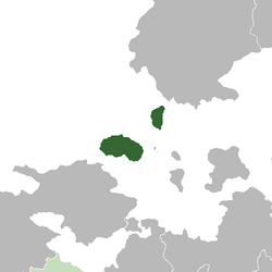 Location of the Burgoignesc province of Alcairet (dark green) In Audonia (gray) Bulkh, in real union with Burgundie (light green) | |
| Nation | |
| Constituent Country equivalent | Burgoignesc Overseas Representative Assembly |
| Geographic Designation | Audonio-Alshari Burgundie |
| Colonized by | 1577 |
| Capital | Baab Genjareb |
| Government | |
| • Governor-Epistates | Guillem-Aymen Ballart al-Javed |
| Area | |
| • Total | 87,204.9 km2 (33,670.0 sq mi) |
| Population (2030) | |
| • Total | 12,400,550 |
| • Density | 140/km2 (370/sq mi) |
| Demonym | Alcaireti |
Alcairet, colloquially called Gassavelie Nouveau (New Gassavelia), is a Burgoignesc province of the Burgoignesc Overseas Representative Assembly in confluence of the Sea of Istroya and the Aab-e-Farus, in the Barbary Straits in Audonia. It is considered part of La Garrote a chain of Burgoignesc islands that historically allowed the Maritime Dericanian principalities to control the trade routes of western Audonia. Historically Alcairet was a part of the states that ruled the northern coast of Battganuur. It was conquered by the Oduniyyad Caliphate in the 7th century AD. It remained under Oduniyyad control until the fall of that empire in 1514 when it was left to its own devices until the Truffle Races between the coastal states of the Kingdom of Dericania (Burgundie) and Caphiria led to its annexation by Company for the Aid of the Protestants Refugees in 1577. It was administered as part of the Barbary Straits Colony from 1577-1836 when the mainland was lost, then given provincial status in 1875 when the unified nation of Burgundie was formed.
Geography
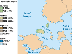
Alcairet is an island in the western mouth of the Barbary Straits. The islands are the remains of a land bridge that used to connect the southwestern and northern continental islands of Audonia. At the end of the last ice age when sea levels rose, the lowlands flooded and formed the Barbary Straits.
Climate
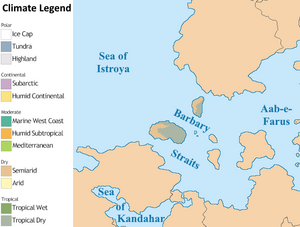
Alcairet's prevailing winds are the warm and moist trade winds blowing westerly from the Aab-e-Farus. The province has a tropical wet and dry climate in the east, and semi-arid in the west.
| Climate data for 1981–2010 normals | |||||||||||||
|---|---|---|---|---|---|---|---|---|---|---|---|---|---|
| Month | Jan | Feb | Mar | Apr | May | Jun | Jul | Aug | Sep | Oct | Nov | Dec | Year |
| Average high °C (°F) | 29.2 (84.6) |
30.3 (86.5) |
30.5 (86.9) |
30.2 (86.4) |
29.2 (84.6) |
27.6 (81.7) |
26.4 (79.5) |
25.6 (78.1) |
25.7 (78.3) |
26.0 (78.8) |
27.0 (80.6) |
27.8 (82.0) |
28.0 (82.3) |
| Daily mean °C (°F) | 26.1 (79.0) |
26.7 (80.1) |
26.7 (80.1) |
26.5 (79.7) |
25.9 (78.6) |
24.7 (76.5) |
23.5 (74.3) |
22.7 (72.9) |
22.8 (73.0) |
23.0 (73.4) |
23.9 (75.0) |
24.8 (76.6) |
24.8 (76.6) |
| Average low °C (°F) | 22.9 (73.2) |
23.1 (73.6) |
22.9 (73.2) |
22.8 (73.0) |
22.7 (72.9) |
21.7 (71.1) |
20.7 (69.3) |
19.8 (67.6) |
19.8 (67.6) |
20.0 (68.0) |
20.9 (69.6) |
21.7 (71.1) |
21.6 (70.9) |
| Average precipitation mm (inches) | 83.4 (3.28) |
107.4 (4.23) |
106.3 (4.19) |
94.9 (3.74) |
41.9 (1.65) |
32.5 (1.28) |
18.8 (0.74) |
9.8 (0.39) |
7.6 (0.30) |
11.0 (0.43) |
12.6 (0.50) |
51.5 (2.03) |
577.7 (22.76) |
| Average precipitation days | 11 | 10 | 11 | 6 | 5 | 8 | 13 | 14 | 12 | 11 | 8 | 10 | 119 |
| [citation needed] | |||||||||||||
History
Prehistory
Alcairet was originally settled by Indo-Aryan peoples who likewise settled areas from Zaclaria to Pukhgundi. These people shared languages with common roots, the Indo-Aryan languages which later diverged into Proto-Umardonian (west of the Sindhus River) and proto-Sindhus (east of the Sindhus River).
Umaronid Empire
The Umaronid Empire, a Bronze Age civilization that thrived in western Audonia from approximately 3300 to 1300 BCE, left an indelible mark on the region. Renowned for their meticulous urban planning, the Umaronids constructed sprawling cities like Harappa and Mohenjo-daro, characterized by grid-like layouts, multi-story houses, and sophisticated drainage and water supply systems. This meticulous attention to detail extended to their economic practices, evident in their standardized weights and measures that facilitated trade and commerce across the empire. The Umaronids demonstrated exceptional craftsmanship and technological ingenuity. Their mastery of metallurgy is evident in the production of bronze tools and weapons, while their artistry is showcased in intricate seals, pottery, and figurines. Notably, the empire developed a unique script, yet to be deciphered, which tantalizingly hints at a complex language and potentially rich literary traditions. Despite its advancements, the Umaronid Empire eventually declined. While the precise reasons remain unclear, factors such as climate change, shifting river courses, and migrations likely played a role. Nevertheless, the legacy of the Umaronids endures, providing valuable insights into the social, economic, and cultural dynamics of early Audonian civilizations. The empire's contributions to urban planning, metallurgy, and artistic expression continue to inspire and inform contemporary understanding of the region's history.
Classical Antiquity
-
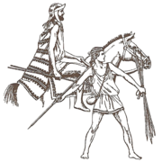
Istroyan soldiers
Northern Alcairet, under the dominion of the Arunid Empire, experienced a profound agricultural revolution, the burgeoning of a lucrative timber industry, and a dynamic cultural exchange that left an enduring legacy on the region's identity. Meanwhile, southern Alcairet, witnessed the rise and fall of empires, the fusion of Istroyan and Persian cultures, and the establishment of a vibrant Christian realm, the Ashrafinid Empire. While the coastal regions flourished under Istroyan influence, the interior of southern Alcairet remained a realm of tribal societies. These tribes, such as the Parthians and the Elamites, maintained their traditional nomadic or semi-nomadic lifestyles, herding livestock, cultivating crops, and engaging in trade with neighboring regions. The decentralized nature of tribal power structures made it difficult for a single dominant entity to emerge. Instead, the interior was characterized by a patchwork of alliances, rivalries, and shifting power dynamics. This political fragmentation, while fostering a degree of autonomy for individual tribes, also made the region vulnerable to external incursions and conquest.
Arunid Empire
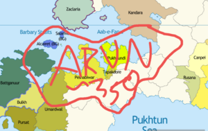
The Arunid Empire's dominion over northern Alcairet, encompassing the present-day provinces of Ahabijan, Andivaz, Takand, Maradan, and Malarand, represents a pivotal epoch in the region's history. The empire's vast reach and influence brought about profound transformations, leaving an enduring legacy that continues to shape Battganuur's identity and development. The Arunid Empire, recognizing the fertile potential of northern Battganuur's plains, initiated a comprehensive agricultural development program. Extensive irrigation systems, including canals and reservoirs, were constructed to harness the waters of the Aab-e-Farus and its tributaries. This led to a significant increase in rice cultivation, transforming the region into a breadbasket for the empire. The surplus rice production not only sustained the empire's burgeoning population but also became a valuable commodity in regional trade networks. Alongside rice, the cultivation of other crops such as wheat, barley, fruits, and vegetables was also promoted, ensuring a diverse and resilient agricultural base. This agricultural revolution not only boosted the region's economic prosperity but also fostered social stability by ensuring food security. Northern Battganuur's lush forests, teeming with valuable hardwoods like teak, mahogany, ebony, rosewood, and padauk, attracted the attention of the Arunid Empire. Recognizing the potential of this resource, the empire established logging operations and implemented sustainable forestry practices. These woods were highly prized for their durability, beauty, and versatility, and were used in the construction of grand palaces, temples, and ships. The timber trade became a lucrative source of revenue for the empire, contributing to its economic power and influence. The demand for Battganuuri hardwoods spurred the development of infrastructure, including roads and ports, further integrating the region into the empire's vast economic network.
The Arunid Empire's dominion over northern Alcairet was not solely an economic endeavor. It also entailed a significant cultural and spiritual exchange. The Fravarti-Zoroastrian faith, with its emphasis on righteousness, social justice, and communal harmony, found fertile ground in the region. While it did not completely supplant existing religious practices, it gained a significant following and left a lasting imprint on the region's spiritual landscape. The empire's cosmopolitan cities, renowned centers of learning and commerce, attracted scholars, artisans, and merchants from across the known world. This influx of diverse cultures led to a vibrant cultural fusion, with elements of Persian, Indian, and Istroyan traditions intermingling with local customs. The adoption of the Umardi language, the lingua franca of the empire, facilitated communication and trade, further cementing the region's integration into the Arunid realm.
Istroyan city states

Beginning in the 6th century BCE, Istroyan mariners, hailing from the bustling city-states of northeastern Sarpedon, embarked on exploratory voyages across the Sea of Istroya. Drawn by tales of fertile lands, exotic spices, and lucrative trade opportunities, they established a series of colonies along the coast of Alcairet. They quickly grew into thriving centers of commerce, culture, and learning. The Istroyans brought with them their language, philosophy, art, and architectural traditions, which deeply influenced the local Persi populations. Over time, a unique fusion of Istroyan and Persian cultures emerged, evident in the syncretic religious practices, the adoption of Istroyan architectural styles, and the widespread use of the Istroyan language in trade and administration. This cultural exchange left an enduring legacy, shaping the distinct identity of southern Alcairet for centuries to come.
Medieval period
The Oduniyyad Caliphate's six centuries of rule left an indelible mark on Alcairet. The spread of Islam transformed the region's religious and cultural landscape, while the Caliphate's patronage of scholarship and the arts fostered a vibrant intellectual atmosphere. Battganuur's strategic location made it a crossroads for trade and cultural exchange, contributing to its unique identity. The Crusades, though a period of conflict and instability, also stimulated cultural exchange and intellectual curiosity. The legacy of this era continues to resonate in Battganuur's diverse cultural heritage, its architectural treasures, and its vibrant intellectual traditions.
The Oduniyyad Caliphate's dominion over Alcairet marked a significant chapter in the region's history, characterized by a confluence of religious fervor, cultural exchange, and geopolitical conflict. This period witnessed the spread of Islam, the flourishing of intellectual and artistic pursuits, and the challenges posed by external forces, particularly the Crusades. Following the collapse of the Arunid Empire and then the Ashrafinid Empire, the Oduniyyad Caliphate swiftly extended its influence over Alcairet. The introduction of Islam, a monotheistic faith with a strong emphasis on social justice and community, profoundly reshaped Battganuuri society. Mosques sprang up across the land, replacing or coexisting with Zoroastrian fire temples and Buddhist monasteries. The Arabic language, the lingua franca of the Caliphate, gained prominence in administration, trade, and scholarship. While the initial spread of Islam was often accompanied by military conquest, it gradually became a process of cultural assimilation and religious conversion. The Caliphate's emphasis on education and social welfare attracted many Battganuuri to the new faith, leading to a gradual but significant shift in the religious landscape. The Oduniyyad period was marked by a remarkable flourishing of intellectual and artistic pursuits in Alcairet. The Caliphate's patronage of scholarship and the arts created a vibrant intellectual atmosphere, attracting scholars, poets, and artists from across the Islamic world. Cities like Alihijan and Isfahan became centers of learning, where renowned scholars and scientists made significant contributions to fields such as mathematics, astronomy, medicine, and philosophy. Battganuuri artisans excelled in producing exquisite textiles, ceramics, metalwork, and calligraphy, which were highly prized throughout the Caliphate. Battganuur's strategic location, straddling the Sea of Kandahar and bordering the Sea of Istroya, made it a vital crossroads for trade and cultural exchange. The Caliphate's vast network of roads and maritime routes connected Alcairet to distant lands, facilitating the flow of goods, ideas, and people.
The Oduniyyad Caliphate's expansion into Sarpedon brought it into conflict with Christian kingdoms, leading to a series of religious wars known as the Crusades in Audonia (1167– 1428CE). Alcairet, as a frontier region of the Caliphate, became a battleground for these conflicts. The Crusades had a profound impact on Alcairet, disrupting trade routes, causing economic instability, and exacerbating religious tensions. The region witnessed the construction of fortified castles and cities, as well as the emergence of military orders dedicated to defending the Christian faith. Despite the immense human and economic cost, the Crusades also fostered cultural exchange and intellectual curiosity. The encounter with Western ideas and technologies stimulated new developments in Battganuuri science, philosophy, and art.
Warring century
The Warring Century spanned the 15th and 16th centuries in the Daria region of Audonia. This era was marked by the tumultuous unraveling of the Oduniyyad Caliphate, factionalism, sectarian and ethnic violence, and ultimately weakened Daria making it prone to colonization by the duchies of Maritime Dericania.
Internal strife, stemming from political dissent and struggles for succession, economic stagnation and corruption progressively eroded the Caliphate's authority. The Caliphate's collapse ripped apart the fragile web of religious and ethnic cohesion that had existed under its rule. Long-simmering tensions between various groups, both religious and ethnic, flared up in the absence of a strong central authority. Communities with distinct cultural and belief systems, previously held together under the Caliphate's umbrella, found themselves at odds. This sectarian discord, coupled with competition for limited resources, fueled a period of widespread tribal and sectarian conflicts.
The power vacuum created by the Caliphate's disintegration paved the way for the rise of warlords. These opportunistic individuals, capitalizing on the prevailing chaos, carved out their own domains in strategic locations, often around cities or fortresses built by the former Caliphate. However, the reach of these warlords was limited due to the lack of a centralized tax system and the constant threat of rival factions. Their control often extended only to their immediate vicinity, creating a patchwork of small, feuding kingdoms.
The economic consequences of the Warring Century were far-reaching. The once-flourishing Silk Road became choked by rampant banditry and instability. The movement of goods became increasingly expensive and perilous. This disruption forced eastern nations, namely Daxia, to hire larger and more expensive caravan guards, some eventually became their own armies, which when coupled with Dericanian colonial expansion ism led to the establishment of the Southern Route, which bypassed the volatile Daria region altogether.
The Warring Century, spanning the 15th and 16th centuries, cast a long and ominous shadow over Alcairet, marking a period of unprecedented upheaval, fragmentation, and social unrest. The once-unified realm, held together by the Oduniyyad Caliphate, crumbled under the weight of internal strife, religious discord, and economic decline, leaving the region vulnerable to external forces and setting the stage for future colonial interventions. The seeds of Battganuur's descent into chaos were sown in the waning years of the Oduniyyad Caliphate. Political infighting, economic mismanagement, and rampant corruption eroded the Caliphate's authority, creating a power vacuum that was quickly filled by ambitious warlords and opportunistic factions. The once-vibrant cities of Alcairet, centers of trade and learning, became battlegrounds for rival groups vying for control. The collapse of the Caliphate unleashed long-suppressed religious and ethnic tensions. Shia and Sunni communities, previously coexisting under the Caliphate's umbrella, turned against each other in a bitter struggle for dominance. The Zoroastrian minority, once tolerated, faced persecution and marginalization. This sectarian strife further fragmented Battganuuri society, creating deep-seated divisions that would haunt the region for centuries. The Warring Century wreaked havoc on Battganuur's economy. Trade routes, once vital arteries of commerce, were disrupted by banditry and conflict. Agricultural production declined as fields were abandoned and irrigation systems fell into disrepair. The once-flourishing cities, symbols of Battganuur's prosperity, became impoverished and depopulated. In the absence of a central authority, warlords emerged as the de facto rulers of various regions. These local strongmen, often backed by private armies, established their own fiefdoms, imposing their own laws and taxes. Their rule was often arbitrary and brutal, further exacerbating the suffering of the common people.
The Warring Century's devastating impact on Alcairet left the region vulnerable to external intervention. The economic decline, social unrest, and political fragmentation made Alcairet an attractive target for the expansionist ambitions of the Maritime Dericanian duchies. These maritime powers, seeking new markets and resources, gradually extended their influence over Alcairet, establishing trading posts, fortresses, and ultimately, colonial administrations. The Warring Century thus laid the groundwork for Battganuur's colonization, a process that would profoundly shape the region's destiny in the centuries to come. The legacy of this tumultuous period continues to resonate in Battganuur's complex social fabric, its diverse religious landscape, and its ongoing struggle for unity and stability.
Early modern history
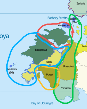
Barbary Straits colony
In the wake of the Warring Century's turmoil, the Duchy of Marialanus, a rising maritime power, sought to expand its influence and commercial interests in Audonia. In 1577, the Marialanii Ularian Trading Company, armed with a royal charter, established the Barbary Straits Colony in northern Battganuur. This colony, strategically positioned at the western terminus of the Silk Road, aimed to revitalize the region's agricultural potential and capitalize on the lucrative trade routes that crisscrossed the continent. The company's administrators, drawing upon their Calvinist principles, implemented a rigid social hierarchy and a strict moral code. They invested heavily in infrastructure, constructing roads, canals, and ports to facilitate trade and transport. The colony's fertile plains were transformed into vast plantations, producing rice, cotton, and other cash crops for export. Audonian slaves, captured or purchased from neighboring regions, were forced to work on the plantations, fueling the colony's agricultural engine. The slave trade became a lucrative source of revenue for the company and its shareholders. Despite the harsh realities of colonial rule, the Barbary Straits Colony became a hub of economic activity and cultural exchange. Its port cities, such as Bandar Abbas and Bushehr, attracted merchants, missionaries, and adventurers from across Audonia and beyond. The colony's unique blend of Marialanii and Battganuuri traditions, though often fraught with tension, contributed to a vibrant and dynamic cultural landscape.
Barbary Wars
Amid the outbreak of the Barbary Wars, while much of the anti-piracy conflict was centered around the Barbary Straits between the Buroignesc Navy and corsairs hailing from what is modern Battganuur, the range of Barbary pirates stretched even further north reaching even the domain of Soirwind. Soirwind being at the time a colonial domain under what is modern day Fiannria, the spike in piracy interrupting crucial trade routes between Fiannria and Soirwind quickly drew the ire of the Levantine state. In ____ Fiannria sent a punitive expedition towards the region to combat the corsairs. Rebuffed from operating in the main combat zone and drawing too close to the Barbary Straits itself, the Fiannan war fleet set for the north towards the northern Sea of Istroya to hunt down Corsairs who broke through and expanded operations that more directly impacted Fiannria itself. The war fleet would operate between the Hezikian Isles and Soirwind for the next three years in its attempt to guard trade routes and eliminate pirate holdouts and outposts.
As the conflict in the Straits themselves raged on, the Fiannan central government would delegate more and more operational authority towards the holy orders which persisted as remants from the Crusaders and independent privateers in combating northern Barbary Piracy. This culminated in the year of _____ following the victory in the Barbary straits themselves, a large contingent of Barbary ships which survived the punitive Burgoignesc expeditions escaped to the north in order to flee arrest and execution and also find a new base of operations, instead off the southern coast of Soirwind, found a fleet of privateers and corsair chasers waiting between the coast and the island of Antilles. This fleet of holy orders, privateers and colonial defense ships from Soirwind, having gotten word of the coming fleet had gathered in the strait to attack and nip the bud of any continued corsair activity in the north. The resultant battle, the Battle in the Kamtague Narrows, saw the bulk of the remaining corsair force sunk or captured, and the remnants scattering, breaking any chance of a major Barbary incursion returning to operate in the north.
Late modern period
Fall of the Burgoignesc colonial empire, massive influx of people fleeing the colonies, men retained to fight in defense of the islands, women and children sent to the Burgoignesc Metropole, thereafter sent to Equatorial Ostiecia. This military force known as La Vestige (Aeng: The Vestige) numbered on average 115,000 soldiers and 80,000 sailors between 1805 and 1835 but morale was low and desertion was high as the men wanted to leave with their families. La Vestige was successful in maintaining the islands for their respective states which eventually unified into Burgundie, but the legacy of bondage damaged the view of many Burgoigniacs with Alcairet for the next 50 years. During the First Fratricide, Alcairet, ruled by the Duchy of Marialianus and Salarive, ruled by the Duchy of Bourgondi sent volunteers to Maritime Dericania and conducted minor raiding of each other, but it was never considered a front of the war.
Contemporary period
While the Occidental Cold War was primarily a series of geopolitical tensions between Urcea and Caphiria, it cast a long shadow over Alcairet due to its proximity to the Caphirian protectorate of Zaclaria. The constant threat of nuclear escalation and the ideological conflict between the Levantine and Sarpedonic blocs deeply affected the socio-political and economic landscape of the islands. Despite the prevailing atmosphere of fear and uncertainty, the Occidental Cold War also served as a catalyst for introspection and change within Alcaireti society. The younger generation, exposed to the liberalizing influences emanating from the Burgoignesc Metropole, began to question the more conservative Calvinist values that had long underpinned their society. This cultural awakening found expression in a burgeoning arts scene, where innovative forms of music, dance, and visual arts challenged the established norms and conventions. Economically, the Occidental Cold War presented a double-edged sword for Alcairet. While the islands' strategic importance in the geopolitical chessboard led to increased investment in infrastructure and military installations by Burgundie, stimulating the local economy and creating employment opportunities, the constant specter of conflict also deterred foreign investment and hampered trade with Sarpedonic bloc nations. The Alcaireti government, faced with the delicate task of balancing its allegiance to Burgundie with the imperative of maintaining regional stability, adopted a pragmatic approach to foreign policy. It maintained a robust military presence in the Barbary Straits while simultaneously engaging in discreet diplomatic channels with Caphirian officials in Zaclaria. This cautious balancing act, though fraught with potential pitfalls, ultimately proved successful in averting conflict and preserving the fragile peace in the region. It was through these efforts, that in 1974 that the Burgo-Caphirian Thaw occured.
Alcairet was also a key military and logistics staging hub during Operation Kipling. As jet technology progressed and the ground wars became more tenuous, more and more bombers were stationed in Alcairet requiring increasingly large airbases and longer runways. After the war's end and the reversion of some of these airbases to civilian control, Alcairet had more airports than it knew what to do with. As a result, Alcairet is the preeminent aircraft maintenance and manufacturing hubs in the Middle seas region. Alcairet also, through its involvement in Operation Kipling adopted containerization early on. Today it serves as a major transshipment and customs hub for Audonian goods bound for Levantia.
Government
| This article is part of a series on the |
| BORA |
|---|
 |
| Statistics |
|
| Key topics |
| Provinces |
|
Burgundie portal |
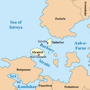
Alcairet is part of the Burgoignesc Overseas Representative Assembly's (BORA) Burgoignesc Audonia geographic designation. BORA is a constituent country equivalent of Burgundie with its own assembly, prime minister, budget, and laws. Burgundie's national governmental influence is limited to subsidies, education, and security, however, its financial and cultural institutes cast a long shadow across Alcairet.
Alcairet is a province within Burgoignesc Overseas Representative Assembly with its own semi-elected Governor-Epistates, representative legislative body, and court system.
Alcaireti are Burgoigniacs/Burgoignix with complete civil and economic rights, and citizenship (political rights) under the same federal service criteria as all residents of Burgundie. Burgoignesc is the official language but Arabic and Burgoignesc are both in use. However, there was a time during the 1960s and 1970s when children were forbidden to speak Arabic in schools. Arabic is now taught in schools; it is sometimes even a requirement for employment.
Provincial executive
The provincial executive is the Governor-Epistates. Three candidates are elected by a single transferable vote election held every 5 years, the three candidates are presented to the Court of St. Alphador and the next Governor-Epistates is chosen from these candidates. If the citizenry rejects the selection, a run-off election is held with the remaining two candidates.
Provincial legislature
Like the Citizens Court of the National Assembly (Burg. La Assemblee de Ciutadans de l'Assemblee Nacional, ACAN), The Alcaireti Citizen's Court of the Provincial Assembly is a unicameral legislator. It makes provincial law, has the power of the provincial purse, and has the power of impeachment, by which it can remove sitting members of the provincial government. The Assembly has three seats for each province, one for the Burgoignesc Overseas Territory Assembly's Alcairet liaison, 3 for the clergy, 3 seats reserved for municipal leaders, and 3 for a rota of private business leaders. On 6 occasions throughout the year 3 more seats are opened to the public to debate topics that are not on the annual legislative agenda.
Administrative divisions and local governance
Military

Alcairet falls under the Navy's Grand Eastern Command, the Army's Middle Seas Command, the Royal Air Service of Burgundie's Audonian Command, and the Vocivine National of Burgundie's Istroyo-Middle Seas Command. Alcairet's strategic location means it is a major military hub for all branches of the Burgoignesc Security Forces with large basing facilities existing for the army (in particular the Burgoignesc Foreign Legion), navy, Royal Air Service, and Vocivine.
Alcairet is the home of the GranCom Orientale Admiral's Administrative Department, Rapid Reaction Force GranCom Orientale Command and its Rapid Deployment Group 1 Burg: Groupement Disembarkement Rapide no. 1, Expeditionary Strike Squadron Kandahar Resolve, and Littoral/Riparian Strike Division Riptide. These assets are spread across 3 naval stations, two on Alcairet and one on Salarive, Fort Ste. Maude, Fort St. Rouland, and Fort Ste. Jean d'Arche Naval Air Station respectively. The army maintains the III Division, Foreign Legion in Fort Ste. Genvieve on Alcairet and the Puhkgundian Gorkha Rifles in Fort St. Reginald on Salarive.
Emergency response
National Gendarmerie
Alcairet is under the jurisdiction of the Alcairet Battalion of the Middle Seas Brigade of the Overseas Gendarmerie Division. The Alcairet Battalion has 5 companies and an HQ section.
- A Company is assigned to the whole of the southern island of Alcairet, excluding the Port of Genjareb and the capital
- B Company is assigned to the whole of the island of Salarive
- C Company is assigned to Baab Genjareb, the city, and specializes in civil disturbances
- D Company is assigned to the Port of Genjareb, conducting supplemental port security
- E Company is assigned to the Port of Selville, conducting supplemental port security
- The HQ section is also based in Baab Genjareb
Additionally, the Provost Gendarmerie for the Middle Seas Region and Alpha Team Action Force, an element of the Gendarmerie Air Service and of the Maritime Gendarmerie are also stationed in Alcairet at various military bases. The training school for the Maritime Gendarmerie is in Alcairet.
Revenue Guard
Revenue Guard, Grand Station of the Orient
Society
| This article is part of a series on the |
| Culture in Burgundie |
|---|
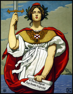 |
| Society |
| Arts and literature |
| Other |
|
Burgundie portal |
Self-reported ethnic origin in Tapakdore (2030)
Ethnically, Alcairetis are predominantly an admixture of ancient Persian and early modern Bergendii bloodlines, reflecting the island's complex history of conquest and cultural exchange. This genetic diversity is mirrored in the linguistic landscape, where Arabic and Burgoignesc coexist as official languages. While Burgoignesc serves as the language of government, commerce, and education, Arabic remains deeply rooted in everyday life, particularly in religious and cultural contexts. Education in Alcairet is highly valued, with a robust public school system that emphasizes both academic rigor and vocational training. The curriculum reflects a blend of Burgoignesc educational philosophies and Alcaireti cultural values, fostering a generation of citizens who are both globally aware and deeply connected to their heritage. This commitment to education has produced a highly skilled workforce, contributing to the island's economic success in sectors such as biotechnology and perfume manufacturing. Alcairetis are known for their warm hospitality, their love of storytelling, and their deep appreciation for the arts. Their worldview is shaped by a strong sense of community, family ties, and a pragmatic approach to life's challenges. This resilience is evident in their ability to adapt to changing circumstances, from the tumultuous era of the Warring Century to the complexities of the modern globalized world. Family plays a central role in Alcaireti society, with extended kinship networks providing support, guidance, and a sense of belonging. Traditional gender roles are still prevalent, but there is a growing movement towards greater gender equality, particularly in urban areas and among the younger generation. Alcaireti cuisine is a delightful fusion of Persian and Burgoignesc flavors, with an emphasis on fresh, local ingredients. Saffron-infused stews, citrus-marinated fish, and date-filled pastries are just a few examples of the island's culinary delights. The arts scene is equally vibrant, with a rich tradition of music, dance, and visual arts that draw inspiration from both local folklore and global trends. Literature in Alcairet is a dynamic field, with a number of authors writing in both Arabic and Burgoignesc. Their works often explore themes of identity, belonging, and the complexities of navigating a multicultural society. Architecture in Alcairet is a fascinating blend of styles, from the ornate Persian-inspired mosques and palaces to the elegant Burgoignesc colonial buildings. This architectural diversity reflects the island's unique history and cultural identity. Sports play a significant role in Alcaireti society, with football (soccer) being the most popular. The national team, known as the Desert Foxes, is a source of immense pride for the island, and their matches are followed with great passion. Other popular sports include basketball, handball, and volleyball. The date palm, a ubiquitous sight in the Alcaireti landscape, is a symbol of resilience, fertility, and the island's deep connection to its natural environment.
Economy
| This article is part of a series on the |
| Economy of Burgundie |
|---|
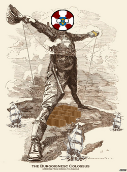 |
| Economy |
| Policies |
| Alliances and Trade Agreements |
| History and culture |
| Key components |
|
Burgundie portal |
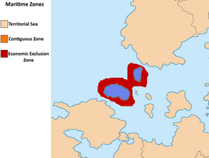
The island's strategic location at the crossroads of major trade routes has historically been a driving force behind its economic development, and recent years have seen a diversification of its economic base, with significant growth in sectors such as biotechnology, perfume manufacturing, tourism, commercial fishing, and agriculture. The tourism industry has emerged as a major pillar of the Alcaireti economy, capitalizing on the island's natural beauty, rich cultural heritage, and modern amenities. The pristine beaches, crystal-clear waters, and diverse marine life of the Sea of Istroya and the Aab-e-Farus attract a steady stream of tourists seeking sun, sand, and sea. The island's historical sites, ranging from ancient Persian ruins to colonial-era fortresses, offer a glimpse into its rich and complex past. Additionally, the vibrant cultural scene, with its festivals, music, dance, and cuisine, provides a unique and immersive experience for visitors. The commercial fishing sector is another significant contributor to the Alcaireti economy. The island's location at the confluence of two major bodies of water provides access to a rich and diverse array of marine life. The fishing industry, employing a significant portion of the population, harvests a wide variety of fish, crustaceans, and mollusks, both for domestic consumption and export. In recent years, there has been a growing emphasis on sustainable fishing practices, ensuring the long-term viability of this vital sector. Agriculture plays a crucial role in Alcairet's economy, with a diverse range of crops cultivated across the island. The fertile soil and favorable climate, combined with modern agricultural techniques, yield a bountiful harvest of olives, grain, tomatoes, citrus fruits, sugar beets, dates, almonds, guar, sea asparagus, purslane, sea kale, cassava, sweet potatoes, yams, and lemongrass. Additionally, the island's unique terroir supports the cultivation of specialized crops like citronella, used for the production of citronella oil, and the practice of meliponiculture, the cultivation of stingless bees for honey production. Beyond these primary sectors, Alcairet's economy is bolstered by a thriving mining industry, extracting valuable resources such as phosphate, iron ore, and salt. These minerals are not only essential for domestic industries but also serve as valuable exports, contributing to the island's trade balance. In recent decades, Alcairet has made significant strides in developing its technological and scientific capabilities. The biotechnology sector, fueled by investment from Burgundie and international partners, is rapidly expanding, focusing on research and development in areas such as pharmaceuticals, medical devices, and agricultural biotechnology. This burgeoning sector is attracting a highly skilled workforce and fostering innovation, positioning Alcairet as a potential hub for biotechnological advancements in the region. The perfume manufacturing industry, leveraging the island's abundance of fragrant flowers and herbs, has gained international recognition for its high-quality products. This sector, combining traditional knowledge with modern techniques, has become a significant contributor to the island's economy and a source of cultural pride. The island's robust infrastructure, including modern ports, airports, and a well-developed transportation network, facilitates trade and commerce. The Port of Genjareb, a major transshipment hub for goods leaving Audonia for the Levantine Union market, plays a crucial role in the island's economy. Recent investments in port automation and customs modernization have further enhanced its efficiency and competitiveness. However, Alcairet's economy also faces challenges. The island's heavy reliance on imports for essential goods such as fuel makes it vulnerable to fluctuations in global commodity prices. Additionally, the tourism industry, while a major source of revenue, is susceptible to external shocks such as political instability, natural disasters, and global economic downturns. Furthermore, the automation of the Port of Genjareb, while improving efficiency, may lead to job losses in the long term.
Standard of living and employment
Because Alcairet's economy is a high-low mix of sectors from biotech to traditional agriculture, opportunities abound for Alcairetis at all skill and education levels, which has helped the islands maintain a fairly steady unemployment rate of around 2.3% for the last decade. The islands' biotech and perfume manufacturing sectors offer stable opportunities for technicians, biologists, pharmacists, data scientists, and chemists. Traditional sectors like mining, fishing, and agriculture provide opportunities for unskilled or lesser educated individuals. The trade and transshipment hubs provide a stable middle ground for people with a moderate education and some skills, in logistics and customs fields, but future automation and trade patterns pose threats. Burgundie's high emphasis on education translates to a particularly educated and skilled workforce, leading to lower unemployment compared to less educated countries in Audonia. The islands' economic diversity cushions against overreliance on any single industry, which has demonstrably made the island more resilient during downturns. Since Burgundie strives for Total Economic Engagement and espouses equal rights and opportunities regardless of gender, race, ethnicity, ability, or background, Alcairet benefits from improved access to education and training, impacting employment prospects across various fields.
Key sectors
Science, research, and education
Alcairet has numerous tertiary and quartiary institutions that are accredited and internationally recognized. The Baab Genjared Institute of Technology, Engineering, Marine Science is the most prestigious.
Trade
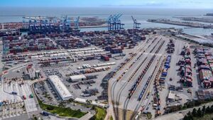
The advent of Containerization in the 1960s and 70s and its intensive use during Operation Kipling made the Port of Genjareb one of the first and largest container ports in the world. The port was rebuilt from 1966-1973 to accommodate a container terminal. The container terminal expanded so rapidly that the adjoining naval base was eventually rebuilt on another part of the island to accommodate the port's rapid expansion. In the modern era the port is used primarily as a customs and transshipment hub for goods leaving Audonia for the Levantine Union market. Burgoignesc Revenue Guard, and LU Douanes both have large inspection and customs operations in Port of Genjareb. Since 2013 there has been a considerable investment by Burgundie and the Levantine Union to automate the port to reduce wait times and to prioritize the inspection process to expedite the transshipment process.
Infrastructure
Maritime
Rail
Alcairet uses Standard gauge, 1,435 mm (4 ft 8+1⁄2 in) for both freight and passenger rail.
Istroyan Rail- Istroyan Rail (Burg: Istroie Ferroviaire), is the public-private joint-venture, intercity, passenger rail operator in Torlen, Antilles, Alcairet, and Chaukhira. It owns and operates all rail corridors, rights of way, and rolling stock that serve this purpose.
Air
Alcairet has one international airport, the Baab Al Audonia International Airport in metro Baab Genjareb.
| Name | Location | Type | Brief description | Code(s) | Picture |
|---|---|---|---|---|---|
| Baab Al Audonia International Airport | Baab Genjareb, Alcairet, |
Passenger, cargo, and air base | 24/7/365 air traffic control operations, 2x runways, capable of receiving all airframes, cargo terminal, passenger terminal, complete maintenance facilities, integrated customs and border control service | ATRO: GBA
ICAO: GBAB |
Energy and electricity
The BORA Waste to Energy Compact went into effect in 2027 with construction of 4 Waste to Energy power plants starting in 2028. The two plants built in Alcairet generates approximately 416,000 kWh/day with a waste reduction capacity of 440,000 kg/day.
Most of the electricity in Alcairet is provided by the el-Fawaz Nuclear Power Station. El-Fawaz has a pair of Gen IV reactors and was rebuilt in 2018 to replace the Gen II reactors built in 1987, itself replacing a fossil fuel burning station that had previously powered the island. The islands also have 6 solar plants, and residential and commercial solar panels are subsidized by the province. Three offshore wind farms off the eastern coast taking advantage of the trade winds provide 16MW. Since 2014, a tidal power facility was built off the western coast of the islands and it generates 8MW.
There is also an undersea power and internet cable from Bulkhawan Province, Bulkh that supplies some energy as the grid fluctuates.
Phone service and internet
Phone and internet service are provided by Great Seas BurgunMobile, Extron Burgundie Mobile, and National Wireless Services, which have 37, 53, and 27 towers respectively across the island. 100% of the island and its population are covered by at least one of the services, National Wireless Services covering the less densely populated and therefore less profitable areas. Copperwire and fiberoptic phone still exists, one or both are required for all municipal and emergency response connections, and people along the route are allowed to buy in, but during emergencies their calls are de-prioritized in favor of emergency response calls, which is the same with mobile service on the island. There is an undersea cable from Salarive to Alcairet and one from Alcairet to Takand Province, in Battganuur.
Highspeed internet service is provided by Great Seas BurgunMobile, and Extron Burgundie Mobile. Residential internet speeds average 2-3 gigabits while commercial speeds are typically higher in the 3-4 gigabit range.
There are also two Global Maritime Distress and Safety System repeaters and a beacon on the islands.
See also
- Pages using duplicate arguments in template calls
- Pages with non-numeric formatnum arguments
- Pages using infobox settlement with possible nickname list
- Pages using infobox settlement with no coordinates
- All articles with unsourced statements
- Articles with unsourced statements
- Pages using country topics with unknown parameters
- Burgundie
- Sub-national Regions in Burgundie
- Islands
- Burgoignesc islands


